Nantlle Ridge Walk from Rhyd Ddu (Route A)
Snowdonia/Eryri Walk
Nat Park - Snowdonia - Moel Hebog Nantlle Ridge
County/Area - Gwynedd
Author - Paul Gasson
Length - 6.0 miles / 9.8 km Ascent - 2300 feet / 697 metres
Time - 5 hours 20 minutes Grade - moderate
Maps 

| Ordnance Survey Explorer OL17 | Sheet Map | 1:25k | BUY |
| Anquet OS Explorer OL17 | Digital Map | 1:25k | BUY |
| Ordnance Survey Landranger 115 | Sheet Map | 1:50k | BUY |
| Anquet OS Landranger 115 | Digital Map | 1:50k | BUY |
Walk Route Description
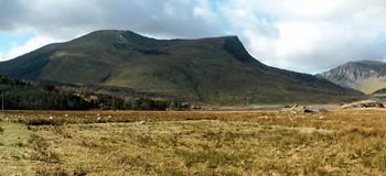
Click image to see photo description.
This Nantlle ridge walk is a fairly short but spectacular route, and visits the best parts of the ridge, itself a classic route in the area. It is best done in clear weather to enjoy the extensive views, but if low cloud or fog descends, careful navigation is required, particularly to locate the descent from Trum y Ddysgl.
Park in the car park alongside the A4085 Beddgelert to Caernarfon road at Rhyd Ddu (Grid ref. SH571526). Cross the main road, taking care as there is fast traffic on this section, to a footpath leading downhill across marshy ground. The path is partly paved with slate slabs, which can be slippery when wet.
Turn left at the Afon Gwyrfai to a footbridge. Cross this and follow the signs to the exit onto the B4418 road. Turn left off the road immediately and follow a track. After passing the farm of Drwsycoed Uchaf, a footpath with stiles starts to climb uphill towards the ridge. The route of the Nantlle ridge walk is clear and well marked, soon becoming very steep as the path skirts steep crags to your right. Finally the gradient slackens and easy slopes lead, via another stile, to the stony summit of Y Garn (or Garn II in some guide books). This will probably have taken about 75 minutes.
After regaining your breath and enjoying the 360 degree views, follow the narrowing ridge, just West of South, towards the imposing spire of Mynydd Drws-y-coed. The path is reasonably clear running between the remains of a stone wall and precipitous crags. It leads to the foot of the spire where easy but in places very exposed grade 1 scrambling leads to the summit of Mynydd Drws y Coed. As you cross a 'notch' right on the summit, watch out for the notorious 'head banger' boulder which can give you a nasty bump on the head while you concentrate on crossing the notch!
A downward slope leads to a small col. The path then climbs quite steeply upwards, but with no difficulties, to the summit of Trum y Ddysgl and the end of ascent for the day.There are fine views all around, particularly eastwards to the Snowdon massif, and South to Moel Hebog.
An almost level, grassy plateau with no very clear path leads onwards. Follow the edge of the steep ground to your left. The route soon turns almost southeast onto a broad, grassy ridge which descends quite steeply at first before continuing at an easier angle into the valley.
As the ridge ends, follow the edge of the Forestry plantation down to Bwlch-y-ddwy-elor (Pass of the Two Biers) that formed part of the ancient route between Cwm Pennant and Rhyd Du. The rough path drops down steeply to meet the Bwlch at a gate close to a boggy patch that will need to be crossed.
Turn left on the clear pathway dropping down through the forest to join a forestry road. Turn right here, then left onto another forestry road and then continue easily through (currently felled) forestry to eventually rejoin your outward track at the boulder marked with a white arrow where the steep climb to the ridge began. Follow your outward path back to the car park where you can reflect on completing the Nantlle ridge walk.
Other walks nearby
| Walk 3613 | Moel Cynghorion from Llyn Cwellyn | moderate | 5.0 miles |
| Walk 3060 | Moel Lefn & Moel yr Ogof | moderate | 7.0 miles |
| Walk 2150 | Llyn Dinas and Cwm Bychan from Beddgelert | easy/mod | 6.0 miles |
| Walk 2560 | Moel Hebog, Moel yr Ogof & Moel Lefn from Beddgelert | mod/hard | 6.5 miles |
| Walk 1799 | Moel Hebog | moderate | 5.5 miles |
| Walk 1988 | Beddgelert, Moel Hebog, Meol yr Ogof & Moel Lefn | mod/hard | 6.8 miles |
| Walk 3074 | Mynydd Sygun | moderate | 4.5 miles |
| Walk 3231 | Moel Hebog, Meol yr Ogof and Moel Lefn from Beddgelert | mod/hard | 6.8 miles |
| Walk 1426 | Aberglaslyn and Cwm Bychan | easy/mod | 5.8 miles |
| Walk 1427 | Craflwyn circular from near Beddgelert | easy/mod | 2.5 miles |
Recommended Books & eBooks
The Wales Coast Path
 A single guidebook to walking the whole Wales Coast Path - 1400km (870 miles) the length of Wales from Chester to Chepstow, including Anglesey, described in 57 stages. The route passes through the Snowdonia and Pembrokeshire National Parks and many AONBs and can be linked with the Offa's Dyke Path for a complete circuit of Wales.
More information
Great Mountain Days in Snowdonia
 Inspirational guidebook to 40 great mountain day walks and scrambles in Snowdonia. Inspirational routes for all abilities across the National Park with routes up Snowdon and Moel Eilio, the Glyderau, the Carneddau, Eifionydd, Siabod and the Moelwynion, Rhinogydd (the Harlech Dome), Migneint and the Arans and Cadair Idris and the Tarrens.
More information
Messaging & Social Media
Message Walking Britain and follow the latest news.

Mountain Weather
Stay safe on the mountains with detailed weather forecasts - for iOS devices or for Android devices.