Betchcott Hills & Pole Bank from Bridges
Shropshire Hills Walk
Region - Shropshire Hills
County/Area - Shropshire
Author - Lou Johnson
Length - 9.0 miles / 14.6 km Ascent - 1340 feet / 406 metres
Time - 5 hours 50 minutes Grade - moderate
Maps 

| Ordnance Survey Explorer 217 | Sheet Map | 1:25k | BUY |
| Anquet OS Explorer 217 | Digital Map | 1:25k | BUY |
| Ordnance Survey Landranger 137 | Sheet Map | 1:50k | BUY |
| Anquet OS Landranger 137 | Digital Map | 1:50k | BUY |
Walk Route Description
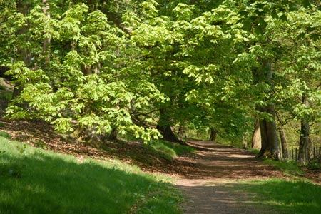
Click image to visit gallery of 12 images.
This walk explores the valleys and hills on the western flanks of the Long Mynd. Quieter than the other side of this range of rounded hills, all the paths are easily followed and, except when low cloud is lying on the high ground, there should be no problems with navigation. The start is the hamlet of Bridges (Grid ref SO393964) where there is limited parking on the road to Overs. The Horseshoe Inn has a parking area for customers and you are requested not to abuse this.
After parking follow the lane eastwards past the Youth Hostel. After a short way take the first signed path on your left. This is the Shropshire Way and it proceeds through woodland with Darnford Brook on your right. The way ahead is clear and easy to follow. Reaching a track at Ratlinghope (Grid ref. SO401970), go straight across the track and follow the path through a landscaped garden. You soon enter open fields and ahead you can see the main ridge that will shortly be followed towards Pole Bank.
Nearing Lower Darnford care is needed to keep on route. Follow the Shropshire Way as it trends away from the farm. Then go right at the next signpost still following the Shropshire Way. This leads you along a clear path to climb a short ridge before heading up Golden Valley to reach the main ridge track (Grid ref SO420985). Turn right here and stay with the main track (The Port Way) as it undulates along the ridge crossing near the summit of Betchcott Hill and then crossing the flank of Henley Nap to reach a road (Grid ref. SO435966).
Turn right along this road. When the road bears right continue straight ahead on a clear, wide path. Ignore paths going left and right, and follow the main path to reach a road near a small parking area (Grid ref SO420952). Go straight across and follow the well maintained path all the way to the summit of Pole Bank (grid ref. SO415944). At 516 metres above sea level this is the highest point on the Long Mynd. As might be expected the views are good especially to the west and there is an orientation table pointing out the highlights.
After enjoying the view retrace your steps. Ignore the first wide track going left and continue a short way further on and locate the path junction signed "Priory Cottage" (SO418948). Turn left down this with the fence on your left. The views ahead to the Stiperstones are good and you can make good progress downhill. Joining a track continue ahead passing through a gate just before Priory Cottage (Grid ref. SO403954). Continue down the track descending to Coates Farm where you turn right on the lane. Follow this quiet lane down through the hamlet of Overs to reach the start.
Other walks nearby
| Walk 3395 | The Stiperstones Ridge | easy/mod | 5.5 miles |
| Walk 3422 | Ratlinghope & the Stiperstones from the Knolls | moderate | 7.5 miles |
| Walk 3596 | The Stiperstones from the Knolls | easy | 2.0 miles |
| Walk 3045 | The Stiperstones & Blakemoor Flat from the Knolls | easy/mod | 5.0 miles |
| Walk 2054 | Linley Hill & Beeches from Wentnor | easy/mod | 7.0 miles |
| Walk 1809 | Shelve & the Stiperstones from The Bog | moderate | 9.0 miles |
| Walk 2083 | Linley Hill and Linley from The Bog | moderate | 8.5 miles |
| Walk 1072 | Stiperstones low level circular | easy | 4.0 miles |
| Walk 1180 | Pole Bank (Long Mynd) from Carding Mill | moderate | 6.5 miles |
| Walk 1409 | Haddon Hill and Bodbury Hill | easy/mod | 4.4 miles |
Recommended Books & eBooks
Hillwalking in Shropshire
 Guidebook to 32 walking routes in Shropshire in the West Midlands. The routes range from 3 miles (5km) to 12 miles (19km), taking in highlights such as The Wrekin, Wenlock Edge, Long Mynd and Stiperstones, Castle Ring and Bury Ditches. Many routes start near delightful towns and villages including Church Stretton, Ludlow and Bishops Castle.
More information
Messaging & Social Media
Message Walking Britain and follow the latest news.

Mountain Weather
Stay safe on the mountains with detailed weather forecasts - for iOS devices or for Android devices.