Handa Island - Scottish Wildlife Trust
Highland Walk
County/Area - Highland - Northern Highland
Author - Lou Johnson
Length - 4.0 miles / 6.5 km Ascent - 650 feet / 197 metres
Time - 2 hours 40 minutes Grade - easy
Maps 

| Ordnance Survey Explorer 445 | Sheet Map | 1:25k | BUY |
| Anquet OS Explorer 445 | Digital Map | 1:25k | BUY |
| Ordnance Survey Landranger 9 | Sheet Map | 1:50k | BUY |
| Anquet OS Landranger 9 | Digital Map | 1:50k | BUY |
Walk Route Description
Click image to visit gallery of 12 images.
The island of Handa lies off the west coast of Sutherland and is home to a Wildlife Reserve managed by the Scottish Wildlife Trust. During the period from April to September the island becomes the breeding ground for about 200,000 seabirds with some species recording numbers of International significance. Formed from Torridon sandstone, there are many ideal nesting locations along the steep cliffs and a visit to the island during the breeding season is an unforgettable experience.
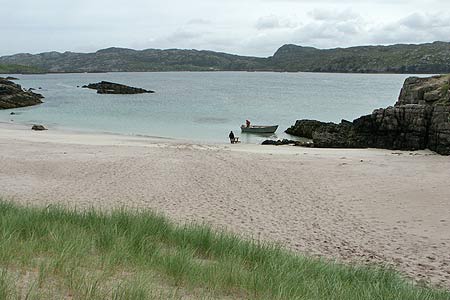
The start of this walk is the small harbour at Tarbet (Grid ref. NC164488), which is reached via a narrow road from the A894 between Scourie and Laxford Bridge. From here a small ferry (charge payable locally) takes you to the island. Please remember that crossings are on demand and weather dependent. Once on the island, visitors are met by the resident guide and briefed on what there is to see with a few gentle reminders about where you can and cannot go on the reserve. In addition you can hire binoculars and borrow guides to bird species. Note that there are no refreshments available.
From the landing beach a complete circuit of the island path is recommended. This takes around two and a half hours excluding time taken watching the birds. In places there are precipitous cliffs and care should be exercised throughout your stay. From the beach the path leads up to the remains of a village that was inhabited until 1847 when crop failure forced the residents to move to the mainland. At the junction of paths keep right and climb gently across the open moorland. Descending north, you soon reach Puffin Bay and just a little further along the path you reach Great Stack, which is one of the highlights of the walk.
Walking west, the island's cliffs are not so high and you begin to get wide ranging views across the sea to some of the iconic mountains of Sutherland. These, like Handa, are also made from Torridon sandstone and you will probably have passed some of them en-route to the start of this walk. As the path turns south you are treated with some excellent views across the narrow straits separating the island from the mainland with rugged terrain the order of the day. Reaching the path junction near the start of the walk, turn right and descend to the beach for the returning ferry. Please note that return ferries finish in the afternoon so do be careful and allow enough time to complete the full circuit of the island.
For further information visit the Scottish Wildlife Trust Web Site.
Other walks nearby
| Walk 1318 | Sandwood Bay | moderate | 10.0 miles |
| Walk 2530 | The Foinaven & Arkle Traverse | very hard | 16.5 miles |
| Walk 1117 | Glas Bheinn & Eas a' Chual Aluinn (waterfall) | mod/hard | 8.5 miles |
| Walk 1317 | Sail Gharbh (Quinag) | moderate | 5.4 miles |
| Walk 1266 | The Old Man of Stoer and the Point of Stoer | easy | 4.5 miles |
| Walk 1312 | Achmelvich Bay and Alltanabradhan | easy | 3.0 miles |
| Walk 1769 | Suilven (North-western approach) | hard | 12.0 miles |
| Walk 3272 | Conival & Ben More Assynt from Inchnadamph | hard | 11.0 miles |
| Walk 1316 | Falls of Kirkaig | easy | 5.8 miles |
| Walk 1319 | The Bone Caves of Inchnadamph | easy | 3.0 miles |
Recommended Books & eBooks
Skye's Cuillin Ridge Traverse
 This 2-volume set provides all the information required to complete the main ridge traverse on Skye's Black Cuillin. Strategy, gear, training, navigation and logistics are covered, and 10 classic scrambles are described. A lightweight second guidebook gives the scrambler detailed maps, topos and route description for the ridge traverse itself.
More information
Walking in Torridon
 This guidebook contains 52 day walks in Torridon, a remote and much-loved area of the Scottish Highlands. Based around Shieldaig and Slioch, the routes are split into 3 sections: easy walks, long and high level walks and mountain ascents over 2000ft including 9 Munros, and 5 outline suggestions for major ridge walks.
More information
Messaging & Social Media
Message Walking Britain and follow the latest news.

Mountain Weather
Stay safe on the mountains with detailed weather forecasts - for iOS devices or for Android devices.