Broadway & Chipping Campden from Dover's Hill
Cotswolds Walk
Region - Cotswolds
County/Area - Gloucestershire & Worcestershire
Author - Lou Johnson
Length - 11.0 miles / 17.9 km Ascent - 1445 feet / 438 metres
Time - 7 hours 0 minutes Grade - moderate
Maps 

| Ordnance Survey Explorer OL45 | Sheet Map | 1:25k | BUY |
| Anquet OS Explorer OL45 | Digital Map | 1:25k | BUY |
| Ordnance Survey Landranger 150 | Sheet Map | 1:50k | BUY |
| Anquet OS Landranger 150 | Digital Map | 1:50k | BUY |
| Ordnance Survey Landranger 151 | Sheet Map | 1:50k | BUY |
| Anquet OS Landranger 151 | Digital Map | 1:50k | BUY |
Walk Route Description
Click image to visit gallery of 9 images.
The Cotswolds in late Spring offer walkers a wonderful introduction to what many consider as being 'typical' British countryside. This walk, although quite lengthy, has plenty of interest en-route and can be shortened by omitting the Chipping Campden 'loop' towards the end of the route.
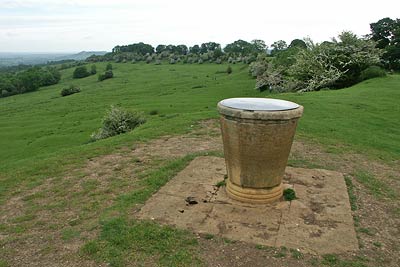
The start is the National Trust car park at Dover's Hill (Grid ref. SP136395) but could also be any other point along the route including Broadway where there is a public transport option. After parking locate the topograph from where there are extensive views and with your back to the car park go half left downhill. There are two gates in the boundary hedge on your left and either can be used to gain access to the lane. If you use the higher gate then turn right down the lane to reach a signed footpath on your left (Grid ref. SP 134398), which is almost opposite the lower gate.
The path leads through paddocks and fields. The path is clearly waymarked (as is most of this route) and leads you to cross the access track to Park Farm. A short distance further on you cross a stream and reach a complex junction of paths (Grid ref. SP125398). Take the second track on your left - Buckle Lane - which leads through woodland to reach a lane. Turn left uphill for approximately 500 metres to a road junction. Turn right and take the signed bridleway on your left. This leads across the outer fringe of a golf course and continues under the busy A44 on the outskirts of Broadway.
Go under the A44 and turn left down a lane which leads to the main street through Broadway. Turn right and enjoy the many fine buildings that flank this classic Cotswold high street. Reaching a road junction turn left for Snowshill and follow this to pass the Parish Church on your left. Just beyond the church turn left down a narrow lane. This leads into a footpath. Continue on this path and turn right in front of the Bowling Club.
After approximately 100 metres turn left (Grid ref. SP097372). Continue straight ahead, ignoring paths to the right and left, eventually joining the Cotswold Way (Grid ref. SP104371) which is followed all the way to the Broadway Tower. The view from here is far reaching with the Vale of Evesham and the Malvern Hills two of the many landmarks.
Having enjoyed the view turn north and follow the Cotswold Way waymarks across the flanks of Broadway Hill to reach the A44. Note that there has been a path diversion either side of the A44 which does not agree with many maps. Once across the A44 continue on the Cotswold Way across fields and a road to enter a wide grassy drive (Grid ref. SP124376). This leads into 'The Mile Drive' and subsequently into a road (Grid ref. SP134388). There is no need to walk along the road as the path stays inside the fence line taking a half right diagonal line across the field to Dyers Lane. (Note if you wish to shorten the walk then stay on the road and turn left at the first junction. This leads to Dover's Hill car park).
Turn right down Dyers Lane towards Chipping Campden. After 400 metres take the signed footpath on the left. This leads across a field to reach a housing estate and continues between back gardens to reach a road. (Take note of this point as you will return here after visiting the town.) Turn right and then left at the main road and you will enter Chipping Campden with its many fine buildings and quaint stone market hall built in 1627.
After exploring the town retrace your steps to the point noted above and continue uphill following the Cotswold Way waymarks. The lane soon deteriorates into a track to reach Kingcomb Lane (Grid ref. SP143397). Turn left for 100 metres and then take the signed footpath on the right. This leads between fences to Dover's Hill. Reaching open pasture turn left and the car park is reached after approximately 500 metres.
Other walks nearby
| Walk 2541 | Hidcote & Foxcote from Mickleton | easy/mod | 7.5 miles |
| Walk 1749 | Upper Quinton & Hidcote Bartrim from Mickleton | easy/mod | 6.8 miles |
| Walk 3072 | Broadway, Stanton & Laverton | easy/mod | 7.5 miles |
| Walk 3250 | The Broadway Tower from Broadway | easy/mod | 5.0 miles |
| Walk 3212 | Ebrington & Foxcote circular | easy | 3.7 miles |
| Walk 2094 | Snowshill Circular | easy | 4.4 miles |
| Walk 2340 | Ilmington Down | easy/mod | 4.3 miles |
| Walk 2408 | Ebrington & Hidcote from Ilmington | easy/mod | 8.0 miles |
| Walk 3249 | Hidcote & Ilmington Down | easy/mod | 8.0 miles |
| Walk 3063 | Stanway & Snowshill circular | moderate | 8.0 miles |
Recommended Books & eBooks
The Cotswold Way Map Booklet
 Map of the 102 mile (163km) Cotswold Way National Trail, between Chipping Camden and Bath. This booklet is included with the Cicerone guidebook to the trail, and shows the full route on OS 1:25,000 maps. The trail typically takes two weeks to walk, and is suitable for walkers at all levels of experience.
More information
The Cotswold Way
 Guidebook to walking the Cotswold Way National Trail. Between Chipping Campden and Bath, the 102 mile route explores the Cotswolds AONB. Described in both directions over 13 stages, the Cotswold Way can be walked year round and is suitable for beginner trekkers. Includes separate OS 1:25,000 map booklet of the route.
More information
Messaging & Social Media
Message Walking Britain and follow the latest news.

Mountain Weather
Stay safe on the mountains with detailed weather forecasts - for iOS devices or for Android devices.