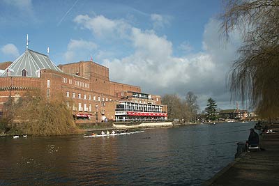
Stratford-upon-Avon from Milcote
Warwickshire Walk
County/Area - Warwickshire
Author - Lou Johnson
Length - 7.0 miles / 11.4 km Ascent - 200 feet / 61 metres
Time - 3 hours 40 minutes Grade - easy/mod
Maps 

| Ordnance Survey Explorer 205 | Sheet Map | 1:25k | BUY |
| Anquet OS Explorer 205 | Digital Map | 1:25k | BUY |
| Ordnance Survey Landranger 151 | Sheet Map | 1:50k | BUY |
| Anquet OS Landranger 151 | Digital Map | 1:50k | BUY |
Walk Route Description

Click image to visit gallery of 6 images.
This walk provides an excellent way of visiting Stratford-upon-Avon. As well as allowing you time to explore the town with its many Shakespearian connections it also removes some of the difficulties associated with parking in the town centre. However on busy days an early start may still be required as there is only limited parking at the start of the walk. The route is generally level and apart from a few short sections is generally free from mud except after prolonged rainy periods.
The car park at Milcote (Grid ref SP170515) is located on the north side of the minor road between Clifford Chambers and Welford-on-Avon and has adequate parking for most days. Located alongside the old railway line between Stratford and Honeybourne, the car park has the benefit a café, which is appropriately an old railway restaurant car preserved on a short section of track.
From the car park walk northeast along the old railway line towards Stratford. After approximately 2 kilometres a girder bridge that once carried the railway over the River Avon comes into view. Just before the bridge descend left and go left again under the trackbed and left again to reach the river bank, which should be on your left. This footpath leads you past the restored weir and locks to pass under a road bridge (Grid ref. SP201539).
Continue ahead on the riverside path past another weir to reach the pleasant lawns and recreation ground alongside the river. At weekends you may see rowers training on the river with their coaches cycling along the path in hot pursuit of their crews! Passing the bandstand you will see the Royal Shakespeare Theatre on the far bank and shortly afterwards you cross the river by the first available bridge. This leads you to the basin where many boats are usually moored. Keeping left of the basin will lead you to a road junction with Sheep Street straight ahead and Waterside running left to right.
It is worthwhile exploring the town centre where you will find many interesting buildings, a variety of shops, cafes and pubs and many reminders of the town's most famous son. This is probably best achieved by using Sheep Street as the way into town and making a note of where you need to be to continue this walk.
To complete the walk, and assuming you have not visited the town centre, turn left down Waterside past the side of the theatre complex. There are many interesting buildings along this street and you will pass the spot where the passenger ferry operates across the river to the recreation ground walked through on the outward route. Waterside leads you into Southern Lane. Turn left at the next junction into Old Town passing Holy Trinity Church on your left. This is where Shakespeare and Anne Hathaway are buried and you can visit this church (admission charge payable).
Just after the Church turn left down Mill Lane following the footpath under the main road. On reaching the other side turn right and walk along the road as far as the roundabout (Grid ref. SP196540). Here you turn left along the old railway track used for the outward route. With Stratford Race Course on your right and the River Avon on your left continue along the broad path to reach the girder bridge. All that remains now is to stay on the track back to the car park.
Other walks nearby
| Walk 2673 | Stratford-upon-Avon circular | easy | 3.8 miles |
| Walk 3246 | River Avon & Cleeve Prior from Bidford-on-Avon | easy | 4.5 miles |
| Walk 1749 | Upper Quinton & Hidcote Bartrim from Mickleton | easy/mod | 6.8 miles |
| Walk 2541 | Hidcote & Foxcote from Mickleton | easy/mod | 7.5 miles |
| Walk 2340 | Ilmington Down | easy/mod | 4.3 miles |
| Walk 2408 | Ebrington & Hidcote from Ilmington | easy/mod | 8.0 miles |
| Walk 3249 | Hidcote & Ilmington Down | easy/mod | 8.0 miles |
| Walk 2836 | Wootton Wawen | easy/mod | 8.0 miles |
| Walk 3212 | Ebrington & Foxcote circular | easy | 3.7 miles |
| Walk 1308 | Broadway & Chipping Campden | moderate | 11.0 miles |
Recommended Books & eBooks
No suggestions for this area.Mountain Weather
Stay safe on the mountains with detailed weather forecasts - for iOS devices or for Android devices.

