Brunt Knott from Staveley
Lake District Walk
Nat Park - Lake District - Lake District Lesser Fells
County/Area - Cumbria
Author - Lou Johnson
Length - 7.0 miles / 11.4 km Ascent - 1600 feet / 485 metres
Time - 5 hours 10 minutes Grade - easy/mod
Maps 

| Ordnance Survey Explorer OL7 | Sheet Map | 1:25k | BUY |
| Anquet OS Explorer OL7 | Digital Map | 1:25k | BUY |
| Ordnance Survey Landranger 90 | Sheet Map | 1:50k | BUY |
| Anquet OS Landranger 90 | Digital Map | 1:50k | BUY |
Walk Route Description
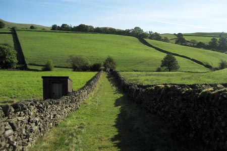
Click image to see photo description.
This walk on the periphery of the Lake District explores the landscape to the northwest of Staveley and includes an ascent of one of the Outlying Fells, namely Brunt Knott. This route is far removed from the busier routes around the major honeypots of the Lake District National Part. Due to its nature a decent map and some navigation skills are required.
For convenience's sake the route is described from the railway station in Staveley (grid ref. SD469980). With your back to the station turn right along The Banks to reach Main Street. Turn left here and in a short distance you will find a footpath (opposite the Post Office) on the right that leads across the River Kent. Once across the river turn left to reach a road (grid ref. SD471984). Continue alongside the river to Barley Bridge. Bear right here and follow the road as far as signed bridleway on the left, which is taken through Scroggs Farm to reach a lane (grid ref. SD466966). Keep straight ahead and take the lane on the right leading up to Elfhowe. Just prior to these farms bear right on a rough track/path (grid ref. SD468988). Keep the wall on your right across a number of walled fields to reach a more substantial track just north of Park House (grid ref. NY470009).
Turn right along this track for a short distance and take the first footpath on your left leading uphill to High House (grid ref. NY474009). Turn right (roughly south) along the track until your reach a junction (grid ref. NY476000). Turn left here climbing to Brunt Knott Farm. Pass the farm and continue uphill with the summit of Brunt Knott ahead and slightly to your left. There are a number of options to reach the summit. You can make a beeline but the ground is steep and fairly rough. The other option is to locate the path which leaves the track at grid ref. NY486001) which makes the ascent much easier.
After enjoying the views from the summit return to Brunt Knott Farm and descend their access track to the junction at grid ref. NY476000, which should be familiar. Turn left here and follow the lane to Littlewood Farm (grid ref. SD480992). Here take the signed footpath to Staveley on your right. Which descends to Barley Bridge. Turn left here along the lane and you will soon be back in Staveley.
Other walks nearby
| Walk 1049 | Staveley Tarns circular | easy/mod | 6.0 miles |
| Walk 2464 | Kentmere Valley Circular | moderate | 10.0 miles |
| Walk 1463 | School Knott & Grandsire from Ings | easy/mod | 6.5 miles |
| Walk 3590 | Orrest Head & Allen Knott from Windermere | easy | 4.4 miles |
| Walk 3451 | Underbarrow, Lord's Lot and Crossthwaite | easy/mod | 5.6 miles |
| Walk 1320 | Shorter Kentmere Horseshoe | mod/hard | 10.5 miles |
| Walk 2652 | Photographer's Kentmere Horseshoe | mod/hard | 13.5 miles |
| Walk 2488 | Shipman Knotts & Kentmere Pike | moderate | 6.2 miles |
| Walk 1147 | Longsleddale and Kentmere Pike | moderate | 8.0 miles |
| Walk 3033 | Tarn Crag & Harrop Pike from Sadgill | moderate | 5.5 miles |
Recommended Books & eBooks
Walking the Lake District Fells - Keswick
 Part of the Walking the Lake District Fells series, this guidebook covers a wide range of routes to 30 Lakeland summits that can be climbed from Keswick, Whinlatter, Bassenthwaite, Caldbeck, Mungrisdale and Threlkeld, with highlights including Skiddaw and Blencathra. Includes suggestions for longer ridge routes.
More information
Outdoor Adventures with Children - Lake District
 Guidebook to 40 outdoor adventures in the Lake District with children under 12, including walking, cycling, orienteering, paddling, boating, hostelling and more. Graded activities for varying age ranges or for families with children of different ages.
More information
Messaging & Social Media
Message Walking Britain and follow the latest news.

Mountain Weather
Stay safe on the mountains with detailed weather forecasts - for iOS devices or for Android devices.