Llanarmon Dyffryn Ceiriog Circular
Wrexham Walk
County/Area - Wrexham
Author - Lou Johnson
Length - 6.0 miles / 9.8 km Ascent - 1000 feet / 303 metres
Time - 4 hours 0 minutes Grade - moderate
Maps 

| Ordnance Survey Explorer 255 | Sheet Map | 1:25k | BUY |
| Anquet OS Explorer 255 | Digital Map | 1:25k | BUY |
Walk Route Description
Click image to see photo description.
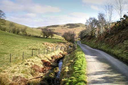
A circular walk from Llanarmon Dyffryn Ceiriog in the Cieriog Valley that explores the valley and the rolling hills to the south of the village. The route uses a section of the Upper Ceiriog Way to reach the summit of Cefn-Hir-fynydd (464 metres) from where there are extensive views across the surrounding area.
Limited on-street parking is available in Llanarmon Dyffryn Ceiriog (grid ref. SJ157328). As an alternative patrons can park at The Hand in the centre of the village. After parking, walk east along the road signed to Oswestry. Continue along the road for about 5400 metres and turn left onto the first signed footpath. The path, with occasional yellow waymarks, crosses fields to Ty'n-y-fedw after which the route soon enters woodland. Exiting the trees continue across a field to join a track (grid ref. SJ176335).
Turn sharp right along the rising track. Keep right at the first fork and shortly after keep right again at the next junction of tracks. Continue uphill on the clear track to reach a lane (grid ref. SJ171327). Go straight across and continue climbing. After 400 metres you reach a cross track. Turn right to follow the Upper Ceiriog Way. The clear track takes you across of Cefn-Hir-fynydd and down to a lane at Llidiart-cae-hir (grid ref. SJ146310).
Bear left along the lane and take the first footpath on the right over a stile. After crossing the first field you join a clearer track which leads down to Cyrchynan Ucha farm. Pass to the left of two large barns and continue northeast on a rising track. The track soon fades and becomes a grassy path. As you start to descend go through a gate on the right (grid ref. SJ151321) and descend to a lane. Turn left downhill back to the start.
Other walks nearby
| Walk 3031 | Cadair Berwyn | moderate | 9.3 miles |
| Walk 1086 | Post Gwyn and Craig-y-Mwn from Pistyll Rhaeadr | moderate | 6.5 miles |
| Walk 3053 | Berwyn Tops from Tan Y Pystyll | moderate | 14.0 miles |
| Walk 1845 | Castell Dinas Bran from Llangollen | easy/mod | 4.0 miles |
| Walk 3655 | Rhewl, Moel y Gamelin & Moel Morfydd | moderate | 5.4 miles |
| Walk 1256 | Cadair Bronwen | moderate | 9.5 miles |
| Walk 1067 | Ruabon Mountain & The Limestone Edges of Llangollen | moderate | 11.0 miles |
| Walk 2388 | Chirk Castle & Ceiriog Valley | easy/mod | 6.0 miles |
| Walk 2598 | Ruabon Mountain, World's End & Panorama Circular | moderate | 12.5 miles |
| Walk 2460 | Pontcysyllte Aqueduct Circular | easy | 4.5 miles |
Recommended Books & eBooks
No suggestions for this area.Messaging & Social Media
Message Walking Britain and follow the latest news.

Mountain Weather
Stay safe on the mountains with detailed weather forecasts - for iOS devices or for Android devices.