Pateley Bridge & Nidderdale Way
Nidderdale AONB Walk
Region - Nidderdale AONB
County/Area - North Yorkshire
Author - Lou Johnson
Length - 7.1 miles / 11.5 km Ascent - 980 feet / 297 metres
Time - 4 hours 30 minutes Grade - easy/mod
Maps 

| Ordnance Survey Explorer 298 | Sheet Map | 1:25k | BUY |
| Anquet OS Explorer 298 | Digital Map | 1:25k | BUY |
Walk Route Description
Click image to see photo description.
Walk from Pateley Bridge that explores Nidderdale upstream to Wath Bridge. The route then climbs a ridge before descending into the valley containing Ashfold Side Beck which is followed upstream to the former Providence Lead Mine. A final climb leads to Dub Bridge from where a gradual descent if made to return to Pateley Bridge. The walk follows the Nidderdale Way, which is generally signed and waymarked, except for the final section of the walk nearing Pateley Bridge.
The start is the South Car Park in Pateley Bridge (grid ref. SE157655) which lies on the B6265 on the south side of the River Nidd. After parking, exit the car park and turn left into the centre of Pateley Bridge. Cross the river and turn sharp left at a fingerpost to join the Nidderdale Way. After a brief section along Mill Lane the path soon runs beside the River Nidd. After nearly three kilometres of easy walking across pastures near the river you reach a lane at Wath Bridge (grid ref. SE145677).
Turn left, cross the river, and continue to a T-junction. Cross straight over to a kissing gate with an adjacent fingerpost. The rising path passes to the left of a barn and continues up to stile. Once in the next field, head half left in the next field keep to the left of a solitary tree and continue to Spring Hill Farm. Pass through the yard and continue to a lane (grid ref. SE140672). Turn right and continue for 200 metres to Heathfield. Turn left (with adjacent fingerpost) and follow the track through trees into open countryside. Where the track bends sharp right, continue ahead downhill for 500 metres to approach Spring House Farm. Pass to the right of the buildings and continue downhill to reach a clear track with a caravan site opposite.
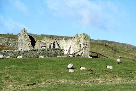
Turn right up the track which follows Ashfold Side Beck upstream. Stay on the track for just over two kilometres and fork left off the track at a fingerpost (grid ref. SE119622). Cross the bridge to enter the old workings of Providence Lead Mine. Once over the bridge, bear right and follow a clear path that loops uphill to reach a wall (grid ref. SE119660). At the end of the wall continue ahead to reach a track (West Lane) and turn right. West Lane is now followed until near the end of the walk. Reaching the top of the hill, West Lane drops down to Dub Bridge. Keep ahead on West Lane for just over two kilometres passing Hillend along the way. The next landmark is when West Lane reaches a wood (grid ref. SE147655). Bear left off West Lane and the Nidderdale Way to join a field path which skirts Eagle Hall and leads in due course to a lane on the edge of Pateley Bridge (grid ref. SE156654). Turn right and almost immediately left between houses to reach the B6265. Turn left and the car park is a short distance away on the right.
Other walks nearby
| Walk 3726 | Brimham Rocks Circular | easy | 4.7 miles |
| Walk 3507 | Dacre Banks Circular | easy/mod | 6.5 miles |
| Walk 1574 | Thruscross Reservoir | easy | 4.5 miles |
| Walk 2405 | Ripon Rowel Walk Leg 3 - Sawley to Ilton | moderate | 11.0 miles |
| Walk 1573 | Grimwith Reservoir | easy | 4.5 miles |
| Walk 2572 | West Scrafton & Middlesmoor from Lofthouse | mod/hard | 18.0 miles |
| Walk 1405 | Thruscross Reservoir & Kex Gill Moor | easy/mod | 8.5 miles |
| Walk 3659 | Scar House Reservoir, Dale Edge & Middlesmoor | moderate | 9.0 miles |
| Walk 3528 | Fountains Abbey & Markenfield Hall | moderate | 8.7 miles |
| Walk 1572 | Swinsty Reservoir | easy | 3.0 miles |
Recommended Books & eBooks
Trail and Fell Running in the Yorkshire Dales
 Guidebook to 40 of the best trail and fell runs in the Yorkshire Dales National Park. Ranging from 5 to 24 miles, the graded runs start from bases such as Ribblehead, Dent, Sedbergh, Malham and Grassington and take in the region's diverse delights, from castles and waterfalls to iconic mountains such as Whernside, Ingleborough and Pen Y Ghent.
More information
Messaging & Social Media
Message Walking Britain and follow the latest news.

Mountain Weather
Stay safe on the mountains with detailed weather forecasts - for iOS devices or for Android devices.