Cul Mor from Knockan Crag Walk
Walk 2274 - Route Maps & Profile
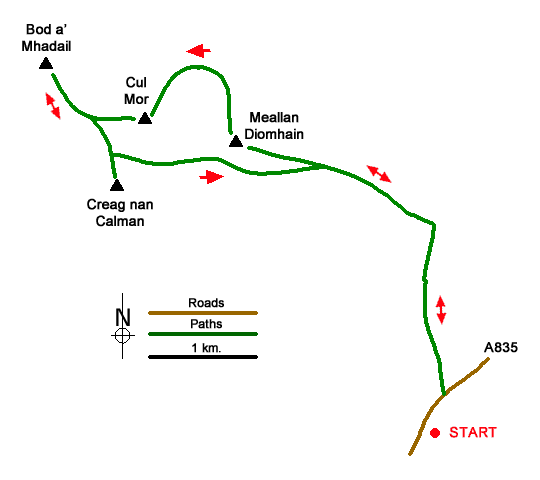
Route Map
Digital Maps - Copyright © 2011-2024. All rights reserved.
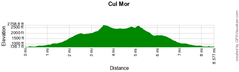
Route Profile
Sketch Map
Suggested Maps 

| Ordnance Survey Explorer 439 | Sheet Map | 1:25k | BUY |
| Anquet OS Explorer 439 | Digital Map | 1:25k | BUY |
It is recommended you take a map. The preferred scale is 1:25k.
Start Point Details
Ordnance Survey Grid Ref NC188091
Latitude 58.033933 Longitude -5.070652
Postcode IV27 4HH
what3words start slowness.dancer.balance
Walk description may contain detailed information on the start point for this walk.
Further Information
Highland
Highland is an administrative area which contains most of the Scottish Highlands. It is sparsely populated and contains some of the finest scenery in the British Isles. High Mountains, deep glens and lochs contain many great walks. The area includes Ben Nevis the highest mountain in the UK. The area also includes part of the Cairngorm National Park, an area of high mountains, and glorious Isle of Skye.
Walk grading - Learn how each walk is assessed and select a walk to suit your ability and experience by going to Walk Grading Details.
Messaging & Social Media
Message Walking Britain and follow the latest news.

Mountain Weather
Stay safe on the mountains with detailed weather forecasts - for iOS devices or for Android devices.