Rushup Edge & Mam Tor from Edale
Peak District Walk
Nat Park - Peak District - Kinder Scout Edale
County/Area - Derbyshire
Author - Lou Johnson
Length - 10.0 miles / 16.3 km Ascent - 1700 feet / 515 metres
Time - 6 hours 40 minutes Grade - moderate
Maps 

| Ordnance Survey Explorer OL1 | Sheet Map | 1:25k | BUY |
| Anquet OS Explorer OL1 | Digital Map | 1:25k | BUY |
Walk Route Description
Click image to see photo description.
Edale is surrounded by a ring of hills and gritstone edges which provide a variety of excellent walks. This route starts from the village of Edale, and after using a section of the Pennine Way to the top of Jacob's Ladder turns south across moorland to Brown Knoll. The walk continues to Rushup Edge where the ridge is followed to Mam Nick. A short ascent leads to the summit of Mam Tor. A section along the Castleton Great Ridge to Hollins Cross and a descent back to the start.
The start is the large car park or railway station at Edale served by trains between Manchester and Sheffield (grid ref. SK124853). On arrival continue uphill into the village past the church to the Old Nags Head where you turn left onto the Pennine Way to Upper Booth. From here stay on the Pennine Way and ascend Jacob's Ladder on the southern slopes of Kinder Scout to reach the point where the Pennine Way turns sharp right (grid ref. SK081861).
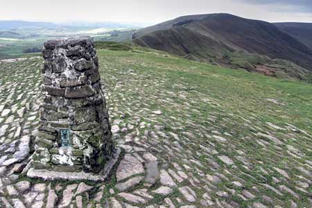
After passing through a gate, turn left on a paved path to cross Brown Knoll. After 800 metres locate another paved path heading left. Take this and continue to the trig point of Brown Knoll. The onward route heads southeast across the moor for just over two kilometres to reach a track (grid ref. SK099832). Turn right and continue to a wall. Turn left, signed to Mam Tor and Hollins Cross, and continue over the ridge of Rushup Edge and the summit at Lord's Seat. From here a clear path leads down to the road at Mam Nick. Turn left and shortly after right onto the path which climbs steeply onto Mam Nick. Take time to enjoy the view which includes most this walk.
Descend from Mam Tor along the Castleton Great Ridge and continue to a col at Hollins Cross (grid ref. SK136845) which offers a final chance to enjoy the view north to Kinder and south into the White Peak. Leave the ridge path and turn sharp left and continue for a short way to a junction where you keep left along a signed bridleway which leads towards Greenlands. Reaching a junction just before Greenlands, turn right and follow the farm access lane downhill to the valley road. Turn right and then first left to return to Edale station or car park.
At the three-way fingerpost turn right downhill to the Plough at Casden (grid ref. SP826045). Turn left along the road and the right through a gap in a fence with waymarks attached. Follow the Ridgeway through Pulpit Hill Nature Reserve. Go straight ahead at a cross path and continue across a field to reach the outward route as noted in paragraph two. Turn left and walk downhill to the start at Great Kimble.
Other walks nearby
| Walk 2522 | Rushup Edge & Edale from Mam Nick | moderate | 7.0 miles |
| Walk 1368 | Mam Tor, Upper Booth & Rushup Edge | moderate | 7.0 miles |
| Walk 1831 | Mam Tor & Hollins Cross from Mam Nick | easy | 3.0 miles |
| Walk 1688 | Old Dam & Sparrowpit from Mam Nick | moderate | 9.0 miles |
| Walk 1087 | Mam Tor & Cave Dale | moderate | 6.5 miles |
| Walk 1519 | Catleton & Speedwell Cavern Circular | easy | 4.3 miles |
| Walk 1521 | Cave Dale and Winnats Pass | easy | 4.5 miles |
| Walk 1665 | Hollins Cross & Lose Hill | easy/mod | 6.0 miles |
| Walk 3426 | Lose Hill & Hollins Cross | easy/mod | 5.0 miles |
| Walk 1489 | Blackden Brook, Kinder & Upper Ashop | moderate | 6.8 miles |
Recommended Books & eBooks
Great Mountain Days in the Pennines
 An inspirational guidebook to 50 classic walks on the rolling Pennine landscape. The graded routes, between 6 and 13 miles in length, cover classic Pennine fells and moorland such as Whernside, Ilkley Moor and Pendle Hill; exploring the North and South Pennines, Yorkshire Dales, Howgills and Dark Peak. Many routes are also suited to fell running.
More information
Dark Peak Walks
 Guidebook to 40 walks in the Dark Peak area of the Peak District National Park. 35 circular routes for most abilities, from 8km to 19km, around Edale, Marsden, Fairholmes, Baslow and Castleton, including Kinder Scout and Mam Tor, and 5 longer (25km to 45km) routes highlighting the best of the Gritstone Edges, High Moorland and Deep Valleys.
More information
Messaging & Social Media
Message Walking Britain and follow the latest news.

Mountain Weather
Stay safe on the mountains with detailed weather forecasts - for iOS devices or for Android devices.