Weardale Circular from Westgate
Pub Walk + Moorland Walk + Riverside Walk
Region - North Pennines
County/Area - Durham
Author - Lou Johnson
Length - 6.4 miles / 10.4 km Ascent - 900 feet / 273 metres
Time - 4 hours 10 minutes Grade - easy/mod
Maps 

| Ordnance Survey Explorer OL31 | Sheet Map | 1:25k | BUY |
| Anquet OS Explorer OL31 | Digital Map | 1:25k | BUY |
Walk Route Description
Click image to see photo description.
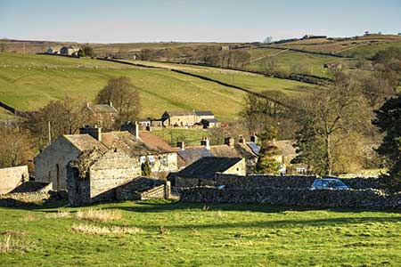
A circular walk from Westgate full of interest. The route follows the Weardale Way upstream before exploring the Weardale moors. The route includes field paths, walled lanes, the remains of Slitt Mine and the partially wooded valley containing Middlehope Burn.
On-street parking is available near the Hare and Hounds in Westgate (grid ref. NY908381). After parking take the lane beside the pub signed to Brotherlee. Cross the River Wear and take the signed footpath on the right. Cross the stile and follow the Weardale Way across fields to reach kissing gate and a lane. Cross the lane to the signed path opposite. The path leads across fields latterly running close to the river. Climb the steps up to the A689 at Bridge End. Cross the road to continue along the Weardale Way running beside the river. Reaching the next lane, turn right over the footbridge and continue to a T-junction (grid ref. NY889382).
Turn left and continue uphill for 400 metres to turn right at footpath fingerpost up a clear track. When the track bends right continue ahead up across fields to reach a road (Side Head). Turn left, enjoy the view over Weardale on your left, and continue up to the next fingerpost on the right. To join a rising track between walls. After 700 metres the wall on the left ends. Continue ahead across open moor with the path running close to a wall on your right. Follow this path to reach a road (grid ref. NY883401).
Turn right uphill soon passing a plantation on your left and the highest point of the walk. Follow the road as it bends left and descend Middlehope Bank. After 800 metres of easy downhill walking, you reach a fingerpost on the right. Turn right and follow the track for a kilometre to a junction (grid ref. NY901399). Turn left and continue along the track to cross Middlehope Burn. Continue along the track until it turns sharp left. Leave the track here and turn right. The path runs beside a wall on your left. The onward path follows Middlehope Burn downstream and after a kilometre reaches the remains of Slitt Mine. Continue south on the path beside the burn, crossing and recrossing the stream. Before joining a track, which leads to a road. Bear right downhill and continue to the A689 in Westgate. Turn left back to the start.
Other walks nearby
| Walk 1659 | Race Head & Sedling Rake from Wearhead | easy/mod | 6.0 miles |
| Walk 3634 | Catterick Moss & Bollihope Carrs | moderate | 5.6 miles |
| Walk 3424 | Cronkley Fell from Hanging Shaw | easy/mod | 7.0 miles |
| Walk 3526 | Hanging Shaw, Cronkley Scar, Low Force & High Force | moderate | 12.7 miles |
| Walk 3099 | High Force, Low Force and the River Tees | easy/mod | 7.5 miles |
| Walk 3274 | Cronkley Scar & Cauldron Snout | moderate | 8.0 miles |
| Walk 1683 | High Cup Nick & Cow Green Reservoir | moderate | 12.8 miles |
| Walk 3336 | Cauldron Snout | easy | 3.6 miles |
| Walk 3593 | Meldon Hill from Cow Green Reservoir | moderate | 9.2 miles |
| Walk 2815 | Pennypie and Blanchland from Baybridge | easy/mod | 3.8 miles |
Recommended Books & eBooks
Walking in the North Pennines
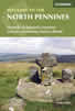 This guidebook describes 50 day walks across the North Pennines, England's remotest Area of Outstanding Natural Beauty taking in parts of Cumbria, County Durham and Northumberland. Most of the routes are circular and they range from 5 to 14 miles, with something to suit all abilities. Route descriptions are accompanied by 1:50K OS mapping.
More information
Walking in County Durham
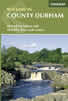 Guidebook offering detailed descriptions of 40 day walks, plus 10 traffic-free cycle routes along old railway trackbeds. Together they cover 450 miles and spread all over County Durham to show the region's history and natural wonders. The terrain covered ranges from field paths to open moorlands, from the North Sea to the high Pennines.
More information
Messaging & Social Media
Message Walking Britain and follow the latest news.

Mountain Weather
Stay safe on the mountains with detailed weather forecasts - for iOS devices or for Android devices.