Braunston-in-Rutland Circular
Pub Walk + Countryside Walk + Abbey + Church
County/Area - Rutland
Author - Lou Johnson
Length - 5.3 miles / 8.6 km Ascent - 420 feet / 127 metres
Time - 3 hours 0 minutes Grade - easy
Maps 

| Ordnance Survey Explorer 234 | Sheet Map | 1:25k | BUY |
| Anquet OS Explorer 234 | Digital Map | 1:25k | BUY |
Walk Route Description
Click image to see photo description.
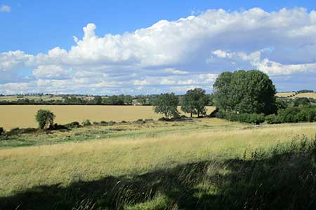
A circular walk from Braunston-in-Rutland which is located not far from Rutland's County town of Oakham. The route crosses undulating countryside typical of the county. The route uses a section of the Leighfield Way, provides the chance to see the Braunston 'Goddess', a mysterious stone carving in All Saints churchyard, and passes through the village of Brooke where the earthworks of a priory remain.
On street parking is available near to All Saints church in Braunston (grid ref. SK833066). After parking walk south along Wood Lane with the church on your right. Continue ahead until the lane bends left. Take the track ahead, and at the end of some barns, cross footbridge on the left, pass through gate and head half-right across two fields to cross a stile by Prior's Coppice. Follow the path between the trees and a fence and continue to reach a cross track (grid ref. Sk827050).
Cross the track into the filed opposite. The path runs along the right-hand side of the field to join a track After 20 metres take the stile on the left and cross a field diagonally to the fare right-hand corner near Leigh Lodge. Pass through a gate and bear left. After 100 metres turn left at a T-junction. And follow a drive for just under two kilometres passing Leigh Lodge Cottages just over halfway. Reaching a road, turn right and follow this road to a crossroads (grid ref. SK847052).
Turn left and continue into the village of Brooke. Reaching a T-junction with a grass triangle, turn left (signed to Braunston).200 metres beyond this junction the earthworks of the former priory are in the fields to the right. Follow the road around a right-hand bend and after 200 metres tune left through a gate onto a signed footpath. The path keeps to the right-hand side of the field. The path arcs left to a way post. Turn right over a small bridge. Cross a stile onto a grassy track. Bear left and after 5 metres cross stile into a field on the right. The path keeps to the right-0hand edge of this field. The onward path continues across fields and into an enclosed path which then leads back to Wood Lane. Turn right back to the start in Braunston.
Other walks nearby
| Walk 2323 | Hambleton Peninsula circular | easy | 4.9 miles |
| Walk 2927 | Hallaton, Glooston & Rolleston from Tugby | moderate | 12.5 miles |
| Walk 2913 | Stockerston, Great Easton & Gretton from Lyddington | moderate | 15.0 miles |
| Walk 3628 | Morcott & Harringworth Circular | easy/mod | 7.2 miles |
| Walk 1708 | Lowesby and South Croxton | easy/mod | 7.0 miles |
| Walk 1443 | Burrough Hill & Somerby from Twyford | moderate | 11.0 miles |
| Walk 2831 | Cranoe, Medbourne & Blaston from Hallaton | moderate | 11.5 miles |
| Walk 2198 | Empingham & Exton | easy/mod | 9.0 miles |
| Walk 3425 | Rolleston from Billesdon | easy | 5.3 miles |
| Walk 3351 | Rolleston, Skeffington & Tilton from Billesdon | moderate | 12.3 miles |
Recommended Books & eBooks
No suggestions for this area.Messaging & Social Media
Message Walking Britain and follow the latest news.

Mountain Weather
Stay safe on the mountains with detailed weather forecasts - for iOS devices or for Android devices.