Sheringham to Cley-next-the-Sea
Norfolk Walk
County/Area - Norfolk
Author - Lou Johnson
Length - 8.5 miles / 13.8 km Ascent - 450 feet / 136 metres
Time - 4 hours 40 minutes Grade - easy/mod
Maps 

| Ordnance Survey Explorer 251 | Sheet Map | 1:25k | BUY |
| Anquet OS Explorer 251 | Digital Map | 1:25k | BUY |
| Ordnance Survey Landranger 133 | Sheet Map | 1:50k | BUY |
| Anquet OS Landranger 133 | Digital Map | 1:50k | BUY |
Walk Route Description
Click image to visit gallery of 6 images.
This section of Norfolk Coast Path offers a variety of scenery and by using the Hopper bus service detailed below you avoid the need to retrace your steps. Starting at Sheringham, the initial section of the route is in the shadow of the sandy cliffs but this soon changes to shingle beach backed by salt marshes with a wide variety of wildlife, especially birds.
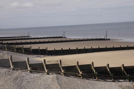
The start is the North Norfolk Railway station (Grid ref. TG156430) in Sheringham. This is also the bus stop for the Coast Hopper Bus and there is plenty of pay and display car parking in the vicinity. From the station, walk down Station Road and into High Street. Continue down through the shopping area to reach the coast. Sadly the cliffs in the immediate vicinity have suffered from the construction of vast walls of concrete to protect the cliffs from erosion. The groynes on the beach and large boulders are placed to protect the concrete walls, obvious evidence of the destructive power of the sea at this location.
Turn left along the promenade past the small lifeboat museum. Continuing west take the higher path when offered the choice soon reaching the outskirts of the town. The path remains on the cliff top initially following an undulating route. Gradually the height of the cliffs reduces and by Weybourne Hope the path is more or less flat. Following a route along the back of the shingle beach, progress is quite quick and Gramborough Hill is soon reached. Do not expect anything too exciting - this hill is nothing more than a blip on the landscape.
The car park (Grid ref TG081443) a few hundred metres further on has a mobile coffee shop in season. The next section of path skirts Salthouse Marshes with their varied birdlife. From here onwards you can either walk behind the beach or on it depending on your mood. A pair of binoculars would also be useful for the birdlife. As you pass Cley Marshes on your left you can see the hides used by birdwatchers. The onward route is never in doubt, and with a pleasant backdrop of hills inland and a forward view that includes the windmill at Cley and the church tower at Blakeney, there is always something to keep your interest.
Reaching the car park (Grid ref. TG047452) and "Arkwright's café", the path turns inland for the final section into the village of Cley-next-the-Sea. Passing the windmill, look out for the path going left that leads onto the High Street, which is worth exploring. Refreshments are available in the village. The bus stop for the Hopper is opposite the delicatessen on the A149 just after it turns sharp right towards Blakeney.
Note - There is an excellent bus service operating along the A149 coast road between Sheringham and Kings Lynn. Operated by Norfolk County Council, this 'Coast Hopper' service is useful for many walks as the bus route shadows the Norfolk Coast Path. This enables one way walks to be undertaken with relative ease but also means that other walks can be altered to suit your needs.
Other walks nearby
| Walk 2151 | Metton & Felbrigg Hall | easy/mod | 6.2 miles |
| Walk 1654 | Cley next the Sea & Salthouse | easy | 6.7 miles |
| Walk 1730 | Blakeney Point | moderate | 9.0 miles |
| Walk 2401 | Salthouse from Cley-next-the-Sea | easy | 4.0 miles |
| Walk 1804 | Blakeney & Cley next the Sea | easy | 5.0 miles |
| Walk 1600 | Morston Salt Marshes from Morston Quay | easy | 2.5 miles |
| Walk 2307 | Blakeney from Morston Quay | easy | 2.0 miles |
| Walk 3732 | Morston, Blakeney & Cley next the Sea | easy | 4.0 miles |
| Walk 3678 | Brampton & the Bure Valley from Buxton | easy/mod | 6.0 miles |
| Walk 2297 | Honing & East Ruston Circular | easy/mod | 6.4 miles |
Recommended Books & eBooks
No suggestions for this area.Messaging & Social Media
Message Walking Britain and follow the latest news.

Mountain Weather
Stay safe on the mountains with detailed weather forecasts - for iOS devices or for Android devices.