Great Shunner Fell & Lovely Seat
Yorkshire Dales Walk
Nat Park - Yorkshire Dales - Wensleydale
County/Area - North Yorkshire
Author - Lou Johnson
Length - 11.4 miles / 18.5 km Ascent - 1800 feet / 545 metres
Time - 7 hours 30 minutes Grade - mod/hard
Maps 

| Ordnance Survey Explorer OL30 | Sheet Map | 1:25k | BUY |
| Anquet OS Explorer OL30 | Digital Map | 1:25k | BUY |
| Ordnance Survey Landranger 98 | Sheet Map | 1:50k | BUY |
| Anquet OS Landranger 98 | Digital Map | 1:50k | BUY |
Walk Route Description
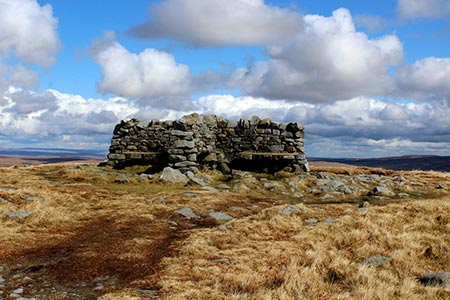
Click image to see photo description.
This Yorkshire Dales walk includes the summits of Great Shunner Fell (716 metres), the third highest mountain in Yorkshire, and Lovely Seat (670 metres) in an energetic walk. The route uses the Pennine Way as far as the summit of Great Shunner Feel. However, from there the route becomes more difficult with rough and often wet ground to cross. The descent from Lovely Seat is pathless over rough ground.
The start is Hardraw where roadside parking can be found at the west end of the village (grid ref. SD865912). After parking walk towards the village and turn left onto the Pennine Way which is followed for about 7 kilometres to the summit of Great Shunner Fell. Initially the path follows a walled track. The track climbs steadily and where the walled track ends after 1.5 kilometres, you reach open country (grid ref. SD857921). Almost immediately the track forks. Take the left fork staying on the Pennine Way. Briefly there is a section with a wall on your immediate left. The gradient steepens to reach a gate (grid ref. SD848932). Go through the gate, pass a sheepfold on your left, and shortly after turn right still following the Pennine Way. The path rises across a wild moorland landscape. As you approach Great Shunner Fell's summit the path bears to the right. Cross a stile to the summit where a wonderful view opens up for you to enjoy. Highlights of the panorama include Swaledale with its patchwork of green fields and hay barns and the view west to Wild Boar Fell.
From the summit follow the Pennine Way for a few metres to a gate. Turn right here and follow the fence to descend to Butter Tubs Pass. In places the path is easy to follow but where it fades use the fence as a guide. Stay with fence as it turns right and continue alongside the fence. The fence then swings left to cross Little Shunner Fell (grid ref. SD859971). From here the path swings southeast generally following the fence. However, you might take an alternative route to avoid wet ground. The path descends to a wet col aptly named Grimy Gutter Hags> Here the fence swings right leading across some rough ground to reach the road across Butter Tubs Pass (grid ref. SD868954).
Turn left up the road as far as a fence corner on the right. Turn right off the road and follow the path uphill beside the fence. This path leads to a stile on the left, so you access the summit of Lovely Seat. After enjoying the view and studying your map, re-cross the stile and turn left along the path to a fence corner. You now have a section of rough, pathless ground to cross. From the fence corner head south west and by using trial and error keep descending to avoid the peat hags and drainage ditches. Maintain a south-westerly direction to continue the descent. As you lose height you should see a small carpark on the west side of the road and a clear track heading east. Both features provide useful navigation aids.
Reaching the road (approx. grid ref. SD866937), turn left and continue along the road past High Shaw. Just before a phone box on the left at Simonstone, take the signed footpath on the right. Follow the track passing West House on your left and continue following the path to reach the road In Hardraw where you turn right back to the start.
Other walks nearby
| Walk 2155 | Mossdale & Cotterdale | easy/mod | 7.9 miles |
| Walk 2273 | Dodd Fell Hill & Drumaldrace | moderate | 11.5 miles |
| Walk 2286 | Gayle & Aysgill Force from Hawes | easy | 3.5 miles |
| Walk 2363 | Drumaldrace (Wether Fell) from Burtersett | easy/mod | 5.2 miles |
| Walk 2265 | Semer Water, Stalling Busk & Marsett | easy | 4.0 miles |
| Walk 3524 | Semer Water and Cam High Road from Bainbridge | easy/mod | 5.7 miles |
| Walk 1053 | Swinner Gill and Muker | mod/hard | 8.5 miles |
| Walk 2409 | The Upper Eden valley without a car | moderate | 12.0 miles |
| Walk 2822 | Aysgarth & Castle Bolton | mod/hard | 14.5 miles |
| Walk 1694 | Nappa Hall & Whitfield Gill Force | easy/mod | 6.0 miles |
Recommended Books & eBooks
The Pennine Way
 Guidebook to the Pennine Way National Trail with OS map booklet. The 265 mile route from Edale to Kirk Yetholm takes three weeks to walk and is suitable for fit and experienced long distance walkers. The route crosses the Peak District, Yorkshire Dales and North Pennines National Parks. Includes separate OS 1:25,000 map booklet of the route.
More information
The Pennine Way - the Path, the People, the Journey
 A portrait of the The Pennine Way, Britain's oldest and best known long-distance footpath, stretching 268 miles from the Peak District to the Scottish Borders. This personal, thoughtful and often humorous story of the path's remarkable history, includes the experiences of walkers and local characters on this exhilarating and complex path.
More information
Messaging & Social Media
Message Walking Britain and follow the latest news.

Mountain Weather
Stay safe on the mountains with detailed weather forecasts - for iOS devices or for Android devices.