Great Shunner Fell from Hardraw
Yorkshire Dales Walk
Nat Park - Yorkshire Dales - Wensleydale
County/Area - North Yorkshire
Author - Lou Johnson
Length - 9.2 miles / 15 km Ascent - 1500 feet / 455 metres
Time - 6 hours 10 minutes Grade - mod/hard
Maps 

| Ordnance Survey Explorer OL30 | Sheet Map | 1:25k | BUY |
| Anquet OS Explorer OL30 | Digital Map | 1:25k | BUY |
| Ordnance Survey Landranger 98 | Sheet Map | 1:50k | BUY |
| Anquet OS Landranger 98 | Digital Map | 1:50k | BUY |
Walk Route Description
Click image to see photo description.
This North Yorkshire walk takes you to the summit of Great Shunner Fell (716 metres), the third highest mountain in the Yorkshire Dales National Park. This linear route uses the Pennine Way which makes navigation an easier task than it might be when you consider the terrain.
The start is the village of Hardraw where limited roadside parking is available at the west end of the village (grid ref. SD865912). After parking walk towards the village. Turn left onto the Pennine Way (signed Thwaite and Cotterdale). You now have about 7 kilometres following the Pennine Way to the summit of Great Shunner Fell. Initially the path follows a walled track. The track climbs steadily and where the walled track ends after 1.5 kilometres, you reach open country (grid ref. SD857921).
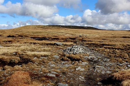
A few metres later the track forks. Take the left fork staying on the Pennine Way. The clear track continues to climb across the moor. For a brief section there is a wall on your immediate left and after passing the section of wall, the gradient steepens. Reaching a gate (grid ref. SD848932). Go through the gate, pass a sheepfold on your left, and shortly after turn right still following the Pennine Way.
The way ahead is still easy to follow rising across a wild moorland landscape. As you approach Great Shunner Fell's summit the path bears to the right and a wonderful view opens up for you to enjoy. Highlights of the panorama include Swaledale with its patchwork of green fields and hay barns and the view west to Wild Boar Fell. If like me, you have frequently walked in this area you will be able to identify many of the places you have walked in the past.
With the hard work now over you can retrace your route back to the start at Hardraw. With very few exceptions the path is downhill all the way and you can relax and enjoy the view to the south across Wensleydale to the higher ground of Three Peaks Country.
Other walks nearby
| Walk 2155 | Mossdale & Cotterdale | easy/mod | 7.9 miles |
| Walk 2273 | Dodd Fell Hill & Drumaldrace | moderate | 11.5 miles |
| Walk 2286 | Gayle & Aysgill Force from Hawes | easy | 3.5 miles |
| Walk 2363 | Drumaldrace (Wether Fell) from Burtersett | easy/mod | 5.2 miles |
| Walk 2265 | Semer Water, Stalling Busk & Marsett | easy | 4.0 miles |
| Walk 3524 | Semer Water and Cam High Road from Bainbridge | easy/mod | 5.7 miles |
| Walk 1053 | Swinner Gill and Muker | mod/hard | 8.5 miles |
| Walk 2409 | The Upper Eden valley without a car | moderate | 12.0 miles |
| Walk 2822 | Aysgarth & Castle Bolton | mod/hard | 14.5 miles |
| Walk 1694 | Nappa Hall & Whitfield Gill Force | easy/mod | 6.0 miles |
Recommended Books & eBooks
The Pennine Way
 Guidebook to the Pennine Way National Trail with OS map booklet. The 265 mile route from Edale to Kirk Yetholm takes three weeks to walk and is suitable for fit and experienced long distance walkers. The route crosses the Peak District, Yorkshire Dales and North Pennines National Parks. Includes separate OS 1:25,000 map booklet of the route.
More information
Pennine Way Map Booklet
 Map of the 270 miles (435km) Pennine Way National Trail, between Edale in the Peak District and Kirk Yetholm in the Scottish Borders. This booklet is included with the Cicerone guidebook to the trail, and shows the full route on Ordnance Survey 1:25,000 maps. This popular long-distance route typically takes three weeks to complete.
More information
Messaging & Social Media
Message Walking Britain and follow the latest news.

Mountain Weather
Stay safe on the mountains with detailed weather forecasts - for iOS devices or for Android devices.