Kirkby Malham & Hanlith from Malham
Yorkshire Dales Walk
Nat Park - Yorkshire Dales - Malhamdale
County/Area - North Yorkshire
Author - Lou Johnson
Length - 4.0 miles / 6.5 km Ascent - 650 feet / 197 metres
Time - 2 hours 40 minutes Grade - easy
Maps 

| Ordnance Survey Explorer OL30 | Sheet Map | 1:25k | BUY |
| Anquet OS Explorer OL30 | Digital Map | 1:25k | BUY |
| Ordnance Survey Landranger 98 | Sheet Map | 1:50k | BUY |
| Anquet OS Landranger 98 | Digital Map | 1:50k | BUY |
Walk Route Description
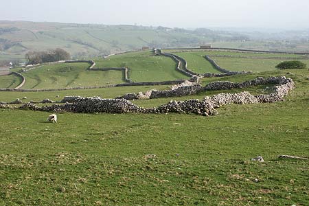
Click image to visit gallery of 3 images.
Malham and its many natural attractions are mainly located to the north of the village with Malham Cove in particular providing a magnet for visitors. Away from the crowds, Malhamdale provides many pleasant Yorkshire Dales walks offering a taste of rural life.
This walk starts from the Visitor Centre (Grid ref SD900627) located on the approach to Malham. Exit the car park onto the main road and immediately turn right to take the signed footpath along a walled lane heading almost due west to Hall Close. Reaching the end of the lane go into the field and continue ahead maintaining the same direction. The onward route is not that clear in places and the use of a detailed map is useful. However there are some waymarks and providing you keep the woodland to your left you will pass Old Accraplatts on your right to cross fields and exit on to a farm track (Grid ref. SD883617).
Turn left here and continue ahead and down Cow Close Lane into the attractive village of Kirkby Malham. Reaching the main road through the village, turn right with a pub a short way along on your right that provides a potential source of refreshments. Just past the pub, turn left and walk down the lane to cross the River Aire (Grid ref. SD900611). Continue along the lane past Hanlith Hall and then uphill into the hamlet of Hanlith. At a sharp bend (Grid ref. SD901614) the Pennine Way goes off left. Take this and follow the clear path across meadows with the River Aire below to your left.
Reaching the path junction near Mires barn (Grid ref. SD902264) go straight ahead towards Malham village. Turn left over the bridge and turn left down the road to reach the start.
Other walks nearby
| Walk 1282 | Malham Tarn & Arncliffe | moderate | 12.5 miles |
| Walk 3092 | Malham Cove, Malham Tarn & Watlowes | easy | 4.4 miles |
| Walk 2385 | Airton & Bell Busk Circular | easy/mod | 6.8 miles |
| Walk 1377 | Calton and Hanlith Moors | easy/mod | 6.5 miles |
| Walk 2066 | Winterburn Reservoir circular | easy | 6.0 miles |
| Walk 1701 | Bordley Hall & Malham Moor from Threshfield Moor | easy/mod | 7.0 miles |
| Walk 2332 | Mastilles Lane & Bordley from Kilnsey | easy/mod | 6.8 miles |
| Walk 3107 | Flasby Fell from Flasby | easy/mod | 6.5 miles |
| Walk 3109 | Rylstone Edges & Cracoe from Rylstone | easy/mod | 6.0 miles |
| Walk 2617 | Nappa Cross & Victoria Cave from Langcliffe | moderate | 9.5 miles |
Recommended Books & eBooks
Pennine Way Map Booklet
 Map of the 270 miles (435km) Pennine Way National Trail, between Edale in the Peak District and Kirk Yetholm in the Scottish Borders. This booklet is included with the Cicerone guidebook to the trail, and shows the full route on Ordnance Survey 1:25,000 maps. This popular long-distance route typically takes three weeks to complete.
More information
Trail and Fell Running in the Yorkshire Dales
 Guidebook to 40 of the best trail and fell runs in the Yorkshire Dales National Park. Ranging from 5 to 24 miles, the graded runs start from bases such as Ribblehead, Dent, Sedbergh, Malham and Grassington and take in the region's diverse delights, from castles and waterfalls to iconic mountains such as Whernside, Ingleborough and Pen Y Ghent.
More information
Messaging & Social Media
Message Walking Britain and follow the latest news.

Mountain Weather
Stay safe on the mountains with detailed weather forecasts - for iOS devices or for Android devices.