Cupwith & Shooter's Nab from Marsden
South Pennines Walk
Region - South Pennines
County/Area - West Yorkshire - South Pennines
Author - Stephen Starkey
Length - 13.0 miles / 21.1 km Ascent - 2540 feet / 770 metres
Time - 9 hours 0 minutes Grade - moderate
Maps 

| Ordnance Survey Explorer OL21 | Sheet Map | 1:25k | BUY |
| Anquet OS Explorer OL21 | Digital Map | 1:25k | BUY |
| Ordnance Survey Landranger 110 | Sheet Map | 1:50k | BUY |
| Anquet OS Landranger 110 | Digital Map | 1:50k | BUY |
Walk Route Description
Click image to visit gallery of 12 images.
This is a walk amongst the wild moorland typical of the South Pennines but offering extensive views throughout. As well as views of the local area (Colne Valley and Huddersfield), a clear day will reveal views across West Yorkshire to the power stations at Ferrybridge and Eggborough in the East (53 km away) and beyond Ovenden Wind Farm (21 km away) to the North. On the whole, this walk uses clear footpaths. There are times however when the route passes through private gardens. At such times please respect the privacy and property of others but also be confident of your rights to follow the public footpaths. Confidence in your navigational abilities, possibly combined with a GPS with pre-programmed route, will be helpful. With numerous sheep tracks, the route from Deer Hill Reservoir to the top of Shooters Nab and back to the catchment dike is not always obvious amongst the heather.
From the Standedge Visitor Centre Car Park (Grid ref. SE047118), also home to the Marsden Moor offices of the National Trust, follow Station Road in a Westerly direction in order to cross the railway lines at Marsden Station. At the T-junction, turn right - the bus stop describes this as Dirker Drive, the road name sign states Reddisher Road leading to Dirker Drive. Either way, about 50 metres along the road, immediately after a barn on the left, a public footpath sign points North along Spring Head Lane. The first part of the lane is a tarmac surface but the climb is quite steep nonetheless and one to get the calf muscles working.
On arriving at a row of houses, the map indicates a choice of paths passing front or back of the houses, both meeting again after a couple of hundred metres. Local residents would prefer you to follow the right hand of the two paths, passing to the front of the houses then continuing above further houses down to the right. After a short, level respite, the deceptively steep climb continues across the Dirker flank of Huck Hill. Should you turn round, there are views across the village of Marsden towards Butterley Reservoir, which we will meet towards the end of the walk.
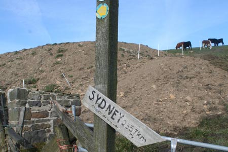
After a short while the path swings round to the North West, crossing another path near to a farm and passing a rather inaccurate signpost to Sydney. This section of the route, and continuing beyond the farm, can be extremely boggy, particularly if the cattle are grazing in the adjacent fields. There are some stones in place to assist but an alternative option is the "wall" top. The going gradually becomes easier as you progress along Huck Hill Lane, with views opening up on the right of Slaithwaite and other villages of the Colne Valley beyond. The repeater mast at Cop Hill and the radio masts at Pole Hill are useful landmarks along this section of the route through the wild South Pennine moors.
This section of the route coincides with both the Kirklees Way and the Colne Valley Circular Walk. Indeed, later sections of the walk also follow part of the Colne Valley Circular Walk so it is worthwhile being familiar with the directional signs for this walk. There are two styles currently in use - the original yellow arrow on a black background and the more recent white background with green arrow and white logo (See photo for examples). After a period of sustained but gentle uphill walking, a stone memorial seat comes in to view with a sandstone pitched path coming from the right and continuing ahead at the seat. At the seat, the Kirklees Way continues ahead whereas the Colne Valley Circular Walk turns right. Our route turns right to continue following the CVCW as it descends towards the mast at Cop Hill. Before doing so though, on a clear day it is worth continuing past the seat for about 100m to Cupwith Reservoir from where there are extensive views across the conurbations of West Yorkshire.
This section of the walk is across wild, heather clad moorland, though the path remains clear throughout. Around Blake Clough you will pass what remains of a stone building that, in Estate Agent speak, may be described as a "desirable residence with extensive natural grounds and superb views though some modernisation required". Shortly after crossing 2 stiles the path emerges on to the bend of a minor road. Continue heading East along the road, wonderfully named as Old Ground, for 400m. You will then see a wooden board sign on the embankment pointing left to continue along the Colne Valley Circular Walk on a lane that leads to Upper House Farm.
Continue on the lane cum path following the CVCW directional signs until you cross a fence with a short but steep drop down to a lane. At this point the CVCW bears left, but our route continues straight ahead on the waymarked path / lane to the cluster of houses at New Close. At New Close the footpath passes through a gate on the right into a field that the landowner has started to use as an extension to their garden. Shortly after passing New Close you may experience a more difficult issue. The path ahead is clearly signed through a gate but the landowner here has locked the gate with 3 padlocks, mounted barbed wire across the top of the fence and is using the field as a paddock for show horses. There are alternative gates and routes you can use - just be confident in your rights and be considerate of others.
On arriving at the lane in the hamlet of Lower Holme, turn right, heading towards the telephone box and minor road. It appears that the path marked on the OS map straight across the road junction no longer exists. However, turning right at the road junction for 30m or so leads to a path on the left that rejoins the path marked on the map. The attractive path cum lane descends very gradually before looping back to Owlers Wood. Although the OS map indicates a number of alternative paths in this area, only one is clearly visible on the ground. After passing through the small wood, the path crosses the railway line. Ignore the more obvious looking path to the left and take the concrete steps ahead to descend towards the Huddersfield Narrow Canal. Here there are a choice of bridges across the canal and River Colne. After crossing the river, take the path to the left, which can be muddy, to ascend through a field to the main A62 trunk road.
Head SW along the road for about 200m to take the signposted footpath immediately after the last of the row of houses. The path climbs through a series of fields, with the remains of a dry stone wall on the left, to merge with another section of the Colne Valley Circular Walk at Hill Top. The embankment just above the chapel makes a nice location to stop for a while, with extensive views across the eastern part of the Colne Valley. For the next section of the walk, we once again follow the CVCW through farmland offering views across Slaithwaite. After crossing the B6109 road the path descends to Bradley Brook and a footbridge hidden amongst the trees. The climb away from the brook is inevitably "very soft" underfoot. As you draw level with a housing estate below left, you will come to some cottages on the right. Immediately after the cottages, turn right to enter a field by means of a somewhat dilapidated stile to follow a public footpath (not signposted) heading SE as it climbs up a small valley. Continue ahead at Lower Hey Farm to emerge on Jerusalem Road to the SW of Jerusalem Farm.
Cross the road and take the path ahead to climb a little further to a second road. Here you go left along the road for about 15m to join a broad and stony bridleway / farm track heading South. This path runs straight for about 950m direct to the Wills O Nats public house. This pub is renowned locally for both its ale and its home cooked food - a fine watering hole at the half way point of the walk. From the pub take the bridleway running SW and follow this for about 1 mile, passing Laund Farm, crossing the B6107/B6109, crossing a catchwater dam along the way. About 200m after a path known as Hassocks Road joins from the left, the path splits. The path ahead leads to a private property, our route bends round to the right and leads on to Deer Hill Reservoir.
Rather than trying to follow the path marked on the OS map alongside the reservoir - something virtually guaranteed to leave you knee deep in bogs - it is recommended to follow the visible path (not shown on the map) that climbs steeply beside the fence then across the heather clad slope to meet the marked path. The route to the top of Shooters Nab is not obvious on the ground and will require a touch of "following your instincts" to lead to the rocks atop the old quarries. Note on the plateau below the obvious track heading NW and a bridge across the Deer Hill Reservoir catchment dike.
The easiest descent from the top of the rocks is to continue West along the brow of the hill to a fence where you will see a clear (though steep) line of descent between the rocks and the fence. Indeed there are indications of an unofficial path starting here. Once down from the top, make your way via any of the clear paths / tracks to the bridge seen from the top of Shooters Nab. Follow the clear and good track as it descends across Holme Moor, ignoring a tempting looking second bridge on the left (Grid ref SE058114). Continue the descent, crossing the catchment dike for Blackmoorfoot Reservoir, until reaching a clear path. Double back left on this path - the Colne Valley Circular Walk once again.
The path now starts a gentle ascent as it meanders to the disused quarries at Hard Hill, again offering panoramic views across Marsden and the Colne Valley but from a much closer perspective. Continue ahead from the quarries on the hillside path. As you pass around Ellen Clough you will see a large number of sapling trees that have been planted by the local tree society in an attempt to try and return this part of the hillside to woodland. Historical records refer to this area as being part of Marsden Forest. After the path turns to the South there are some sections that are boggy and also suffering from erosion so care will be required to ensure you have a solid foothold.
After passing through a gate to emerge on a minor road, continue along the road for a short distance in a Southerly direction. When the road starts to veer away from the wall, stay close to the wall to join a footpath that cuts the corner off walking around the road. When you arrive at the minor road again, turn right down the hill for a short way. When you see a dilapidated wooden gate on the left, you have a choice between continuing along the road or going through the gate and down the 200 or so steps alongside the reservoir outflow. The path down the steps is the CVCW and will take you through part of the mills complex that were a key part of Marsden's industrial heritage. Both options bring you out at a roundabout alongside the village football club.
Go straight ahead at the roundabout, passing the football pitch and go through the bridge that carries the main A62 road. After passing under the bridge there are options for the route back to the car park. The shortest and quickest option is to bear round to the left across the river, following the road past the Parish Church, crossing another of the river's tributaries and then turning left to walk up Station Road to the car park. A more rewarding option for your efforts is to follow the road on the right of the river to the centre of the village where there are numerous pubs and cafes to tempt you. Afterwards, follow Peel Street to the bottom of the hill and across the river (to the Swan Inn) then turn left to follow Station Road around the bend and up the hill back to the car park.
Other walks nearby
| Walk 2613 | Boundary Walk from Marsden | moderate | 13.0 miles |
| Walk 1587 | Scammonden Reservoir | easy | 4.0 miles |
| Walk 2561 | Digley & Ramsden Reservoirs from Wessenden Head | moderate | 9.5 miles |
| Walk 2719 | Huddersfield's green fringe | easy/mod | 10.0 miles |
| Walk 2518 | Black Hill & Four Reservoirs from near Wessenden Head | moderate | 10.0 miles |
| Walk 1586 | Blackmoorfoot Reservoir | easy | 1.5 miles |
| Walk 2914 | The Pots & Pans from Uppermill | easy/mod | 4.5 miles |
| Walk 2634 | Broadstone Hill & the Cotton Famine Road | moderate | 7.0 miles |
| Walk 1583 | Digley Reservoir | easy/mod | 5.0 miles |
| Walk 1091 | Ripponden and the Calderdale Way | easy/mod | 6.5 miles |
Recommended Books & eBooks
No suggestions for this area.Messaging & Social Media
Message Walking Britain and follow the latest news.

Mountain Weather
Stay safe on the mountains with detailed weather forecasts - for iOS devices or for Android devices.