The Hergest Ridge from Kington
Herefordshire Walk
County/Area - Herefordshire & Powys
Author - Peter Lane
Length - 8.5 miles / 13.8 km Ascent - 1200 feet / 364 metres
Time - 5 hours 30 minutes Grade - moderate
Maps 

| Ordnance Survey Explorer 201 | Sheet Map | 1:25k | BUY |
| Anquet OS Explorer 201 | Digital Map | 1:25k | BUY |
| Ordnance Survey Landranger 148 | Sheet Map | 1:50k | BUY |
| Anquet OS Landranger 148 | Digital Map | 1:50k | BUY |
Walk Route Description
Click image to visit gallery of 6 images.
A walk on one of the finest parts of the Offa's Dyke path along the Hergest Ridge, immortalised by Mike Oldfield in his album of the same name released in 1974. Starting from the quaint market town of Kington near the Welsh border, this is a superb route to delight any hill walker or Marilyn bagger.
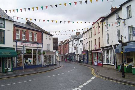
The start point for this walk is the pay and display car park opposite the museum in Crabtree Road off Mill Street West, grid reference SO296565. This is a convenient spot with facilities opposite and ready access to the town for browsing, eating, drinking or visiting the free museum. Impecunious ramblers can drive further up Mill Street and park on the road near the recreation ground for free.
Leave the car park and return towards the High Street, turning up the hill on Church Street to the Church of St. Mary the Virgin. Pass through the churchyard and then cross Montfort Road and head up Ridgebourne Road, signposted to Hergest Croft Gardens. This road becomes a track which is well signposted as the Offa's Dyke National Trail (acorn symbol). This route is straightforward over the entire ridge. Look out for the remains of the racecourse around the summit and, obviously, the spectacular views. Marilyn hill and trig point baggers will have to make a slight detour to the left to achieve the summit proper. This worthwhile, short diversion will afford some great views back to the Shropshire hills and forward to the Welsh hills.
Descend the well marked path to where the final "peak" along the ridge is ahead on the right at grid reference SO240553 and take the bridlepath doubling back along the side of the ridge. This path follows the 350m contour for the most part, providing a less strenuous return route. When it meets the bridlepath that descends from the summit ridge, it is demoted to a footpath, but continues along the same direction. Continue until it returns to the outward route and Ridgebourne Road. Retrace back to the car park. Take some time to explore the free museum and pleasant market town.
Other walks nearby
| Walk 3614 | Herrock Hill from Kington | moderate | 8.0 miles |
| Walk 3565 | The Hergest Ridge from Gladestry | easy/mod | 6.1 miles |
| Walk 3023 | Great Rhos & the Radnor Forest from New Radnor | moderate | 9.0 miles |
| Walk 1787 | Pembridge, Eardisland & the Arrow Valley | easy/mod | 7.4 miles |
| Walk 3643 | LLan-fawr & Lugg Valley from Whitton | moderate | 7.5 miles |
| Walk 1673 | Shobdon Hill and Croft Ambrey from Shobdon Estate | moderate | 12.5 miles |
| Walk 1998 | Harley's Mountain from Lingen | easy/mod | 7.5 miles |
| Walk 1950 | Golden Valley - Hardwicke to Dorstone | moderate | 11.4 miles |
| Walk 2179 | Merbach Hill | easy/mod | 6.5 miles |
| Walk 3631 | Panpunton Hill & Stowe from Knighton | moderate | 7.8 miles |
Recommended Books & eBooks
No suggestions for this area.Messaging & Social Media
Message Walking Britain and follow the latest news.

Mountain Weather
Stay safe on the mountains with detailed weather forecasts - for iOS devices or for Android devices.