North Pennines Walking Guide
This National Landscape (formerly AONB), the second largest in area, covers some wild and remote landscapes in northern England. The area is dominated by the Pennine hills and includes large areas of undulating heather moors and peat.
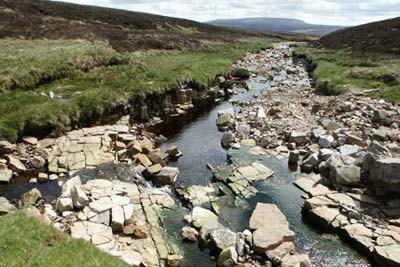
On its western edge, the plateau drops steeply into the Eden Valley with its patchwork of fields. The highest point in the Pennines is the table-top summit of Cross Fell (890m). The high land of this area is the source of a number of major rivers including the Tyne, Tees, Wear and Derwent. Like most of the National Landscapes (formerly AONBs), the North Pennines has diverse fauna and flora that reflects the wide range of habitats.
Sheep farming remains important to the local economy with grouse shooting on the moors adding income to the region. Quarrying of limestone and the mining of minerals remain important sources of income for the region and its inhabitants. Lead mining has declined with the area once the most important area in the world for this activity. However the abandoned lead mines are now part of the area's heritage and are seen by many as an intrinsic part of the landscape.
Major areas of population are few and far between with Allendale Town and Alston the largest. Stone built villages are scattered throughout the area and have seen a decline in their population since the demise of lead mining. However tourism is beginning to redress the balance and with inward migration the villages are beginning to recover.
From a walker's perspective, the North Pennines have much to offer. The large tracts of open moorland see few walkers and make an ideal venue for those requiring solitude. Cross Fell and its adjacent high fells on the main Pennine ridge offer hill walking of the highest quality. The Pennine Way National Trail follows substantial parts of this ridge, together with a very interesting section of Teesdale. Although the higher land grabs the headlines, virtually every part of this Natural Landscape from valley to summit has something for walkers. Rivers, waterfalls and moors combine with picturesque villages and industrial heritage to provide walks that are full of interest.
For more information on this area visit the
official web site for North Pennines
Further Information
Regional Walking Guides
A full list of "Where to Walk" Walking Guides can be found at List of Regional Walking Guides.
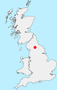
Location Map
Messaging & Social Media
Message Walking Britain and follow the latest news.

Mountain Weather
Stay safe on the mountains with detailed weather forecasts - for iOS devices or for Android devices.