Tarmachan Ridge Walk
Walk 1352 - Route Maps & Profile
Route Map
Digital Maps - Copyright © 2011-2024. All rights reserved.
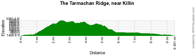
Route Profile
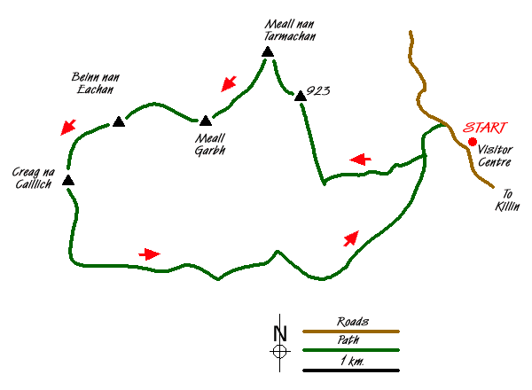
Sketch Map
Suggested Maps 

| Ordnance Survey Explorer OL48 | Sheet Map | 1:25k | BUY |
| Anquet OS Explorer OL48 | Digital Map | 1:25k | BUY |
| Ordnance Survey Landranger 51 | Sheet Map | 1:50k | BUY |
| Anquet OS Landranger 51 | Digital Map | 1:50k | BUY |
It is recommended you take a map. The preferred scale is 1:25k.
Start Point Details
Ordnance Survey Grid Ref NN608378
Latitude 56.511593 Longitude -4.263657
Postcode FK21 8TY
what3words start damp.apes.grades
Walk description may contain detailed information on the start point for this walk.
Further Information
Walk grading - Learn how each walk is assessed and select a walk to suit your ability and experience by going to Walk Grading Details.
Messaging & Social Media
Message Walking Britain and follow the latest news.

Mountain Weather
Stay safe on the mountains with detailed weather forecasts - for iOS devices or for Android devices.