Walk 2825 - printer friendly version
Silkstone Circular & Cannon Hall Country Park Walk
Author - Andy Chaplin
Length - 10.4 miles / 16.9 km
Ascent - 850 feet / 258 metres
Grade - moderate
Start - OS grid reference SE290059
Lat 53.5489390 + Long -1.5637871
Postcode S75 4JF (approx. location only)
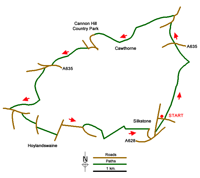
The walk starts in Silkstone where there is plenty of on-road parking. The highlights are the old waggonway from the centre of Slkstone (see www.visitpenistone.co.uk/walks/silkstone_waggonway.pdf) - which still has some of the old stone sleepers, a renovated wagon and reconstructed rails - and the Cannon Hall country park (see www.cannon-hall.com/) - which has a museum, walled garden, parkland and gardens. Part of the route is on the Barnsley Boundary Walk and the Penistone Boundary Walk.
Pick up the waggonway at grid reference SE289054 at the junction of Barnsley Road and High Street then follow it past the back of the Bells Steakhouse pub and onto the Pot House Hamlet craft/café buildings. Cross the Barnsley road and continue on the waggonway over Banks Bottom Dike and along the side of the Silkstone Beck.
When you get to the Royd Lane track at Furnace Bridge turn left in front of the house named Beechwood and take the farm track. Follow the track to the right at the first junction so that you come out on the A635 (grid ref. SE295081). Cross straight over and continue on to Cawthorne Lane. Turn right on the road and just after the bridge over the Cawthorne Dike take the farm track off on the left.
Pick up the path going west past Cinder Hill and go left over a footbridge as you pick up the Barnsley Boundary Walk (BBW) then continue past the cricket ground and into the parkland of the Cannon Hall country park. It is well worth a wander around the gardens, walled garden and house perimeter before coming back down to the Cascade Bridge car park and picking up the BBW again
The BBW goes past Jowett House and Spring House Farm - some of which can be very muddy if churned up by cattle or tractors - and then comes out on the A635 again. Follow it westwards to Coach Gate Lane then take the footbridge at the side of the ford over Daking Brook and take the track up the side of Rons Cliff Dike valley. This is a charming wooded valley that comes out onto the rolling farmland of South Yorkshire around Gadding Moor.
At the top of Gadding Moor turn right on the BBW across the fields and then down to Mill Farm. Take the road out to Gunthwaite Bridge over the Rons Cliff Dike then leave the BBW and follow the Penistone Boundary Walk (PBW) along New Lane. The PBW goes off on the left across fields to Gadding Moor Road then crosses over to follow Cross Lane and Haigh Lane to Cooper Lane.
Before Glen Cottage it takes off up a track then across fields to Within Moor Lane. Follow this to the south then, leaving the PBW, take the first footpath on the left that crosses Whin Moor before picking up the path that goes at or amongst the trees between Noblethorpe Park and north-west Silkstone. The path comes out either on Manor Park or High Street, depending on where you parked.
Messaging & Social Media
Message Walking Britain and follow the latest news.

Mountain Weather
Stay safe on the mountains with detailed weather forecasts - for iOS devices or for Android devices.