Denny Lodge from Beaulieu Road
New Forest Walk
Nat Park - New Forest
County/Area - Hampshire
Author - Lou Johnson
Length - 5.7 miles / 9.3 km Ascent - 350 feet / 106 metres
Time - 3 hours 10 minutes Grade - easy
Maps 

| Ordnance Survey Explorer OL22 | Sheet Map | 1:25k | BUY |
| Anquet OS Explorer OL22 | Digital Map | 1:25k | BUY |
Walk Route Description
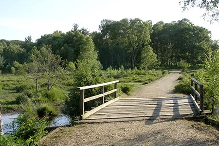
Click image to see photo description.
This New Forest walk explores the area to the southwest of Beaulieu Road railway station and includes the site of the five times a year pony sales. Points of interest along the way include the Bishop's Dyke, pleasant woodland the isolated outpost of Denny Cottage and Denny Lodge. As with many walks in the New Forest, navigation can be confusing with many tracks and paths criss-crossing the landscape, so it is advised you take the relevant OS 1:25000 map to help with route finding.
The start is the car park just west of the railway station (grid ref. SU348063). From the car park, exit south past the wooden barrier to pick up a clear path heading south with the railway on your left. After 800 metres you reach a path on the left (grid ref. SU349055) which crosses the railway. Ignore this path and continue in a southerly direction soon crossing Bishop's Dyke. Stay on the path until just past two footbridges (at Woodfidley Passage) and turn left to cross a railway bridge. Pass through a series of pony pens to an area of open grassland to a path on your right after about 120 metres from the railway bridge (grid ref. SU351042).
Continue down to a gate and continue ahead for 800 metres to a crossroads with a gravel cross track (grid ref. SU352037). Turn right here and follow this clear track for just under two kilometres (ignoring all paths and tracks on each side) to a cattle grid beyond which is a T-junction (grid ref. SU335033). Turn right here and continue for 2.5 kilometres to a clearing with some houses (Denny Cottage on your right). Continue ahead to Denny Lodge (the last house on your left) to reach a concrete bunker (on your left) after a further 100 metres (grid ref. SU333055). Turn right here and follow the path for about 550 metres to reach open grassland. Continue ahead for just over a kilometre to the car park which is located close to a group of conifer trees.
Other walks nearby
| Walk 3550 | Ashurst Circular | easy | 3.3 miles |
| Walk 3615 | Ashurst (Busketts) Circular | easy | 3.4 miles |
| Walk 3542 | RAF Beaulieu near East Boldre | easy | 5.1 miles |
| Walk 3685 | RAF Beaulieu Walk from Hawkhill Inclosure | easy | 3.6 miles |
| Walk 1612 | Lyndhurst Circular | easy/mod | 7.5 miles |
| Walk 3554 | Lyndhurst Circular (short) | easy | 2.9 miles |
| Walk 3543 | Brockenhurst Circular | easy | 4.8 miles |
| Walk 3583 | Brockenhurst, Black Knowl & Ober Water | easy | 5.0 miles |
| Walk 3539 | Holmhill Inclosure from Millyford Bridge | easy | 2.5 miles |
| Walk 3560 | Blackwater Tall Tree trail near Lyndhurst | easy | 2.2 miles |
Recommended Books & eBooks
Walking Hampshire's Test Way
 Guidebook to walking the 71km (44 mile) Test Way in Hampshire from high on the chalk downs of Inkpen Beacon to the Eling Tide Mill near Southampton Water. Following the beautiful, crystal clear River Test, it passes picturesque villages and fascinating historic sites. Also includes 15 day walks to explore this lovely part of pastoral England.
More information
Messaging & Social Media
Message Walking Britain and follow the latest news.

Mountain Weather
Stay safe on the mountains with detailed weather forecasts - for iOS devices or for Android devices.