St Bees to Whitehaven coast path Walk
Walk 3558 - Route Maps & Profile
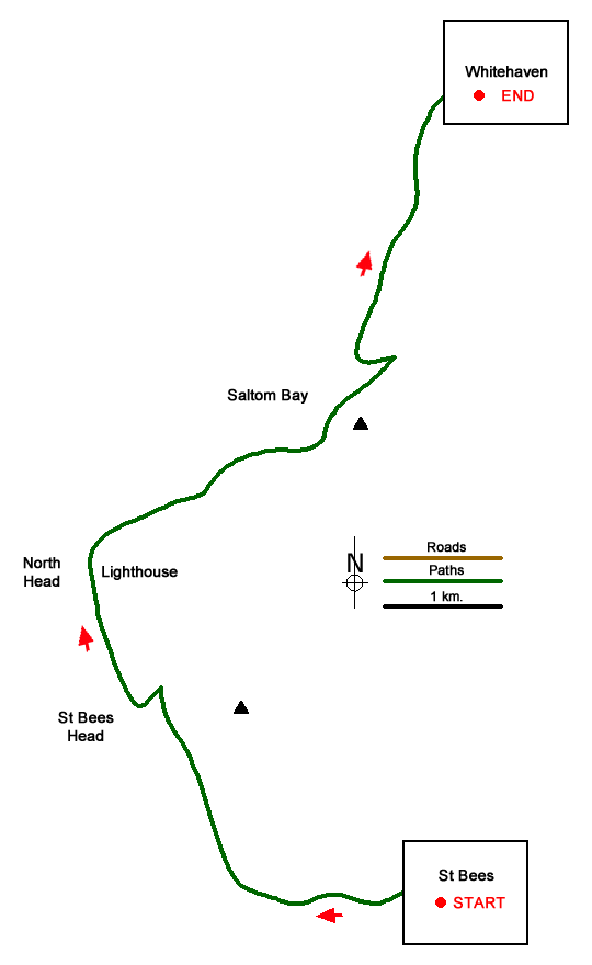
Route Map
Digital Maps - Copyright © 2011-2024. All rights reserved.
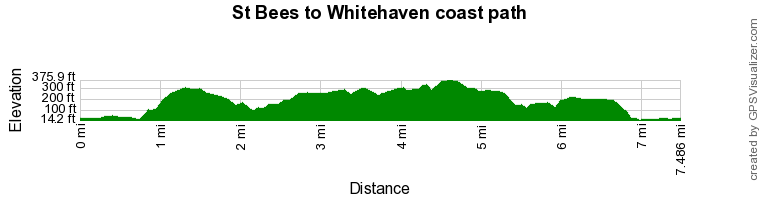
Route Profile
Sketch Map
Suggested Maps 

| Ordnance Survey Explorer 303 | Sheet Map | 1:25k | BUY |
| Anquet OS Explorer 303 | Digital Map | 1:25k | BUY |
| Ordnance Survey Landranger 89 | Sheet Map | 1:50k | BUY |
| Anquet OS Landranger 89 | Digital Map | 1:50k | BUY |
It is recommended you take a map. The preferred scale is 1:25k.
Start Point Details
Ordnance Survey Grid Ref NX970119
Latitude 54.491939 Longitude -3.591667
Postcode CA27 0DG
what3words start estate.rivals.camcorder
Walk description may contain detailed information on the start point for this walk.
Further Information
Cumbria
Cumbria is one of the finest places for walking in Britain with rugged peaks, rolling hills, lakes and valleys providing a wonderful variety of landscapes. Cumbria includes the Lake District National Park, the Howgill Fells, part of the Yorkshire Dales National Park and the highest peaks of the North Pennines so who could ask for more? Sections of the Coast to Coast, Dales Way and Pennine Way long distance paths can also be explored.
Walk grading - Learn how each walk is assessed and select a walk to suit your ability and experience by going to Walk Grading Details.
Messaging & Social Media
Message Walking Britain and follow the latest news.

Mountain Weather
Stay safe on the mountains with detailed weather forecasts - for iOS devices or for Android devices.