Walk 3724 - printer friendly version
River Box from Stoke-by-Nayland Walk
Author - Lou Johnson
Length - 6.0 miles / 9.8 km
Ascent - 300 feet / 91 metres
Grade - easy
Start - OS grid reference TL988363
Lat 51.9895620 + Long 0.8939533
Postcode CO6 4AY (approx. location only)
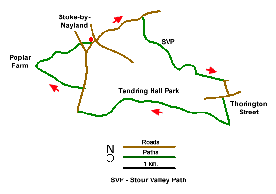
This easy Suffolk walk starts from the lovely village of Stoke-by-Nayland with its medieval houses and St. Mary's Church which has a superb brick tower that can be seen from parts of the walk. The route uses a section of Stour Valley Path to explore the River Box Valley to reach Thorington Street. The walk returns through the grounds of Tendring Hall Park.
The start is the village centre of Stoke-by-Nayland, where limited on street parking is available (grid ref. TL988363). Do be considerate to residents when parking. After parking take Scotland Street (signed to Hadleigh and Shelley). Follow this lane for a kilometre to reach Scotland Place, a large house on the left. Just before this house is a finger post on the right (grid ref. TL996367). Turn right along this path and follow it beside the narrow River Box (on your left) for 800 metres to reach Valley Farm (grid ref. TM001361).
Keep Valley Farm on your left and continue straight ahead along a meandering path with the River Box to your left. (Note - at Valley Farm do not cross the footbridge over the river on the left.) The grassy path crosses several fields and leads to Hudsons Lane in Thorington Street (grid ref. TM010356). Turn right and continue to the B1086. Turn right again and after a short way you reach a fingerpost on the left (grid ref. TM010353). Take this path beside a reservoir to join a lane at Wick Farm.
Turn right along Wick Road and continue for 500 metres to reach a wooden barn (before Grove Cottage) on the left. Just past the barn, turn left at a fingerpost (grid ref. TM007351). Follow the clear track for three kilometres through Tendring Hall Park passing Tendring Hall Farm along the way. Reaching the B1087 (grid ref. TL985351), turn right for 400 metres (you can walk more safely over grass on the left-hand side).
Reaching a fingerpost on the left (grid ref. TL986355), turn left along a clear concrete track, which leads to Poplar Farm. At the T-junction of tracks beside the farmhouse, turn right and follow the track back towards Stoke-by-Nayland. As you near the village the track turns sharp left. Continue ahead here down the side of allotments on your left. Continue to reach a road by St. Mary's Church. Do take time to explore the village and church.
Messaging & Social Media
Message Walking Britain and follow the latest news.

Mountain Weather
Stay safe on the mountains with detailed weather forecasts - for iOS devices or for Android devices.