The Ridgeway, Lockinge, Oxfordshire
Walk Photo 187301
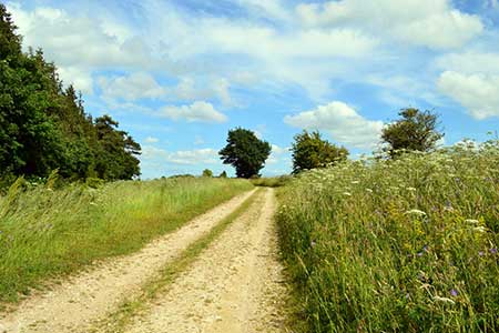
Caption - The Ridgeway, south of Lockinge, Oxfordshire.
Walk 1873 : The Ridgeway from Ardington
Photographer : Oswald Bertram
Use back button to return to the photo gallery lists.
Further Information
Location Map
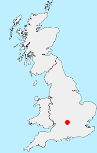
Oxfordshire
The County of Oxfordshire is located between the River Thames in the south, the Cotswolds to the west and the Chilterns in the east. Much of the county's wealth was from wool production in what is predominantly agricultural area. Local Government reorganisation in 1974 saw changes to the county boundaries with the Vale of White Horse and an area south of the Thames added to the county. Oxfordshire includes sections of three Areas of Outstanding Natural Beauty - the Cotswolds, the North Wessex Downs, and the Chilterns. Long-distance footpaths include the Ridgeway, Macmillan Way, Oxfordshire Way, and the D'Arcy Dalton Way. The Thames path follows the river and the valleys of the Thame, Windrush and Cherwell tributaries also provide excellent walking. The Oxford Canal follows the Cherwell from Banbury to Kidlington and again provides some excellent walking on the well-maintained tow path.
Messaging & Social Media
Message Walking Britain and follow the latest news.

Mountain Weather
Stay safe on the mountains with detailed weather forecasts - for iOS devices or for Android devices.