Cast iron Somerset County Council sign, Cockmill Lane
Walk Photo 330404
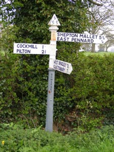
Caption - Standard cast iron Somerset County Council signpost in Cockmill Lane. If you are familiar with the major settlements in the area, but not the very convoluted topology of some of its' minor thoroughfares, the directions indicated by the sign will seem rather puzzling.
Walk 3304 : Pennard Hill from Pylle
Photographer : Tony Maries
Use back button to return to the photo gallery lists.
Further Information
Location Map
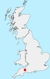
Somerset
Somerset is a rural county in south-west England. The high land of the Blackdown Hills, Mendip Hills, Quantock Hills and Exmoor National Park, contrast with the wide expanses of flat wetland including the Somerset Levels. Adding interest to the landscape are the extensive network of caves and the Cheddar Gorge. Exmoor National Park crosses the border into neighbouring Devon and provides excellent walking. The highest point in Somerset is Dunkery Beacon on Exmoor, with an altitude of 519 metres (1,703 feet). The coast also offers great walking especially the section of South West Coast Path west of Minehead.
Messaging & Social Media
Message Walking Britain and follow the latest news.

Mountain Weather
Stay safe on the mountains with detailed weather forecasts - for iOS devices or for Android devices.