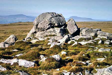
Ward's Stone from Stoops Bridge
Forest of Bowland Walk
Region - Forest of Bowland
County/Area - Lancashire
Author - Lou Johnson
Length - 13.0 miles / 21.1 km Ascent - 1630 feet / 494 metres
Time - 8 hours 10 minutes Grade - mod/hard
Maps 

| Ordnance Survey Explorer OL41 | Sheet Map | 1:25k | BUY |
| Anquet OS Explorer OL41 | Digital Map | 1:25k | BUY |
Walk Route Description
Click image to see photo description.
This walk to Ward's Stone, in the Forest of Bowland, takes you to the highest point in Lancashire (560 metres). The lengthy route combines a cultivated valley with moorland, and despite the length of the walk is never too strenuous. The walk should be avoided in low cloud as the moorland section has few landmarks and can be confusing. After heavy rain some of the moorland paths maybe wet underfoot.
The start is the small car park adjacent to Stoops Bridge near Abbeystead Reservoir (grid ref. SD5635440. After parking walk across the bridge and take the first footpath on the right. Cross the stone set stile and head north across fields. On reaching a road, turn left and continue generally uphill for just under two kilometres to reach the Jubilee Tower (grid ref. SD542573). Turn right into the car park and take the path adjacent to a fence. As you gain height you can enjoy improving views. At the third boundary post (grid ref. SD557589), turn right and make the short ascent onto Grit Fell.
Descend to the east and follow a concessionary path across the moor. Go straight across a track and start a gradual ascent to reach Ward's Stone and an OS trig column after two kilometres. The stone is not the highest point which is soon reached at a second trig column. Ahead you have a view of the Three Peaks Country in the Yorkshire Dales. Continue along the path to reach an angled fence by the Queen's Stone (grid ref. SD595587). Fork right here and keep the fence on your left. Continue to a wall. Bear right with the wall and continue on the grassy path soon passing two boulders (Grey Crag) on the other side of the wall. The wall becomes a fence for a while before a wall takes over again. A fence replaces the wall again at a stile. Continue to a ladder stile in the broad col, with Wolfhole Crag rising ahead.
Turn sharp right and follow the path to start the descent from the watershed. A good track soon appears, and this is followed across Tarnbrook Fell. At the intake wall, the track turns sharp right and continues to a road in Tarnbrook. Turn left (following the Wyre Way, initially a walled track, the path heads southwest across fields to Top of Emmetts where you follow their access drive to a road (grid ref. SD575547). Cross the road to a stile and continue across fields following the Wyre Way to reach Strait Lane. Turn left and head downhill to the start at Stoops Bridge.
Other walks nearby
| Walk 1742 | Grit Fell from the Jubilee Tower near Quernmore | moderate | 7.7 miles |
| Walk 2164 | Clougha Pike from the Jubilee Tower | easy/mod | 4.7 miles |
| Walk 3038 | Wolfhole Crag from Tower Lodge | moderate | 9.0 miles |
| Walk 2257 | Clougha Pike from Quernmore | easy/mod | 4.8 miles |
| Walk 2137 | Clougha & Goldsworthy's Installation Circular | moderate | 5.2 miles |
| Walk 1218 | Fiensdale Head & Bleasdale Water | moderate | 10.0 miles |
| Walk 2594 | Totridge Fell & Fiendsdale Head, Forest of Bowland | moderate | 11.0 miles |
| Walk 1670 | Hazelhurst Fell, Fair Snape Fell and Parlick | moderate | 11.0 miles |
| Walk 1994 | Cockerham, Glasson & Conder Green | easy/mod | 6.6 miles |
| Walk 3505 | Whitewell via Crag Stones from Dunsop Bridge | easy/mod | 8.5 miles |
Recommended Books & eBooks
Walking in the Forest of Bowland and Pendle
 A guidebook to 40 diverse circular day walks suitable for walkers with navigational skills. The Forest of Bowland and Pendle are two of north west England's upland AONBs, perfect for walkers who enjoy exploring rough hilly, sometimes pathless terrain. The routes include Ward's Stone, Pendle Hill, Longridge Fell and Fair Snape Fell.
More information
Walking on the West Pennine Moors
 This guidebook describes 30 walks on the West Pennine Moors, around Blackburn, Darwen, Chorley and Bolton, home to some of the most inspiring and exhilarating walking country. The walks range from short, easy rambles to more challenging hikes covering a variety of terrain, all of it easily accessible for day walking.
More information
Messaging & Social Media
Message Walking Britain and follow the latest news.

Mountain Weather
Stay safe on the mountains with detailed weather forecasts - for iOS devices or for Android devices.