Clougha Pike from Quernmore
Forest of Bowland Walk
Region - Forest of Bowland
County/Area - Lancashire
Author - Lou Johnson
Length - 4.8 miles / 7.8 km Ascent - 1000 feet / 303 metres
Time - 3 hours 20 minutes Grade - easy/mod
Maps 

| Ordnance Survey Explorer OL41 | Sheet Map | 1:25k | BUY |
| Anquet OS Explorer OL41 | Digital Map | 1:25k | BUY |
Walk Route Description
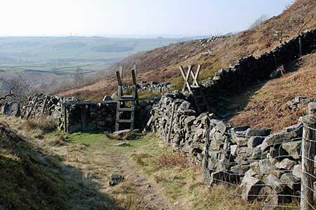
Click image to see photo description.
Clougha Pike is an excellent viewpoint and this walk to the summit starts from the Birk Bank car park near Quernmore. The route follows clear paths although care is needed as in places there are many paths to choose from. The walk follows Windy Clough onto higher ground and then heads along Clougha Scar to reach the summit. The descent route follows Rowton Brook to Low Pleasant where Roman kilns were found nearby.
The start is Birk Bank car park (grid ref. SD526604). After parking cross the stile by the access notice at the rear of the parking area and join a track. At a fork, bear right and then right again to reach a gate. Do not go through the gate and take a path on the left and continue on a boardwalk to a stile. Continue uphill to a path junction with two ladder stiles (grid ref. SD534603). Cross the stile on the left and continue up into Windy Clough following a path along the bottom of the clough. At the head of the clough cross a ladder stile (grid ref. SD537607). Once across the stile turn right and follow the path beside a wall on your right. In places it is quite rocky. The path reaches another stile. Cross this and stay with the wall which is now on your left. On the next section there is a fine view over Morecambe Bay and the Lake District Fells. Continue ahead eventually walking along a stony pavement. Continue to reach the OS trig column (413 m.).
After enjoying the view, head south to join a path. The route slants half right soon after leaving the summit and descends to cross Rowton Brook. Continue beside the brook (on your right) down to a gate with an access notice. Continue ahead soon joining a clear track down to Rooten Brook Farm. Pass through the yard and turn left, cross a footbridge, and continue to Rowton Brook Farm (note the different spelling). Turn left into the yard. Just past the house, turn right through a gate. Cross the field to a stile. Maintain direction down to Brow Top Farm where you follow its drive down to a road.
Turn right downhill and after 200 metres turn right across a wall stile at a fingerpost. Head diagonally across the field to a gap in the wall. Maintain direction to reach the access drive to Rooten Farm. Take the gate opposite and continue along a walled track to Low Pleasant Farm. Pass a large barn and entering the yard take the path on the right. Entering a field, head half-left to drop down to Rigg Lane. It was in this area that the Roman kiln was discovered. Rather amazingly there were still items in the oven. Turn right along the lane. After 250 metres fork right and continue back to the car park.
Other walks nearby
| Walk 2137 | Clougha & Goldsworthy's Installation Circular | moderate | 5.2 miles |
| Walk 1742 | Grit Fell from the Jubilee Tower near Quernmore | moderate | 7.7 miles |
| Walk 2164 | Clougha Pike from the Jubilee Tower | easy/mod | 4.7 miles |
| Walk 2278 | Ward's Stone from Stoops Bridge | mod/hard | 13.0 miles |
| Walk 3459 | Abbeystead Reservoir Circular | easy | 1.6 miles |
| Walk 3457 | Wyre Valley Circular | easy/mod | 6.4 miles |
| Walk 1994 | Cockerham, Glasson & Conder Green | easy/mod | 6.6 miles |
| Walk 1641 | Bankhouses via the Lancashire Coastal Way | easy/mod | 7.0 miles |
| Walk 3038 | Wolfhole Crag from Tower Lodge | moderate | 9.0 miles |
| Walk 1218 | Fiensdale Head & Bleasdale Water | moderate | 10.0 miles |
Recommended Books & eBooks
Walking in the Forest of Bowland and Pendle
 A guidebook to 40 diverse circular day walks suitable for walkers with navigational skills. The Forest of Bowland and Pendle are two of north west England's upland AONBs, perfect for walkers who enjoy exploring rough hilly, sometimes pathless terrain. The routes include Ward's Stone, Pendle Hill, Longridge Fell and Fair Snape Fell.
More information
Walking on the West Pennine Moors
 This guidebook describes 30 walks on the West Pennine Moors, around Blackburn, Darwen, Chorley and Bolton, home to some of the most inspiring and exhilarating walking country. The walks range from short, easy rambles to more challenging hikes covering a variety of terrain, all of it easily accessible for day walking.
More information
Messaging & Social Media
Message Walking Britain and follow the latest news.

Mountain Weather
Stay safe on the mountains with detailed weather forecasts - for iOS devices or for Android devices.