Chinley Churn & South Head
Peak District Walk
Nat Park - Peak District - Kinder Scout Edale
County/Area - Derbyshire
Author - Mike Bexley
Length - 7.5 miles / 12.2 km Ascent - 1450 feet / 439 metres
Time - 5 hours 10 minutes Grade - easy/mod
Maps 

| Ordnance Survey Explorer OL1 | Sheet Map | 1:25k | BUY |
| Anquet OS Explorer OL1 | Digital Map | 1:25k | BUY |
| Ordnance Survey Landranger 110 | Sheet Map | 1:50k | BUY |
| Anquet OS Landranger 110 | Digital Map | 1:50k | BUY |
Walk Route Description
Click image to see photo description.
This Peak District walk makes you familiar with the hills that you can see driving along the A6 Whaley Bridge By-pass and provides a useful introduction to hill walking in this part of the Peak District National Park.
The walk starts from a car park in Chinley (grid ref SK038824). From the car park's narrow entrance turn left in a westerly direction along the road then right at the footpath sign. This path takes you over the railway bridge up to a road. On reaching the road turn left then right at the corner and right again up the steep bridleway.
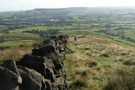
Keep on this bridleway bearing left towards the end to reach grid reference 039836. Take the path left then after the stile climb the steep short path on the right into the disused quarry. Although the summit and trig point of Chinley Churn is out of bounds it is interesting to spend a little time wandering with care in the quarries, certainly the views across the valley make the effort worthwhile.
Proceed along the path north to the gate in the lane to Hills Farm (grid ref 041849). Then right down this lane to the road at Peep-O-Day. Allegedly this interesting name comes from the position of the small window above the porch of the house. In the early morning sun shines through this window onto and down the stairs.
Turn left on the main road then continue up the bridleway on the right. Turn right again following the bridleway to the gate at the end where a sign provides details of nature in the area (grid ref 056846). Keep to the path ahead skirting to the left of South Head. Alternatively you can take the visible path up to South Head summit for the views before dropping back down to the path on your left.
Turn right at the next bridleway (grid ref 066843) passing Beet Farm, with its thoughtful inscriptions above the windows. On reaching the collection of farm buildings named 'Hull End' (grid ref 055827) turn right passing in front of the converted barn with its large window. Follow the path through the farm to a stream then right up the fields to turn left along the lane at the cottages to the road.
Cross over the road to the lane ahead passing White Knowl Farm then left at the buildings (grid ref 047831) following the walled lane brings you to a tunnel under the railway and the road ahead. Turn right on the road and walk through Chinley to your start.
Other walks nearby
| Walk 3407 | Chinley to Edale without a car | moderate | 9.3 miles |
| Walk 2635 | The edges of Combs Moss near Chapel-en-le-Frith | easy/mod | 7.5 miles |
| Walk 1174 | Kinder Low & Mount Famine | moderate | 7.5 miles |
| Walk 1182 | Kinder Downfall | moderate | 8.0 miles |
| Walk 2507 | South Head & Edale Cross from Hayfield | moderate | 8.0 miles |
| Walk 2622 | Sett Valley & Kinder from New Mills | moderate | 10.0 miles |
| Walk 2523 | Black Rocks & Bollinhurst Reservoir | easy | 5.0 miles |
| Walk 2567 | Lyme Park & Dissop Head | easy | 6.0 miles |
| Walk 2576 | Fernilee Reservoir, Goyt Valley | easy | 6.0 miles |
| Walk 3510 | Shining Tor, Cats Tor & Foxlow Edge | easy/mod | 7.0 miles |
Recommended Books & eBooks
Walking in the Peak District - White Peak East
 Guidebook describing 42 half-day and day walks in the limestone landscapes of Derbyshire's White Peak, part of the Peak District National Park. One of two volumes, this book covers the east of the region, with potential bases including Bakewell, Eyam, Castleton, Birchover, Matlock and Wirksworth.
More information
Dark Peak Walks
 Guidebook to 40 walks in the Dark Peak area of the Peak District National Park. 35 circular routes for most abilities, from 8km to 19km, around Edale, Marsden, Fairholmes, Baslow and Castleton, including Kinder Scout and Mam Tor, and 5 longer (25km to 45km) routes highlighting the best of the Gritstone Edges, High Moorland and Deep Valleys.
More information
Messaging & Social Media
Message Walking Britain and follow the latest news.

Mountain Weather
Stay safe on the mountains with detailed weather forecasts - for iOS devices or for Android devices.