Chinley to Edale without a car
Peak District Walk
Nat Park - Peak District - Kinder Scout Edale
County/Area - Derbyshire
Author - Peter Schofield
Length - 9.3 miles / 15 km Ascent - 1700 feet / 515 metres
Time - 6 hours 20 minutes Grade - moderate
Maps 

| Ordnance Survey Explorer OL1 | Sheet Map | 1:25k | BUY |
| Anquet OS Explorer OL1 | Digital Map | 1:25k | BUY |
| Ordnance Survey Landranger 110 | Sheet Map | 1:50k | BUY |
| Anquet OS Landranger 110 | Digital Map | 1:50k | BUY |
Walk Route Description
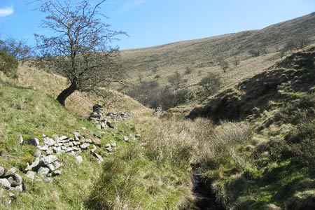
Click image to visit gallery of 5 images.
This Peak District walk offers both easy moorland walking and fine views, particularly on the descent to the Vale of Edale. Like walk 2622, it uses the excellent train service running along the Hope Valley making it very accessible to those without their own transport.
The route starts at Chinley station (Grid ref SK038826). Go left at the station entrance to the B6062. Turning left on to the main road, follow it around the bend for 300m to reach a footpath on the left. Follow the path, turning right over a stile just beyond a cottage (Grid ref SK047830) and continue up the hill to arrive at the A624 at White Knowl Farm.
Immediately opposite, take the right hand of two paths across the fields to a quiet lane. Turn left and continue up the lane for 500m to Slack House. Go down the track in front of the house to cross a stream and continue up the other side through a gate, to reach another gate after a further 50m (Grid ref SK059829).
Do not go through this gate, instead turning left to follow the wall up the hill, arriving at a broad track after 400m. Expansive views open out to the south, while Cowburn Moor looms up ahead. Go left on to the track and follow it for 1K to Shireoaks, continuing left through a gate just beyond the farm as the route climbs to join the Pennine Bridleway after 600m (Grid ref SK071837). To the left, the distinctive features of South Head and Mount Famine are prominent.
Turn right, descending for 700m to arrive at Roych Clough, which is a delightful spot for a refreshment halt. There are no route finding problems as the route wends its way across the moor to arrive at Sheffield Road after a further 2K (Grid ref SK091824). Go left along a concessionary path and after 200m fork left on to a deeply rutted bridleway. This is Chapel Gate which is the ancient pack horse route linking the Vale of Edale with Chapel en le Frith.
Follow the bridleway as it climbs steadily, to arrive at a Peak Footpaths Society signpost after 700m. Turn left, following the bridleway as an extensive panorama opens out across Cowburn Moor towards Kinder to the north and the Vale of Edale to the east. Go left off Chapel Gate after 500m (Grid ref SK099834) and descend the steep path to reach the National Trust barn at Dalehead. Crossing the bridge at the side of the barn, continue along the path as it first contours and then descends to Upper Booth.
From here, there are two ways back to Edale. You can take the familiar route of the Pennine Way to finish at the Nags Head. However, if want something easier, follow the path across the fields to Barber Booth and then on to Edale, finishing opposite the national park visitor centre. Turn right on to the road to arrive at the station after 200m.Whichever route you take, it will make a fine end to a very enjoyable walk.
The Manchester to Sheffield stopping train links the start and finish points at approximately two hourly intervals (hourly on Saturday). The timetable can be found on www.northernrail.org.
Other walks nearby
| Walk 2534 | Chinley Churn & South Head | easy/mod | 7.5 miles |
| Walk 2635 | The edges of Combs Moss near Chapel-en-le-Frith | easy/mod | 7.5 miles |
| Walk 1174 | Kinder Low & Mount Famine | moderate | 7.5 miles |
| Walk 1182 | Kinder Downfall | moderate | 8.0 miles |
| Walk 2507 | South Head & Edale Cross from Hayfield | moderate | 8.0 miles |
| Walk 2622 | Sett Valley & Kinder from New Mills | moderate | 10.0 miles |
| Walk 2523 | Black Rocks & Bollinhurst Reservoir | easy | 5.0 miles |
| Walk 2567 | Lyme Park & Dissop Head | easy | 6.0 miles |
| Walk 2546 | Lantern Pike & Cown Edge from Rowarth | easy/mod | 8.0 miles |
| Walk 2576 | Fernilee Reservoir, Goyt Valley | easy | 6.0 miles |
Recommended Books & eBooks
Dark Peak Walks
 Guidebook to 40 walks in the Dark Peak area of the Peak District National Park. 35 circular routes for most abilities, from 8km to 19km, around Edale, Marsden, Fairholmes, Baslow and Castleton, including Kinder Scout and Mam Tor, and 5 longer (25km to 45km) routes highlighting the best of the Gritstone Edges, High Moorland and Deep Valleys.
More information
Great Mountain Days in the Pennines
 An inspirational guidebook to 50 classic walks on the rolling Pennine landscape. The graded routes, between 6 and 13 miles in length, cover classic Pennine fells and moorland such as Whernside, Ilkley Moor and Pendle Hill; exploring the North and South Pennines, Yorkshire Dales, Howgills and Dark Peak. Many routes are also suited to fell running.
More information
Messaging & Social Media
Message Walking Britain and follow the latest news.

Mountain Weather
Stay safe on the mountains with detailed weather forecasts - for iOS devices or for Android devices.