Blakeney from Morston Quay
Norfolk Walk
County/Area - Norfolk
Author - Lou Johnson
Length - 2.0 miles / 3.3 km Ascent - 100 feet / 30 metres
Time - 1 hours 10 minutes Grade - easy
Maps 

| Ordnance Survey Explorer 251 | Sheet Map | 1:25k | BUY |
| Anquet OS Explorer 251 | Digital Map | 1:25k | BUY |
| Ordnance Survey Landranger 133 | Sheet Map | 1:50k | BUY |
| Anquet OS Landranger 133 | Digital Map | 1:50k | BUY |
Walk Route Description
Click image to visit gallery of 6 images.
This short walk makes use of the Coast Hopper bus service and allows you to explore two villages on the North Norfolk Coast. The route offers some views across the Morston Salt Marshes towards Blakeney Point and the opportunity to visit the parish churches in both Morston and Blakeney. In addition the abundant wildlife in the area will also add considerable interest to the walk. Refreshments are available in season in both villages.
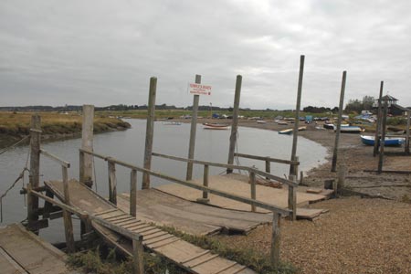
The start can be either village but for the purposes of this description Morston Quay (Grid ref. TG006442) has been chosen as the starting point. There is plenty of parking in the National Trust car park (fee payable) adjacent to the jetties. After parking, follow the Norfolk Coast Path west. This is signed to Blakeney from near the National Trust information Centre.
The path follows a level course with the Morston salt Marshes on your left. These marshes provide a unique habitat and are home to a wide variety of birds. The houses of Blakeney are seen quite soon and with easy level walking you soon reach the village. Like Morston, Blakeney depended on the sea for its livelihood and even today the quay is busy with yachts and sailing boats.
After having explored the waterside walk up the High Street (with the White Horse Hotel on your right). This, like many streets in the village, is lined with cottages built in the traditional style many with pan-tiled roofs and cobble or flint walls. Reaching the top of High Street, cross the main road and bear right up to St.Nicholas Parish Church. This large church has two towers, the smaller of which was used as a lighthouse. After exploring the church return to the main road and catch the Hopper bus back to the Green at Morston. From here it is a short walk back to Morston Quay with a diversion necessary to visit All Saints Parish Church.
Note - There is an excellent bus service operating along the A149 coast road between Sheringham and Kings Lynn. Operated by Norfolk County Council, this 'Coast Hopper' service is useful for many walks as the bus route shadows the Norfolk Coast Path. This enables one way walks to be undertaken with relative ease but also means that other walks can be altered to suit your needs.
Other walks nearby
| Walk 1804 | Blakeney & Cley next the Sea | easy | 5.0 miles |
| Walk 1730 | Blakeney Point | moderate | 9.0 miles |
| Walk 2401 | Salthouse from Cley-next-the-Sea | easy | 4.0 miles |
| Walk 1654 | Cley next the Sea & Salthouse | easy | 6.7 miles |
| Walk 2081 | Holkham Gap and West Beach from Wells-next-the-Sea | easy | 4.0 miles |
| Walk 1908 | Wells-next-the-Sea & Holkham Park | easy/mod | 8.0 miles |
| Walk 2101 | Holkham Park circular | easy | 4.5 miles |
| Walk 3254 | Holkham & Holkham Park Circular | moderate | 10.2 miles |
| Walk 2653 | Sheringham to Cley-next-the-Sea | easy/mod | 8.5 miles |
| Walk 1035 | Burnham Market | easy | 5.5 miles |
Recommended Books & eBooks
No suggestions for this area.Messaging & Social Media
Message Walking Britain and follow the latest news.

Mountain Weather
Stay safe on the mountains with detailed weather forecasts - for iOS devices or for Android devices.