Salthouse from Cley-next-the-Sea
Norfolk Walk
County/Area - Norfolk
Author - Lou Johnson
Length - 4.0 miles / 6.5 km Ascent - 100 feet / 30 metres
Time - 2 hours 10 minutes Grade - easy
Maps 

| Ordnance Survey Explorer 251 | Sheet Map | 1:25k | BUY |
| Anquet OS Explorer 251 | Digital Map | 1:25k | BUY |
| Ordnance Survey Landranger 133 | Sheet Map | 1:50k | BUY |
| Anquet OS Landranger 133 | Digital Map | 1:50k | BUY |
Walk Route Description
Click image to visit gallery of 3 images.
This walk starts from the attractive village of Cley-next the-Sea with the route taking you across the salt marshes to the shingle beach. The walk continues by following the Norfolk Coast Path along the beach for just over two miles before turning inland to the village of Salthouse. The route passes the northern boundary of the Cley Marshes Nature Reserve so there is a good chance of seeing a variety of birds on this walk.
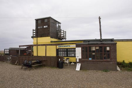
The start is the village of Cley-next-the-Sea (Grid ref TG044437) opposite the 'Delicatessen' bus stop used by the Coast Hopper Bus Service. Almost opposite a waymarked path with the Acorn National Trail symbol leads you behind the backs of houses and past the windmill into open country. The path then continues alongside a road out to a car park (Grid ref. TG047452) and "Arkwright's Café" and the beach.
Turn right along the coast taking the easiest route, either walking on the shingle beach or just inland on a track. After approximately two miles of following the North Norfolk Coast Path you reach a parking area (Grid ref. TG082443). Turn right here and follow the lane back to the main road. Turn right along the main road to the Green in the village of Salthouse where the Hopper bus stop is by the post office.
Note - There is an excellent bus service operating along the A149 coast road between Sheringham and Kings Lynn. Operated by Norfolk County Council, this "Coast Hopper" service is useful for many walks as the bus route shadows the Norfolk Coast Path. This enables one way walks to be undertaken with relative ease but also means that other walks can be altered to suit your needs.
Other walks nearby
| Walk 1804 | Blakeney & Cley next the Sea | easy | 5.0 miles |
| Walk 1654 | Cley next the Sea & Salthouse | easy | 6.7 miles |
| Walk 1600 | Morston Salt Marshes from Morston Quay | easy | 2.5 miles |
| Walk 2307 | Blakeney from Morston Quay | easy | 2.0 miles |
| Walk 3732 | Morston, Blakeney & Cley next the Sea | easy | 4.0 miles |
| Walk 2653 | Sheringham to Cley-next-the-Sea | easy/mod | 8.5 miles |
| Walk 2081 | Holkham Gap and West Beach from Wells-next-the-Sea | easy | 4.0 miles |
| Walk 1908 | Wells-next-the-Sea & Holkham Park | easy/mod | 8.0 miles |
| Walk 2101 | Holkham Park circular | easy | 4.5 miles |
| Walk 3254 | Holkham & Holkham Park Circular | moderate | 10.2 miles |
Recommended Books & eBooks
No suggestions for this area.Messaging & Social Media
Message Walking Britain and follow the latest news.

Mountain Weather
Stay safe on the mountains with detailed weather forecasts - for iOS devices or for Android devices.