Dowsborough Fort from Holford
Quantock Hills Walk
Region - Quantock Hills
County/Area - Somerset
Author - Peter Lane
Length - 6.0 miles / 9.8 km Ascent - 1000 feet / 303 metres
Time - 4 hours 0 minutes Grade - easy/mod
Maps 

| Ordnance Survey Explorer 140 | Sheet Map | 1:25k | BUY |
| Anquet OS Explorer 140 | Digital Map | 1:25k | BUY |
| Ordnance Survey Landranger 181 | Sheet Map | 1:50k | BUY |
| Anquet OS Landranger 181 | Digital Map | 1:50k | BUY |
Walk Route Description
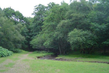
Click image to visit gallery of 6 images.
An energetic short walk in the Quantocks with some historic landmarks and spectacular scenery. The walk visits the high vantage point of Dowsborough Fort and the sinister Dead Woman's Ditch. You may well encounter some wild horses on the hills too.
The Quantock Hills richly deserve their status as an Area of Outstanding Natural Beauty. Rising from the sea, they command fantastic views out across the Bristol Channel to South Wales. The wind blasted desolation of the higher moorland contrasts with some fine woodland and ancient beech tree lined drove roads. These fine rolling hills are, in my humble opinion, the most beautiful in the West Country.
Starting in the small village of Holford, locate the free Quantock Hills AONB car park signed down a country lane to Alfoxton and Hodder's Combe, grid reference ST154411. From the Hodder's Combe car park, retrace along the road to the "triangle" in the road adjacent to the long thatched terrace and follow the signpost marked Holford Combe. Follow the tarmac lane past a swanky hotel and then as it turns into an unmetalled path and finally opens out to a ford with a pleasant stream to the right. A gently inclined path leads off very sharply to the left (double back on yourself) and climbs into the trees. Through a gate and round to the right, the path enters a field by another gate.
Cut directly across the field (path just visible on the ground) to a gate opposite and join the broad bridlepath as it climbs steadily uphill. Once out of the trees, keep to the left ridge (there are many paths on the ground not shown on the OS map and vice versa). The objective is the obvious hill almost straight ahead with a clearly visible path snaking up to its rounded summit - this is Dowsborough Fort. Once inside the earthwork, the rampart and ditch are clearly visible, although the fort itself is much overgrown. The path follows the rampart in a clockwise (SE) direction and then continues for about 50 metres after leaving the rampart before an intersection with an indistinct steeply descending path on the right. Take this path and descend steeply downhill, join a broader path and continue until a sweeping narrow country lane is reached.
Climb steadily uphill along the lane to a road junction and the car park at Dead Woman's Ditch. I shall leave it to the information boards to tell the gory tale of murder, trial and execution and the grim fate that befell the felon. The ditch itself is an ancient boundary. Having satisfied your curiosity at the car park information board, continue right along the summit road for a few metres and locate the obvious broad path on the right heading almost due West. A selection of descending routes await your choice down the "Combes". I chose the route over Higher Hare Knap, right at the second major crossroads of paths. The route is fairly flat, initially, as it approaches the summit. Take the path that heads off left towards the top of Higher Hare Knap and its summit cairn. A narrow path descends from here, crosses a bridlepath and ascends to flank the summit of Lower Hare Knap. The path gets narrower and more enclosed before rejoining the main bridlepath that returns to Holford. Pass through a gate and after the first signs of habitation on the left, turn left to return directly to the car park below.
Other walks nearby
| Walk 1696 | Weacombe Combe, Bicknoller Post, Kilve & Longstone Hill | easy/mod | 7.5 miles |
| Walk 2940 | Beacon Hill & Bicknoller Post from Kilve Beach | easy/mod | 7.0 miles |
| Walk 2330 | Quantock Hills from Dead Woman's Ditch | moderate | 9.2 miles |
| Walk 1856 | Lilstock & East Quantox Head | easy/mod | 8.4 miles |
| Walk 3211 | Crowcombe & Wills Neck | moderate | 7.3 miles |
| Walk 1925 | Plainfield to Wills Neck | easy | 5.0 miles |
| Walk 1924 | Lydeard Hill to Wills Neck | easy | 2.6 miles |
| Walk 2211 | Minehead to Dunster | easy | 5.0 miles |
| Walk 1973 | River Parrett from Pawlett | easy/mod | 7.1 miles |
| Walk 1220 | Dunkery Beacon | moderate | 8.0 miles |
Recommended Books & eBooks
No suggestions for this area.Messaging & Social Media
Message Walking Britain and follow the latest news.

Mountain Weather
Stay safe on the mountains with detailed weather forecasts - for iOS devices or for Android devices.