Devil's Point, Cairn Toul, Braeriach & Lairig Ghru Walk
Walk 1016 - Route Maps & Profile
Route Map
Digital Maps - Copyright © 2011-2024. All rights reserved.
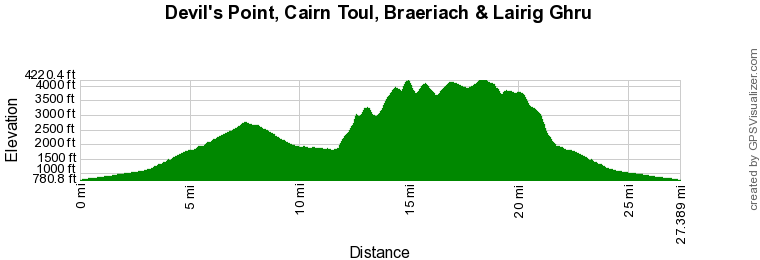
Route Profile
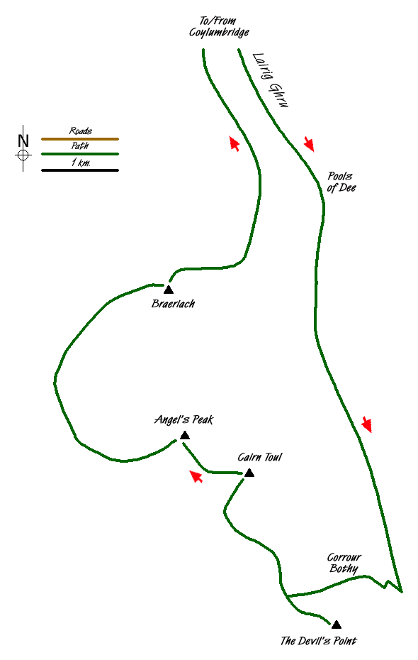
Sketch Map
Suggested Maps 

| Ordnance Survey Explorer OL57 | Sheet Map | 1:25k | BUY |
| Anquet OS Explorer OL57 | Digital Map | 1:25k | BUY |
| Ordnance Survey Landranger 36 | Sheet Map | 1:50k | BUY |
| Anquet OS Landranger 36 | Digital Map | 1:50k | BUY |
It is recommended you take a map. The preferred scale is 1:25k.
Start Point Details
Ordnance Survey Grid Ref NH915107
Latitude 57.174257 Longitude -3.796171
Postcode PH22 1QG
what3words start deriving.onto.pegs
Walk description may contain detailed information on the start point for this walk.
Further Information
Cairngorms
Walking in the Cairngorms National Park, which was formed in 2003 to protect the unique aspects of the area, offers some of the great walks of Scotland. It is the UK's largest national park with a large mountain range at its heart with diverse communities around it. The habitat offers a secure haven for many of Britain's rarest bird, animal and plant species. Forests include remnants of the original Caledonian pine forest which contrast with large areas of heather moorland to foster ecological diversity. Of particular interest to hill walkers is that four of Scotland's five highest peaks can be found in this National Park where the arctic wilderness is the largest example of arctic mountain landscape in the British Isles. Cairngorms Walking Guide
Highland
Highland is an administrative area which contains most of the Scottish Highlands. It is sparsely populated and contains some of the finest scenery in the British Isles. High Mountains, deep glens and lochs contain many great walks. The area includes Ben Nevis the highest mountain in the UK. The area also includes part of the Cairngorm National Park, an area of high mountains, and glorious Isle of Skye.
Walk grading - Learn how each walk is assessed and select a walk to suit your ability and experience by going to Walk Grading Details.
Messaging & Social Media
Message Walking Britain and follow the latest news.

Mountain Weather
Stay safe on the mountains with detailed weather forecasts - for iOS devices or for Android devices.