Devil's Point, Cairn Toul, Braeriach & Lairig Ghru from Coylumbridge
Cairngorms Walk
Nat Park - Cairngorms - Cairngorm North
County/Area - Highland & Aberdeenshire
Author - Andy Smith
Length - 28.0 miles / 45.5 km Ascent - 6400 feet / 1939 metres
Time - 20 hours 20 minutes Grade - very hard
Walk Route Description
Click image to visit gallery of 12 images.
Britain has a wide range of National Parks which can provide a wilderness experience for people from all walks of life. However none come closer to the sheer scale of the Cairngorms in northeast Scotland. Here you can wander for days leaving the outside world to its hectic ways. The Cairngorm National Park is Britain's largest national park and is 40% larger than the Lake District. It is therefore no wonder that it is a favourite choice for the dedicated outdoor enthusiast.
This two-day route is truly a "Munro bagger" taking in the Devil's Point, Cairn Toul, Sgor an Lochain Uaine and Braeriach along with four Corbetts. The approach is via the Lairig Ghru valley and will involve camping for one night. It is essential that you have mastered basic backpacking skills in the outdoors. The route also covers some tough ground and is not a walk for the inexperienced. Remember you will be without contact from the modern world for at least 20 hours, therefore be aware of your capabilities. The best time of the year to attempt this route would be between May and August.
Day One
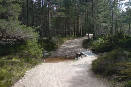
As with walks 1721 and 3299, this route starts at Coylumbridge in the heart of Rothiemurchus Forest near Aviemore where a large campsite is situated at grid ref. NH915107. The best option is to pitch here for a few days leaving the car safe, although a large hotel is within reach over the road. Leave the campsite and head south on the raised bank into the forest passing the campsite grounds. When the path splits take the left fork signed Lairig Ghru and follow for 3km to the Cairngorm Club footbridge. Cross here and continue on to a junction (grid ref. NH938075). Turn hard right here signed Lairig Ghru as the path starts to climb out of the forest providing some fine views.
Once the forest is finally cleared comes a long trudge across open moorland to reach the start of the Lairig Ghru valley, which seems to never arrive. But after an hour or so you find yourself crossing the River Allt Druidh, which makes a great place to take your first serious break. It is also worth noting this will be your last chance for 6 hours to make use of a clean water supply. Once rested and on the way, join the main path. As you enter the Lairig Ghru it almost feels like you're on a film set somewhere in the Grand Canyon as this place is huge by British standards. A hard 9km journey across hostile terrain to base camp by the Corrour Bothy now awaits you as the track slowly winds its way into the valley.
In some sections, the valley floor is crammed with large boulders and these can be a real 'soul tester' at times without much ground being covered. After some considerable time the Valley opens out into a massive bowl 5km across and the fist glimpse of Cairn Toul comes into view. This amazing looking mountain seems to spur you on with not only tomorrow's thought of walking the summit, but also knowing base camp is slowly getting within reach. At NH974006 make sure to bear left at the pools of Dee, to get this wrong would cause huge problems later as the river widens quickly with heavy flows from the corries on either sides of the valley. The going is now spectacular as you walk downhill in this huge valley, the slopes of Ben Macdui tower overhead to your left with the awesome summit of the Devil's Point straight ahead in the distance which lies above base camp for the night.
After a very long day base camp is reached. The Corrour Bothy is a great choice but in summer expect not to be alone as the Aviemore to Lynn of Dee traffic can be very busy so camping is a better option. I chose a grass patch where the river bends (grid ref. NH984961), this not only provided a water supply but stable moor grass with good cold insulation properties. Don't forget you are only 2km from the coldest ever recorded temperature in the British Isles! The walk to this base camp takes around 8 to 9 hours from Coylumbridge.
Day Two
After a deafeningly quiet black night, it is soon time to hit the road. This should be done by 7am at the very latest to stay on schedule. Cross the river at grid ref. NH986957 where a large footbridge is located. Compost toilets are provided at the bothy should the need be so before making the first ascent. There now follows a 500m climb to the main ridge at Coire Odhar high above. Important: From October to June a large snow cornice bridges the waterfall near the summit. This can be avoided by bearing right up a small crag but this involves mild scrambling. This is passable without crampons but be aware, make good footholds over the snow as the drop is severe. It is a short but dangerous section lasting only a few minutes in late Spring.
Once at the summit it is time to bag the first objective, The Devil's Point. Turn left and follow the only track to the summit, which should take about twenty minutes. Summit reached you take in huge views from all around. Ben Macdui dominates the skyline as the Lairig Ghru cuts past into the horizon taking your breath away. This is wild Scotland at its best. Leave the summit heading back the way you came and continue along the ridge towards Stob Coire an t Saighdeir. This section can be slow with a boulder field to negotiate. Make sure you stay close to the edge to avoid navigation problems as you stride towards Cairn Toul which now fills the view ahead.
Cairn Toul is tough going as the final stages seem to refuse to let its remote secrets out until the last minute. The summit is rocky and dramatic with a haunting drop into the Lairig Ghru 600m far below. Lochan Uaine is well worth a picture although caution should be taken when nearing the edge. Many accidents have accrued in this region. This is a great mountain. As well as standing on Britain's fourth highest summit, you should now celebrate knowing you have reached the most inaccessible Munro in the Cairngorm National Park. Leave Cairn Toul and proceed on to The Angel's Peak nearby. Here the ridge turns sharply leftwards with Carn na Criche now in view. Braeriach can be seen but is still a long way off.
Passing the Crown Buttress & Great Gully is hard work, with yet more car sized boulders. The wind is also now a problem as it escapes from the Lairig Ghru below. Take care. Turn slowly at Carn Criche and a path leads off downhill for a while. There now follows the last major ascent, but it's a big one! Braeriach is the third highest Munro and the climb confirms that factor. This is hard work at a time where you have spent half a day climbing. At the summit of Braeriach expect to meet a few people coming up from the north. Views to the south are amazing if energy is found to take photos. Ben Macdui is still in view on the other side of the valley although now viewed from the west face. The most impressive is undoubtedly Cairn Toul 3km to the south. Its snow topped crater stands out like a classic volcano which is so well shaped it almost looks still active.
Leave Braeriach to the north and follow the ridge down. Be prepared to cross near snow cornices at steep angles near the East Gully (grid ref. NH956001). This gives a real alpine experience although be aware of the dangers as tiredness will be very much of an issue at this point. Turn left passing Sron na Lairige and continue downhill with Rothiemurchus Forest now in view on the horizon. The path drops steeply at grid ref. NH960036 where you rejoin the main Lairig Ghru track. Continue for 9km retracing your footsteps from yesterday back to Coylumbridge. Be prepared to use your head torch for the last few miles depending what time base camp was departed. This will be a very painful last few hours to say the least, but thinking back on what two days produced should ease the suffering. The Cairngorm National Park, Britain on the wild side!
Maps 

| Ordnance Survey Explorer OL57 | Sheet Map | 1:25k | BUY |
| Anquet OS Explorer OL57 | Digital Map | 1:25k | BUY |
| Ordnance Survey Digital Map Subscription | |||
| Latest Ordnance Survey Discounts | |||
Other walks nearby
| Walk 1906 | Lochan Mor & Rothiemurchus Forest from Inverdruie | easy/mod | 3.6 miles |
| Walk 1505 | Craigellachie National Nature Reserve | easy/mod | 5.0 miles |
| Walk 1904 | Loch Morlich circular (near Aviemore) | easy | 4.0 miles |
| Walk 2412 | Craiggowrie & Creagan Gorm from Loch Morlich | mod/hard | 7.3 miles |
| Walk 2607 | Lairig Ghru & Chalamain Gap from Glenmore | mod/hard | 11.0 miles |
| Walk 3579 | Meall a'Bhuachaille & Ryvoan Bothy from Glenmore | moderate | 5.5 miles |
| Walk 3218 | Eag a' Chait gap Via Rothiemurchus Lodge from Glenmore | moderate | 8.2 miles |
| Walk 1020 | Glenmore to Linn of Dee via Lairig Ghru & Corrour | hard | 21.0 miles |
| Walk 1605 | Loch an Eilein & Rothiemurchus Forest from Loch Morlich | easy/mod | 10.0 miles |
| Walk 2421 | Braeriach via the Chalamain Gap | hard | 15.0 miles |
Recommended Books & eBooks
Skye's Cuillin Ridge Traverse
 This 2-volume set provides all the information required to complete the main ridge traverse on Skye's Black Cuillin. Strategy, gear, training, navigation and logistics are covered, and 10 classic scrambles are described. A lightweight second guidebook gives the scrambler detailed maps, topos and route description for the ridge traverse itself.
More information
Great Mountain Days in Scotland
 Inspirational guidebook to 50 challenging routes for mountaineers, scramblers, hillwalkers and fell runners, many long enough to backpack over 2 days, especially in winter (12 to 25 miles). A mix of classic routes and unsung gems across Scotland from Galloway to the Outer Hebrides in widely differing wild landscapes. With customised OS mapping.
More information
