Faringdon, Thrupp and towards Lechlade
Oxfordshire Walk
County/Area - Oxfordshire
Author - Visit Southern Oxfordshire
Length - 6.5 miles / 10.6 km Ascent - 200 feet / 61 metres
Time - 3 hours 30 minutes Grade - easy
Walk Route Description
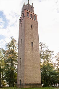
Click image to see photo description.
1 - Start the walk in Faringdon Market Place and head uphill to Church Street, past the churchyard and past the A4095 to Witney. When the metalled road turns 90 degrees right, carry straight on to a farm track. When it starts to bend, continue straight on to an enclosed footpath (Church Path).
2 - At the footpath junction, turn left, (Grove Cottage is on the right) then follow field-edge path down hill. Continue walking on a well marked footpath across two large arable fields, first diagonally towards the right of Haremoor Wood, then on to a footbridge and head towards Smokedown Cottages. Near the cottages, join a track which takes you to the Thrupp road (signed Faringdon 2 miles).
3 - Turn left onto road and just over the bridge, turn left through a gate. Cross the meadow to a stile to the right of Hatton Farm then follow the enclosed path (waymarked) onto a track to Hatton Farm leading to Radcot Road. Before you reach the road turn right over a stile.
4 - Turn right for some 200m and then cross the road to a field-edge bridleway. Continue following the bridleway across a track (which leads to Northfield Farm and Cottages) passing the farm cottages on your right and after a while, the Faringdon Sewage Works to your left. Continue to follow the bridleway until you reach Lechlade Road.
5 - Turn right along the roadside for about 400 metres and then left onto a bridleway (farm track) which passes straight through Step Farm.
6 - Continue for some time to a path junction (where there are 2 entrance gates to fields), and turn left onto a field-edge footpath which leads to a wooden bridge (with stiles). Follow a path, along electricity poles across the field to another small wooden bridge with stiles, over to the left. Go back onto the field-edge path which then cuts across the field corner to a stile. Continue on an enclosed path (called the Glories) and at the top turn left leading onto Canada Lane. Go straight on past school.
7 - At the main road (A417) turn right and then bear left at the mini-roundabout into Gloucester Street and back to Market Place.
Maps 

| Ordnance Survey Explorer 170 | Sheet Map | 1:25k | BUY |
| Anquet OS Explorer 170 | Digital Map | 1:25k | BUY |
| Ordnance Survey Digital Map Subscription | |||
| Latest Ordnance Survey Discounts | |||
Other walks nearby
| Walk 1069 | Badbury Hill, including the Great Barn at Great Coxwell | easy | 6.0 miles |
| Walk 3630 | Longcot & Uffington Circular | easy | 5.2 miles |
| Walk 1062 | Pusey & Buckland circular | easy | 3.5 miles |
| Walk 1554 | Wayland's Smithy & Uffington Castle | easy/mod | 5.5 miles |
| Walk 2915 | Uffington Castle, the White Horse and Wayland's Smithy | easy/mod | 6.5 miles |
| Walk 3116 | Uffington White Horse & Wayland's Smithy | easy | 3.3 miles |
| Walk 2410 | Wayland's Smithy, Ashdown House and Ashbury | easy/mod | 7.5 miles |
| Walk 1419 | The Lambourn Downs from near Astbury | moderate | 14.0 miles |
| Walk 1873 | The Ridgeway from Ardington | easy/mod | 7.0 miles |
| Walk 1439 | Fulbrook & Widford | easy | 6.0 miles |
