Great Stickle & Stickle Pike from near Ulpha
Lake District Walk
Nat Park - Lake District - Lake District Southern Fells
County/Area - Cumbria
Author - Lou Johnson
Length - 5.0 miles / 8.1 km Ascent - 1450 feet / 439 metres
Time - 4 hours 0 minutes Grade - moderate
Maps 

| Ordnance Survey Explorer OL6 | Sheet Map | 1:25k | BUY |
| Anquet OS Explorer OL6 | Digital Map | 1:25k | BUY |
| Ordnance Survey Landranger 96 | Sheet Map | 1:50k | BUY |
| Anquet OS Landranger 96 | Digital Map | 1:50k | BUY |
Walk Route Description
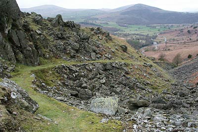
Click image to visit gallery of 6 images.
The Duddon Valley or Dunnerdale in south-west Lakeland, is scenically interesting, flanked in its lower reaches by lower fells. The village of Ulpha, roughly a third of the way up the valley, is where the higher fells begin. Although this Lake District walk does not include any of the high fells it is nevertheless a route that offers many of the characteristics of the more lofty neighbours and makes a perfect half day excursion.
The start is the small car park (SD198920) on the east side of the valley road about a kilometre south of Ulpha village. After parking walk south along the road for a kilometre to the point where a path heads (Grid ref. 202 912) towards an obvious miniature "gorge" slightly ahead on your left. This path climbs quickly and easily on a well prepared grade towards Pickthall Ground.
Once through the "gorge" the path levels and continues towards a wall (Grid ref. SD 206 907). Do not cross the wall but turn left and follow a grassy track beside the wall with Great Stickle rising ahead. The path to its summit is clear although there is a deceptive amount of ascent in the climb to the trig point. The view is wide and varied from Morecambe Bay in the south to the higher fells further up the Duddon Valley.
Descend north from the summit and maintain this general direction towards Stickle Pike using sheep trods and paths. You need to continue to the east or right hand flank from where a steep path leads you to the cairn located on a wonderful little summit. The views are similar to the previous summit although the distinctive shape of Caw dominates to the north.
Use the same path to descend to the east and turn north with Stickle Tarn on your right to reach the road (Grid ref. SD 214 932). Turn left along the road and just before the cross wall (Grid ref. SD 212 934) turn left along a clear path. This path roughly follows the wall in early stages but does trend away to cross Hollow Moss Beck. After crossing this stream head towards Birks (Grid ref. SD 200 930) where you join a rough track that leads down to the road. Turn left and return to the car park.
Other walks nearby
| Walk 2271 | Black Combe from near Stoneside Hill | easy/mod | 6.3 miles |
| Walk 2281 | White Combe FROM near Whicham | easy/mod | 4.5 miles |
| Walk 1299 | Green Crag | moderate | 6.5 miles |
| Walk 2361 | Scafell & Slight Side | hard | 9.5 miles |
| Walk 2362 | Scafell Pike and Scafell | very hard | 11.0 miles |
| Walk 2675 | Eel Tarn and Stony Tarn | easy/mod | 6.0 miles |
| Walk 2229 | Tarns of Eskdale | easy/mod | 7.5 miles |
| Walk 1932 | Slight Side from Whahouse Bridge | moderate | 5.6 miles |
| Walk 2355 | Blea Tarn & Eskdale Green | easy/mod | 6.5 miles |
| Walk 1124 | Beacon Tarn & The Beacon from near Torver | easy/mod | 4.0 miles |
Recommended Books & eBooks
Hadrian's Wall Path
 Hadrians Wall Path guidebook to walk the 84 mile National Trail. Described in both directions, the main description is west to east between Bowness-on-Solway and Wallsend, Newcastle, with extensions to Maryport and South Shields. With extensive historical information related to this World Heritage site and separate 1:25,000 OS map booklet included.
More information
Walking the Lake District Fells - Mardale and the Far East
 Part of the Walking the Lake District Fells series, this guidebook covers a wide range of routes to 36 Lakeland summits that can be climbed from the Ullswater, Haweswater, Troutbeck, Kentmere and Longsleddale valleys, with highlights including High Street, Place Fell and the Kentmere fells. Suggestions for longer ridge routes are also included.
More information
Messaging & Social Media
Message Walking Britain and follow the latest news.

Mountain Weather
Stay safe on the mountains with detailed weather forecasts - for iOS devices or for Android devices.