Circuit of Ovenden Moor from Oxenhope
South Pennines Walk
Region - South Pennines
County/Area - West Yorkshire - South Pennines
Author - Lou Johnson
Length - 8.0 miles / 13 km Ascent - 1250 feet / 379 metres
Time - 5 hours 20 minutes Grade - moderate
Walk Route Description
Click image to visit gallery of 12 images.
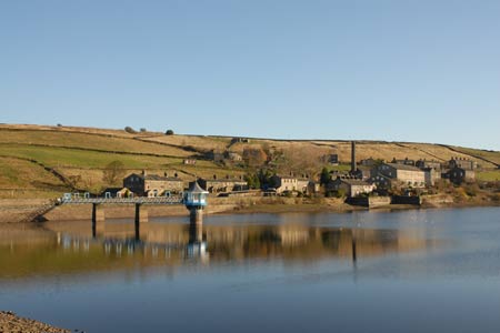
This walk traverses a variety of South Pennine scenery from a valley once busy with industry to wild open moorland. The start is the pleasant workmanlike environment of Oxenhope near the head of the Worth Valley.
Parking is available on the street near the Post office at the junction of Lower Town and the B6141 Denholme Road (Grid ref. SE034348). After parking, walk south (uphill) towards Denholme. Bear left along Jew Lane Stay on this lane, which is flanked by cottages, keeping straight ahead on the lower lane at the junction where Back Leeming forks left. Continuing along the valley the lane crosses the river. Just after the next cottage on the left take the signed footpath leading up to the dam wall of Leeming Reservoir and tarmac track. Go right along the track, bear left at the fork and after a short way go left onto a signed footpath.
This grassy path (the Brontë Way) contours above the reservoir before descending to cross a footbridge over a stream. Continue half left across the next field, cross another bridge and once on the other side bear right to follow a wire fence up hill. This path leads onto open moors initially with a stone wall on your left. Where the wall ends keep straight ahead and continue uphill to a ladder stile next to a water leat. Cross this stile and continue aiming for a footpath sign visible on the skyline ahead. Before reaching the sign you join a rough track.
At the sign (grid ref. SE046333) turn right onto Hambleton Lane. Stay on this track as it rises gently with expansive views on your left across Thornton Moor Reservoir to Halifax and Bradford beyond. On your right you will see the windmills of Ovenden Moor Wind Farm. As the track starts to descend, look out for a path junction (Grid ref. SE049323). Bear right and follow the path to eventually reach the deep clough containing Ogden Water on your right. Continue for a short way and then descend steps on your right to reach the dam across the stream (Grid ref. SE053317). Cross this dam and climb out of the clough onto the moor.
The next section can be a little soft underfoot especially after rain. The way ahead is generally clear as the path roughly heads south west. Cross the footbridge over the stream in Skirden Clough and continue ahead to reach a track. Turn right to reach the former Withens Hotel (now a private residence) and a road (Grid ref. SE045306).
Turn right along the lane passing the information board that gives a detailed overview of the wind farm. The road deteriorates into a rough wide track. Pass Warley Moor Reservoir on your left and as the track starts to descend, look out for a footpath sign on your right (Grid ref. SE032324). Leave the road and follow the path along the edge of the escarpment. You soon encounter some large cairns and other man-made structures, which seem to be built from stone from the adjacent quarries. These add interest to the walk, which now provides a grandstand view north over Oxenhope and beyond. Stay on the edge path to reach Hambleton lane (Grid ref. SE047331). Turn left onto the lane and retrace your steps back to the start.
Maps 

| Ordnance Survey Explorer OL21 | Sheet Map | 1:25k | BUY |
| Anquet OS Explorer OL21 | Digital Map | 1:25k | BUY |
| Ordnance Survey Digital Map Subscription | |||
| Latest Ordnance Survey Discounts | |||
Other walks nearby
| Walk 2705 | Oxenhope to Hebden Bridge without a car | moderate | 11.0 miles |
| Walk 1243 | Haworth Moor and Bronte Bridge from Oxenhope | easy | 3.5 miles |
| Walk 1585 | Haworth Moor circular | easy | 5.0 miles |
| Walk 1135 | Top Withins and the Bronte Bridge | moderate | 8.0 miles |
| Walk 1449 | Cullingworth Circular | easy/mod | 6.3 miles |
| Walk 1584 | Ogden Reservoir | easy | 4.0 miles |
| Walk 2121 | Crimsworth Dean, Lumb Bridge & Hardcastle Crags | moderate | 7.5 miles |
| Walk 1291 | Stoodley Pike | moderate | 11.0 miles |
| Walk 1952 | Five Rise Locks and the River Aire, Bingley | easy | 5.3 miles |
| Walk 1057 | Luddenden Dean and the Calderdale Way | easy/mod | 6.5 miles |
