Ben More and Stob Binnein Walk
Walk 1406 - Route Maps
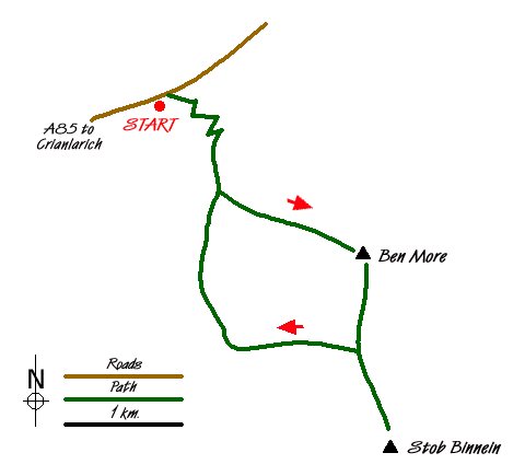
Sketch Map
Suggested Maps 

| Ordnance Survey Explorer OL46 | Sheet Map | 1:25k | BUY |
| Anquet OS Explorer OL46 | Digital Map | 1:25k | BUY |
| Ordnance Survey Digital Map Subscription | |||
| Latest Ordnance Survey Discounts | |||
It is recommended you take a map. The preferred scale is 1:25k.
Start Point Details
Ordnance Survey Grid Ref NN411259
Latitude 56.39855 Longitude -4.576202
Postcode FK20 8QS
what3words start commuted.diverting.switch
Walk description may contain detailed information on the start point for this walk.
Further Information
Walk grading - Learn how each walk is assessed and select a walk to suit your ability and experience by going to Walk Grading Details.
Messaging & Social Media
Message Walking Britain and follow the latest news.

Mountain Weather
Stay safe on the mountains with detailed weather forecasts - for iOS devices or for Android devices.