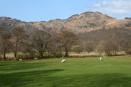
Great Gable (Borrowdale route) from Borrowdale Youth Hostel
Lake District Walk
Nat Park - Lake District - Lake District Western Fells
Wainwrights - Brandreth, Great Gable, Green Gable, Grey Knotts
County/Area - Cumbria
Author - Stephen Starkey
Length - 12.0 miles / 19.5 km Ascent - 3850 feet / 1167 metres
Time - 9 hours 50 minutes Grade - hard
Maps 

| Ordnance Survey Explorer OL4 | Sheet Map | 1:25k | BUY |
| Anquet OS Explorer OL4 | Digital Map | 1:25k | BUY |
| Ordnance Survey Landranger 90 | Sheet Map | 1:50k | BUY |
| Anquet OS Landranger 90 | Digital Map | 1:50k | BUY |
Walk Route Description
Click image to visit gallery of 6 images.
This is a full Lake District walk from Borrowdale Youth Hostel, taking in all the highlights of the iconic Great Gable before returning via quieter fells that offer not only different viewpoints of Great Gable but also a splendid viewpoint of the magnificent fells South West of Ennerdale (including Pillar and Steeple). The beauty of this route, other than Great Gable, is that the footpaths start and finish at the front door of the Youth Hostel. Alternative start points would be Seathwaite, Seatoller or Honister Pass though the latter will mean tackling the hardest parts of the route with tiring legs.
Warning - the traverse of the Southern slopes of Great Gable requires a sure foot, a head for heights and a steady nerve. There are parts of this path that provide significant exposure and parts that will need Grade 2 Scrambling Skills. If you choose to "Thread the Needle", be aware that this is classed as a Grade 3 scramble. Once on the traverse, any attempt to by-pass the "worst" parts will involve descending very steep, pathless scree.
Exit the Youth Hostel and turn right on to the path towards Seatoller. Shortly after passing through a kissing gate, you come to a rock ledge just above the River Derwent. It's hardly Via Ferrata stuff, but a chain handrail has been provided to assist. About 650m after leaving the Youth Hostel, just as Folly Bridge comes in to view on the left; a secondary path leads off to the left to cross a break in the wall next to a yew tree. Take this path and follow it to cross the River Derwent via Folly Bridge.
On arriving at the Borrowdale Road, cross the road and take the lane cum path opposite. When the surfaced lane bends round to the right leading to Thorneythwaite Farm, take the footpath ahead to the left of the lane. Stay on this path through a number of fields until arriving at the farm at Seathwaite. Parts of this section can be soft under foot. On a nice day, this part of the walk offers stunning views of the steep sided fells (Thorneythwaite Fell, Base Brown, Grey Knotts etc.) on both sides of the valley. On arriving at Seathwaite, turn left to follow the main path towards Styhead and the Scafell Massif. The path climbs gently along side Styhead Gill to arrive at Stockley Bridge. Cross the bridge and ignore the path off to the left immediately after a wall and start to climb the stone pitched path ahead, climbing around Greenhow Knott to rejoin Styhead Gill.
Continue along the path, pitched in parts, as it tracks next to the picturesque stream. As a footbridge across the stream comes in to view, the going becomes more difficult for a while as you have to negotiate a boggy section where there are numerous rocks to help. There is no "right" path here - just take the route you find easiest but without deviating too far from the stream. Cross the footbridge then continue in a SSW direction, passing Styhead Tarn and climbing very gradually until arriving at a Mountain Rescue Stretcher Post. This is known as Sty Head and numerous paths meet here. The required path heads off NW for 25m or so before it splits in two. The right hand, stone stepped, path climbs direct to the summit of Great Gable. However, it is the left hand, less obvious path that we take. The Westbound soft grassy path soon veers back to the NW and starts to become more rugged underfoot.
The first difficulty arrives just below the popular climbing location of Kern Knotts where there are two or three sections of awkward moves over large slabs of rock. If you find these not to your liking, this is the time to retreat. The path now steepens as it makes its way across the slopes of Great Gable. The path is relatively obvious but the steep slopes demand care, particularly in the areas where the rocks and scree are loose. As the route progresses, the huge mass of rock of Great Napes comes ever closer. Above on the right the aptly named Sphinx Rock stands sentinel like over Wasdale. Eventually, on the right, the impressive Napes Needle reveals itself. From the main path, the Needle is, in many ways, just another rock pinnacle. However, venture away from the path around the back of the Needle and suddenly the magical attraction of one of Lakeland's iconic rocks becomes evident. Before setting out to "Thread the Needle", bear in mind that this is a full on Grade 3 Scramble with no escape options.
Once past Napes Needle the path continues in pretty much the same vein as before - rocky path, loose in places, across steep slopes with another couple of bad steps thrown in for good measure. The excitement eventually fades away to leave a relatively straightforward section below the crags of White Napes. As you pass White Napes (Grid ref. NY206100), it is worth paying attention and looking for a visible track off to the right. If you spot the track climbing away up the rocky slopes, take it to climb across the Western slopes of Great Gable. If you miss the path, do not worry too much and just carry on joining any of the other paths from Wasdale to Beck Head. All the paths merge again just before Beck Head so the only penalty of missing the White Napes path is one of losing and having to regain additional altitude.
From the path junction at Beckhead Tarn, start climbing, gently at first, to the East before turning to the South East to tackle the unrelentingly steep climb up Great Gable's North West ridge. Initially the path is quite sound and easy to follow though the incessant passage of hundreds of walkers is starting to take its toll. The higher you climb, the less obvious the path becomes as you start to negotiate your way through the crags and boulder fields leading to the top of Gable's "Bowler Hat" summit. Regardless of the time of day, day of the week, time of year, it is highly improbable that you will be alone atop one of the UK's most iconic mountains.
The classic view from Great Gable is looking down Wasdale from the Westmorland Cairn to the South of the summit. I'm getting closer to seeing the view. The most recent ascent of Great Gable I've made, the view was partially obscured by haze. My first ascent it was difficult to see beyond the cairn, intervening ascents have gradually got better. Next time may be! From Great Gable the route continues by descending the NE slopes, passing to the right of Gable Crag, on the way to the col at Windy Gap - a more apt name is difficult to imagine. The subsequent climb to Green Gable is on an obvious, though somewhat eroded, path. The gradient is not as severe as you have been through on Great Gable but it is steeper than the map leads you to believe. The views back to Great Gable provide justification for a breather on the way up to Green Gable. Once at the summit of Green Gable, the views SSE across Styhead Tarn to Great End are quite spectacular. Having arrived at the summit of Green Gable, the worst of the day's climbing is done.
From the summit of Green Gable, there are two clear paths heading off in a generally NE direction. The right hand one of these provides an escape route via Mitchell Cove and the Northern flanks of Base Brown back to Seathwaite but this does involve a quite steep final descent alongside Sour Milk Gill. The main route takes the left hand of the two paths, which soon swings round to the North, and goes on past the series of small tarns at Gillercomb Head to the quiet peak of Brandreth. By comparison with the majesty of Great Gable, Brandreth is often regarded as the poor relation. However, the paths around Brandreth provide excellent vantage points for views South back to Great Gable, South East to Base Brown and most especially West to Pillar, Steeple, Haystacks and the Buttermere ridge. From Brandreth continue NNE on the clear but sometimes squelchy path to Grey Knotts and onwards for quite a steep descent to the Youth Hostel and Slate Mine at the top of the Honister Pass.
From the Slate Mine you could follow the Honister road in an Easterly direction to Seatoller then a number of options back to Borrowdale Youth Hostel. However, a safer, quieter and altogether more enjoyable option is to follow the old mine track down Little Gatesgarthdale. There are sections where the 'new' road and the old mine track are the same. Eventually though, at grid ref. 238-139 the two finally diverge and we follow the path sweeping around to the NE below the craggy slopes of High Scawdel (part of Dale Head). From here we follow the path NE / N, crossing Scaleclose Gill to reach a path junction to the W of the Southern end of Scaleclose Coppice. Turn R on the path here and descend past the waterfall at Scaleclose Force before picking up the path around the edge of Johnny Wood that leads back direct to the front door of the Youth Hostel.
Other walks nearby
| Walk 1693 | Grange & Watendlath from Rosthwaite | easy/mod | 7.6 miles |
| Walk 1175 | Combe Gill Circuit | moderate | 5.5 miles |
| Walk 3328 | Eagle Crag & Seargeant's Crag from Stonethwaite | moderate | 7.0 miles |
| Walk 3133 | Ullscarf and Watendlath from Stonethwaite | mod/hard | 10.0 miles |
| Walk 1245 | Castle Crag & Grange | easy/mod | 6.0 miles |
| Walk 1268 | Cat Bells & High Spy | moderate | 8.0 miles |
| Walk 2525 | Standing Crag & Dock Tarn from Watendlath | moderate | 7.0 miles |
| Walk 2526 | Standing Crag, Ullscarf & Borrowdale | mod/hard | 10.0 miles |
| Walk 1065 | Haystacks | moderate | 5.5 miles |
| Walk 1112 | Great Gable | hard | 7.3 miles |
Recommended Books & eBooks
Outdoor Adventures with Children - Lake District
 Guidebook to 40 outdoor adventures in the Lake District with children under 12, including walking, cycling, orienteering, paddling, boating, hostelling and more. Graded activities for varying age ranges or for families with children of different ages.
More information
Walking the Lake District Fells - Mardale and the Far East
 Part of the Walking the Lake District Fells series, this guidebook covers a wide range of routes to 36 Lakeland summits that can be climbed from the Ullswater, Haweswater, Troutbeck, Kentmere and Longsleddale valleys, with highlights including High Street, Place Fell and the Kentmere fells. Suggestions for longer ridge routes are also included.
More information
Messaging & Social Media
Message Walking Britain and follow the latest news.

Mountain Weather
Stay safe on the mountains with detailed weather forecasts - for iOS devices or for Android devices.