Sarratt Bottom and Chenies from Little Chalfont
Buckinghamshire Walk
County/Area - Buckinghamshire & Hertfordshire - South Buckinghamshire
Author - Lou Johnson
Length - 6.3 miles / 10.2 km Ascent - 350 feet / 106 metres
Time - 3 hours 30 minutes Grade - easy/mod
Walk Route Description
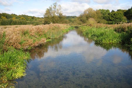
Click image to see photo description.
This pleasant walk explores the Chess Valley to the east of Little Chalfont. The route includes a section of the Chiltern Way long distance footpath. The route is relatively flat and is a perfect way to spend half a day.
The start is Chalfont & Latimer railway station where a good service is provided from London by the Metropolitan line and Chiltern Railways from Marylebone. Exit the station on the north side and walk left along Bedford Avenue. Turn right into Chenies Avenue and continue ahead to reach West Wood (grid ref. SU996981). At a junction of paths go ahead on the Chess Valley Walk and continue downhill through the wood to reach a gate. The path ahead then leads to a road (grid ref. SU999984). Cross the road taking the path opposite. This leads you across the River Chess.
Immediately after crossing the river, take the path on the right. This leads along the River Chess to another road (grid ref. TQ003987). Stay on the Chess Valley Walk crossing another road at Mill Farm (grid ref. TQ015988) to regain the riverside path beyond. The path veers away from the River Chess at Frogmore Meadow to return to the river a short way further on.
Reaching a lane (grid ref. TQ030990), turn right. After a short distance the lane turns sharp left. Here continue ahead alongside the river to reach a junction of paths (grid ref. TQ033984). Turn right here to cross the Chess following the Chiltern Way. The way head leads through Turveylane Wood to reach a road (grid ref. TQ021971). Turn right along the road towards the centre of Chenies. Pass the Bedford Arms on your right and reaching a road junction bear left. Where the road turns left, walk ahead along a waymarked bridleway (grid ref. TQ016982). Reaching a junction, turn right. Continue ahead for about 200 metres to reach a further junction of paths (grid ref. TQ014983).
Turn left here following a clear track that follows the ridge with a wide ranging view to your right across the Chess Valley. You enter Walk Wood to reach Stoney Lane (grid ref. TQ005981). Cross this with care and continue along a track with open country to your right. Ignore paths to the right and left eventually reaching the point where you entered West Wood at the beginning of the walk (grid ref. SU996981). Turn left here along Chenies Avenue towards the start.
Maps 

| Ordnance Survey Explorer 172 | Sheet Map | 1:25k | BUY |
| Anquet OS Explorer 172 | Digital Map | 1:25k | BUY |
| Ordnance Survey Digital Map Subscription | |||
| Latest Ordnance Survey Discounts | |||
Other walks nearby
| Walk 2928 | Amersham to Chorleywood via Chalfont St Giles | easy/mod | 8.5 miles |
| Walk 1517 | Amersham circular via Hyde Heath and Little Missenden | easy/mod | 8.0 miles |
| Walk 1373 | Amersham Old Town Circular | easy/mod | 11.5 miles |
| Walk 1149 | Chesham to Rickmansworth (Chess Valley) | easy/mod | 10.5 miles |
| Walk 1060 | Little Missenden and Amersham | easy/mod | 8.5 miles |
| Walk 1392 | Chesham & Cholesbury Circular | moderate | 16.0 miles |
| Walk 2369 | Chesham & Little Missenden Circular | easy/mod | 9.4 miles |
| Walk 3403 | Chipperfield to Kings Langley Circular | easy | 5.0 miles |
| Walk 1507 | Chipperfield Common circular | easy | 2.0 miles |
| Walk 1815 | Hertfordshire Way between Chipperfield and Bovingdon | easy/mod | 7.5 miles |
