Cottered Warren & Wakeley from Aspenden
Hertfordshire Walk
County/Area - Hertfordshire
Author - Lou Johnson
Length - 6.4 miles / 10.4 km Ascent - 300 feet / 91 metres
Time - 3 hours 30 minutes Grade - easy
Walk Route Description
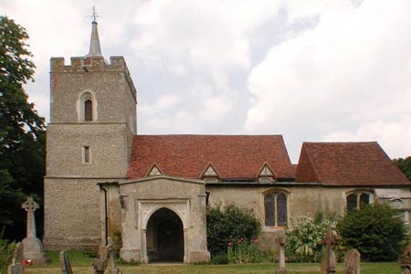
Click image to see photo description.
This is a pleasant circular walk exploring the Hertfordshire countryside to the west of the village of Aspenden. The village offers limited parking opportunities (grid ref. TL353283) so do park with care and respect resident's access. The village can be reached from the A10 Trunk Road or from the centre of Buntingford. It is useful to have an 1:25000 Ordnance Survey map to help with navigation.
After parking, walk west along the main lane through the village towards the church. However do not turn right towards the church but continue straight ahead with the lane soon becoming a track with trees to your left. The track bends to the right and then left to lead west towards Tannis Court. Before reaching Tannis Court take the footpath on the right (grid ref. TL339281). This path leads along the edge of fields to reach a footpath junction (grid ref. TL332283). Continue straight across to join the "Chain Walk", passing through a small wood, to reach a lane (grid ref. TL325285).
Leave the "Chain Walk" here and go left along this lane and continue to Cottered Warren rejoining the "Chain Walk" before reaching the buildings. Continue on the signed path through the buildings, cross a field, pass the edge of Drinkwater Wood on your right to reach Back Lane (the Old Roman Road) at grid ref. TL320276. Turn left along the old Roman Road briefly following the "Chain Walk". Continue straight ahead for just over one and a half miles, ignoring footpaths and bridleways joining from the left and right. During this section the "Chain Walk" joins your route yet again for a short section!
After passing Wakeley Farm and a small wood on your left, turn left onto the bridleway at grid ref. TL342261. This leads past a small wood on your left to join the access track for Wakeley Farm. Turn left along this track. Do not go left towards Wakeley Farm, instead bear right to follow the track that will lead you back to the start in Aspenden.
Maps 

| Ordnance Survey Explorer 194 | Sheet Map | 1:25k | BUY |
| Anquet OS Explorer 194 | Digital Map | 1:25k | BUY |
| Ordnance Survey Digital Map Subscription | |||
| Latest Ordnance Survey Discounts | |||
Other walks nearby
| Walk 2970 | The Beane Valley from Walkern to Hertford | moderate | 14.3 miles |
| Walk 2107 | Reed to Nuthampstead Circular | easy/mod | 7.3 miles |
| Walk 2306 | Furneux Pelham Circular | easy/mod | 7.0 miles |
| Walk 2220 | Hertfordshire Way from Nuthampstead to Great Hormead | easy/mod | 10.0 miles |
| Walk 1265 | Clothall & Roe Green | easy/mod | 7.3 miles |
| Walk 1118 | Roe Green and Sandon from Therfield circular | easy/mod | 7.3 miles |
| Walk 1812 | Therfield to Royston & Reed Circular | easy/mod | 10.0 miles |
| Walk 2411 | Albury Circular | easy/mod | 7.5 miles |
| Walk 1503 | Weston & Clothall circular Weston | easy | 5.5 miles |
| Walk 1810 | Graveley and Warren's GreenWeston | easy/mod | 7.0 miles |
