Newcastle on Clun circular
Shropshire Hills Walk
Region - Shropshire Hills
County/Area - Shropshire
Author - Lou Johnson
Length - 7.5 miles / 12.2 km Ascent - 1300 feet / 394 metres
Time - 5 hours 0 minutes Grade - moderate
Maps 

| Ordnance Survey Explorer 201 | Sheet Map | 1:25k | BUY |
| Anquet OS Explorer 201 | Digital Map | 1:25k | BUY |
| Ordnance Survey Explorer 216 | Sheet Map | 1:25k | BUY |
| Anquet OS Explorer 216 | Digital Map | 1:25k | BUY |
Walk Route Description
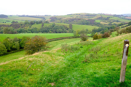
Click image to see photo description.
This circular walk from Newcastle on Clun explores a beautiful part of Shropshire with rolling hills using the Offa's Dyke Path and the Shropshire Way. The walk does also involve some quiet country lanes although traffic levels are very low in this quiet part of England. What is remarkable is how much evidence of the dyke remains despite many centuries passing since its construction.
The start is Mill Street in Newcastle on Clun where parking can be found by the green on Mill Street (grid ref. SO249824). After parking walk north up to Church Street and turn right. Follow this quiet rural lane past the small church on your left and follow the lane as it bends right. The lane climbs to a junction with Quarry House on your left. Keep right here, and just past a cottage on the left turn right up steps to join the Offa's Dyke Path (grid ref. SO256827).
The path climbs steeply following the earthwork to reach the mid-point of this National Trail. Pass through a gate and continue to climb. The onward route then descends across the north-western flank of Graig Hill. Pass a house on your left, cross a track, continue through several fields, cross a footbridge, and exit through a gate onto a lane (grid ref. SO261842). Turn right, and then left at the first junction. After a short distance turn right at a fingerpost to Hergan. Pass a house on the right and continue through a gate. Fork right and climb steadily initially with a stepped section. The path passes through trees. After heading north for 700 metres the path swings northeast to reach a lane (grid ref. SO261854) with the slopes of Hergan rising on your right.
Cross the lane to a gate opposite and join a track. Fork right onto the Shropshire Way leaving the Offa's Dyke Path to continue around the northern flank of Hergan. At the end of the track, bear half-right to a stile. The path then continues alongside a fence and trees on your left. The path passes behind a house to exit onto a lane (grid ref. SO270852). Turn left and continue straight ahead at a junction. Where the lane bends left, continue ahead onto an enclosed track (Signed Shropshire Way). At the end of the track continue ahead across a field with hedge right. Maintain direction across the next field and the descend gently through many fields keeping to the left-hand field edge.
The path eventually is enclosed with hedges and reaches a cross track (grid ref. SO282827). Turn right through a gate and follow this track down to a lane in Whitcott Keysett (grid ref. SO275827). Turn right and continue to a road junction. Bear left (signed to Newcastle) and follow Church Road back to Newcastle.
Other walks nearby
| Walk 3050 | Clun circular | moderate | 11.5 miles |
| Walk 2471 | Clun Valley Circular | easy/mod | 8.1 miles |
| Walk 3631 | Panpunton Hill & Stowe from Knighton | moderate | 7.8 miles |
| Walk 2816 | Kinsley Wood, Stowe and Offa's Dyke | moderate | 12.0 miles |
| Walk 1907 | Stowe & Offa's Dyke from Kinsley Wood | moderate | 7.0 miles |
| Walk 3253 | Warren Hill, Gors Lydan & Moelfre Hill | easy/mod | 6.0 miles |
| Walk 3643 | LLan-fawr & Lugg Valley from Whitton | moderate | 7.5 miles |
| Walk 2395 | Mitchell's Fold & Bromlow Callow | easy/mod | 6.1 miles |
| Walk 2814 | Corndon Hill from Priest Weston | easy | 1.5 miles |
| Walk 3696 | Newtown (Y Drenewydd) & Gregynog Circular | mod/hard | 10.3 miles |
Recommended Books & eBooks
Hillwalking in Shropshire
 Guidebook to 32 walking routes in Shropshire in the West Midlands. The routes range from 3 miles (5km) to 12 miles (19km), taking in highlights such as The Wrekin, Wenlock Edge, Long Mynd and Stiperstones, Castle Ring and Bury Ditches. Many routes start near delightful towns and villages including Church Stretton, Ludlow and Bishops Castle.
More information
Messaging & Social Media
Message Walking Britain and follow the latest news.

Mountain Weather
Stay safe on the mountains with detailed weather forecasts - for iOS devices or for Android devices.