Circuit of Alton Water
Suffolk Walk
County/Area - Suffolk
Author - Lou Johnson
Length - 7.6 miles / 12.4 km Ascent - 350 feet / 106 metres
Time - 4 hours 10 minutes Grade - easy/mod
Walk Route Description
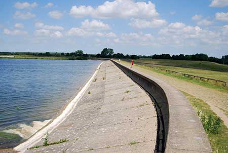
Click image to see photo description.
Alton Water is the largest reservoir in Suffolk and this walk completes a clockwise circuit of this inland water. The route is generally easy to follow on clear paths and tracks with a short section of road walking. The walk starts from The Wonder pay and display car park on the west side of the reservoir (grid ref. TM140364). However alternative parking is available at other points around the shoreline. After parking, join the cycleway and footpath close to the reservoir and continue with the reservoir on your right.
Continue along the clear path around the shore passing the village of Tattingstone on your left. The path leads to a road by Lemons Hill Bridge (grid ref. TM137374). Turn right across the bridge, pass a small car park, and then take the next signed path on the right. The path leads across a field into woodland and a path junction where you turn left. Follow the path through trees turning right and then right again to regain the shoreline. Continue along the clear path, ignoring paths on the left. The path continues around an inlet. Ignore a bridleway on the right and stay on the path around a headland to near Birchwood House (grid ref. TM149368).
The route continues along the shore soon running beside a track after which the path continues to reach the northern end of the reservoir dam. Cross the dam and turn right with the path soon joining an access road. Continue past the Alton Water Sports Centre to reach the Visitor Centre and toilets (grid ref. TM156353). Turn right onto a tarmac path opposite the visitor centre (adjacent to a zebra crossing). Pass a playground on your right and a campsite on your left. The onward route follows a clear path back to the start at The Wonder car park.
Maps 

| Ordnance Survey Explorer 197 | Sheet Map | 1:25k | BUY |
| Anquet OS Explorer 197 | Digital Map | 1:25k | BUY |
| Ordnance Survey Digital Map Subscription | |||
| Latest Ordnance Survey Discounts | |||
Other walks nearby
| Walk 2374 | Freston Circular | easy/mod | 6.6 miles |
| Walk 3658 | Manningtree, Flatford Mill and Dedham | easy/mod | 7.1 miles |
| Walk 3660 | Stour Valley & Dedham from Flatford Mill | easy | 3.5 miles |
| Walk 2017 | Pin Mill to Shotley Gate | easy | 5.5 miles |
| Walk 1639 | Erwarton, Church End & River Orwell from Pin Mill | easy/mod | 8.0 miles |
| Walk 3642 | Shotley Gate & Ewarton from Chelmondiston | moderate | 10.6 miles |
| Walk 1648 | Church End & Erwarton from Shotley Gate | easy | 6.0 miles |
| Walk 3724 | River Box from Stoke-by-Nayland | easy | 6.0 miles |
| Walk 3267 | Ramsholt, River Deben and Shottisham Circular | easy/mod | 9.2 miles |
| Walk 2768 | Boxford Circular | easy | 5.6 miles |
Recommended Books & eBooks
Suffolk Coast and Heath Walks
 Guidebook to three long-distance routes exploring the varied landscapes of the Suffolk Coast and Heaths AONB. The Suffolk Coast Path covers 55 to 60 miles from Lowestoft to Felixstowe. The Stour and Orwell Walk is 40 miles from Felixstowe to Cattawade near Manningtree, while the Sandlings Walk is 59 miles from Ipswich to Southwold.
More information
