Wing & Cublington Circular
Buckinghamshire Walk
County/Area - Buckinghamshire - North Buckinghamshire
Author - Lou Johnson
Length - 8.0 miles / 13 km Ascent - 400 feet / 121 metres
Time - 4 hours 20 minutes Grade - easy/mod
Walk Route Description
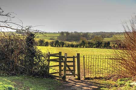
Click image to see photo description.
Walk from Wing (Bucks.) exploring the countryside and villages to the west. The route visits Aston Abbotts and Cublington which both have pubs. The walk also includes a section of the Outer Aylesbury Ring path. All Saints Church at Wing is one of the oldest churches in the country. Cublington was also home to RAF Wing during WW11 with its Wellington bombers active on raids over occupied Europe.
The start is All Sanits Church (grid ref. SP880266) in Wing where on-street parking is available nearby. After parking enter the churchyard. Follow the tarmac path on the left and continue to a gate which leads into a field. Descend the field to a path junction in the next field. Continue ahead and maintain direction across fields. The path becomes a grassy track and continues along the right-hand boundary. Where the track bends right, continue straight across the next field to a cross track. Maintain direction across the next field to a path junction in the middle of the field (grid ref. SP861219) and turn left. The path crosses a smaller field before joining a grassy track along the right-hand edge of the next field. Where the track bends left continue into the next field and after 100 metres turn right
The onward path maintains direction for 1.4 kilometres running along the right-hand field boundary for much of the way. The path swaps sides of the hedge and soon leads onto a clear track which leads into Chapmans Lea. Continue to a T-junction with the main road through Aston Abbotts. Turn right through the village passing St James the Great church on your left. 80 metres beyond the church, turn left onto a signed footpath. The path initially follows a hedge on your left before striking across the field to far left-hand corner. The continuing path crosses several fields before crossing a driveway. Cross this an maintain direction for just over a kilometre to exit onto Whitchurch Road (grid ref. SP838221).
Turn right and continue along Cublington High Street. Immediately after the church, turn left along an enclosed path with the churchyard on your left. Continue past a thatched cottage and bear right along Silver Street. At the next T-junction, turn left and after 150 metres right into Reads Lane. You are now following the Outer Aylesbury Ring (OAR). After 400 metres turn left at a footpath sign by Old Manor Farm. Cross the stile to the right of the gate and follow the waymarked path through Cedars Farm. The OAR then crosses fields heading east. The path is well waymarked and leads towards Stewkley Road. Just before reaching this road, the AOR turns right and leads to a stile on Cublington Road. Cross the road to the stile opposite and continue along the path beside a hedge. After 400 metres you rejoin the outward route. Turn left and head up the field to enter the churchyard and the starting point in Wing.
Maps 

| Ordnance Survey Explorer 172 | Sheet Map | 1:25k | BUY |
| Anquet OS Explorer 172 | Digital Map | 1:25k | BUY |
| Ordnance Survey Digital Map Subscription | |||
| Latest Ordnance Survey Discounts | |||
Other walks nearby
| Walk 1816 | Old Linslade Circular | easy/mod | 9.0 miles |
| Walk 1943 | Cheddington to Tring via Marsworth | easy/mod | 8.0 miles |
| Walk 1909 | Woburn Circular | easy/mod | 7.5 miles |
| Walk 1351 | The parkland of Woburn Abbey and Eversholt | easy/mod | 8.0 miles |
| Walk 3225 | Woburn Estates Circular | easy/mod | 9.0 miles |
| Walk 1689 | Woburn Abbey, Eversholt & Milton Bryan | easy/mod | 9.6 miles |
| Walk 1604 | Long Marston circular | easy/mod | 6.5 miles |
| Walk 2763 | Ivinghoe Beacon Circular | moderate | 8.2 miles |
| Walk 3409 | The Three Counties Tops | mod/hard | 17.0 miles |
| Walk 3669 | Grand Union Canal - Aylesbury to Wendover | moderate | 11.7 miles |
