Winder & Arant Haw from Sedbergh
Howgills Walk
Nat Park - Yorkshire Dales - Howgill Fells
Region - Howgills
County/Area - Cumbria
Author - Lou Johnson
Length - 7.0 miles / 11.4 km Ascent - 1900 feet / 576 metres
Time - 5 hours 20 minutes Grade - moderate
Walk Route Description
Click image to see photo description.
The Howgills offer many miles of walks across the grassy rounded hills that make up this range. Situated at their southwestern extremity is the small market town of Sedbergh, which in this case provides a convenient place to start.
Parking is available at a number of places but the car park adjacent to the information office at grid ref. SD658921 is probably as good as any. Exit the car park and turn right along Main Street turning right again into Howgill Lane. Follow this lane for about 700 metres and turn left (Grid ref. SD 652923) along a track towards Lockbank Farm. Go through the gate in the intake wall and onto open fellside.
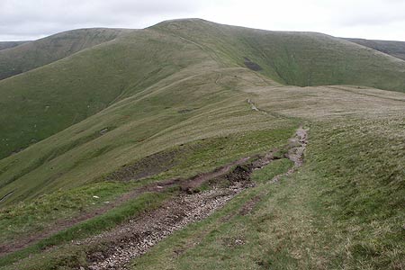
There are a number of paths in this immediate vicinity but the preferred route is to go half left up the fellside to reach a wide path (Grid ref. SD 650926) which is followed uphill across the flank of Winder. The going is easy and quick progress is made despite the uphill grade. Reaching the col (Grid ref. SD 658937) between Winder and Arant Haw turn sharp left to follow the clear path along the ridge to the summit of Winder, which provides a good place to have a break. There is a trig point here and the view offered across the surrounding countryside is superb.
Having taken in the view return downhill to the col and continue straight ahead on the path that eventually leads to the Calf (the highest point in the Howgills). Arant Haw is the hill to your immediate left and although it might be tempting to make a direct ascent it is possible to reach the summit without too much effort by continuing on the main path above Hobdale Scar (Grid ref. SD 667949) where a sharp left turn will take you almost back on yourself to the grassy summit. The summit on my last visit was marked by a small heap of stones and provided rather more extensive views than those from Winder.
Careful navigation is imperative in the Howgills with an often complex system of ridges and valleys. Before continuing acquaint yourself with the main features around you and when sure descend on a path running west towards a spot height 515 (Grid ref. SD 653947) that might be considered the summit of the Nab. The path turns southwest here and drops down to Crosdale Beck which can be forded just above Crosdale Wood.
Follow the path alongside the intake wall southwards. it is a bit of switchback but will bring you back to the gate where you first entered the open fellside. Retrace your steps back into Sedbergh where an assortment of possibilities are available for refreshment.
Maps 

| Ordnance Survey Explorer OL19 | Sheet Map | 1:25k | BUY |
| Anquet OS Explorer OL19 | Digital Map | 1:25k | BUY |
| Ordnance Survey Digital Map Subscription | |||
| Latest Ordnance Survey Discounts | |||
Other walks nearby
| Walk 2438 | Cautley Spout & the Calf from Sedbergh | moderate | 10.0 miles |
| Walk 1196 | The Calf | mod/hard | 10.5 miles |
| Walk 2458 | Winder, The Calf & Fell Head | moderate | 9.8 miles |
| Walk 3007 | Fell Head & The Calf from Howgill | moderate | 7.5 miles |
| Walk 3006 | Cautley Spout & The Calf | moderate | 5.5 miles |
| Walk 1393 | Yarlside | moderate | 4.0 miles |
| Walk 1387 | Cautley Spout | easy | 2.0 miles |
| Walk 1052 | Whernside & Dentdale | mod/hard | 12.0 miles |
| Walk 3233 | Dent & Gawthrop | easy/mod | 6.0 miles |
| Walk 2253 | Uldale Falls & Wandale | moderate | 8.5 miles |
Recommended Books & eBooks
Walking the Lake District Fells - Buttermere
 Part of the Walking the Lake District Fells series, this guidebook covers a wide range of routes to 32 Lakeland summits that can be climbed from the Buttermere, Lorton and Newlands valleys, with highlights including Haystacks, High Stile, Grasmoor and the fells of the Coledale Round. Suggestions for longer ridge routes are also included.
More information
The Cumbria Way
 A guidebook to the 73 mile Cumbria Way, an easy long-distance walk though the heart of the Lake District National Park, from Ulverston in the south to Carlisle in the north, with good transport links to either end. The route is largely low-level but this guide offers alternative mountain days to climb some of the famous fells en route.
More information
