Hinton & Dryham Circular
Cotswolds Walk
Region - Cotswolds
County/Area - Gloucestershire
Author - Lou Johnson
Length - 3.0 miles / 4.9 km Ascent - 300 feet / 91 metres
Time - 1 hours 50 minutes Grade - easy
Maps 

| Ordnance Survey Explorer 155 | Sheet Map | 1:25k | BUY |
| Anquet OS Explorer 155 | Digital Map | 1:25k | BUY |
Walk Route Description
Click image to see photo description.
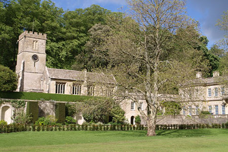
This short walk from Hinton (Gloucestershire) explores a typical rural area of the Cotswolds. The route follows lanes, field paths and a short section of the Cotswold Way. You can also visit Dyrham Church and the adjacent house which is owned by the National Trust. The Bull Inn in Hinton is a perfect place to stop for refreshments.
Suitable parking is available in a layby at the west end of the village green (grid ref. ST732768). After parking walk into the village and pass the Bull Inn on your left where alternative parking is available for patrons. Continue along the lane to the next junction (grid ref. ST738766). Turn left uphill and take the signed footpath on the right. Follow the path up the field with the hedge on your right across the southern flank of Hinton Hill to a gap in the hedge. Continue across the next field to a get. Entering a larger field walk straight across.
Reaching the far side of the field, turn right onto The Cotswold Way. The path crosses several fields and descends to reach Upper Street in Dyrham (grid ref. ST739759). Turn left and follow the road as it bends right. You may wish to make a short diversion to Dyrham Church along a track on the left. Pass Dyrham Park and House (NT) on your left and continue down the lane between stone walls.
Reaching the next junction with a grass triangle, fork right and continue through the village. At the first T-junction turn right signed to Hinton and Pucklechurch. Continue up the lane ignoring the lane on the right. Continue uphill to reach a junction with Talbot Farm on your left. Keep straight ahead here and continue to the next junction (grid ref. ST733764). Bear half right here into Chapel Lane. Where the lane ends, continue ahead through a gate onto a footpath. The onward path bears a little left to cross two more fields, each with gates, to reach the road in Hinton. Turn left and the layby used at the start of the walk is a short distance away.
Other walks nearby
| Walk 1891 | Solsbury Hill from Northend | easy | 3.0 miles |
| Walk 1567 | Keynsham to Bath on the south side of the Avon | easy/mod | 11.1 miles |
| Walk 3347 | Ford & North Wraxall from Castle Combe | easy/mod | 8.0 miles |
| Walk 2804 | Bath to Keynsham over Kelston Round Hill | easy/mod | 9.0 miles |
| Walk 2212 | Bristol Curiosities Trail | easy | 1.5 miles |
| Walk 2213 | Bristol Maritime Trail | easy | 1.5 miles |
| Walk 2214 | Bristol Literary Trail | easy | 1.5 miles |
| Walk 2215 | Bristol Religious Trail | easy | 1.5 miles |
| Walk 1518 | Brunel's masterpieces and the Avon Gorge | easy | 4.0 miles |
| Walk 2087 | The Cam Brook Valley from Southstoke | easy | 5.5 miles |
Recommended Books & eBooks
The Cotswold Way
 Guidebook to walking the Cotswold Way National Trail. Between Chipping Campden and Bath, the 102 mile route explores the Cotswolds AONB. Described in both directions over 13 stages, the Cotswold Way can be walked year round and is suitable for beginner trekkers. Includes separate OS 1:25,000 map booklet of the route.
More information
The Cotswold Way Map Booklet
 Map of the 102 mile (163km) Cotswold Way National Trail, between Chipping Camden and Bath. This booklet is included with the Cicerone guidebook to the trail, and shows the full route on OS 1:25,000 maps. The trail typically takes two weeks to walk, and is suitable for walkers at all levels of experience.
More information
Messaging & Social Media
Message Walking Britain and follow the latest news.

Mountain Weather
Stay safe on the mountains with detailed weather forecasts - for iOS devices or for Android devices.