Brushfield, Miller's Dale & Monsal Head from Lees Bottom
Peak District Walk
Nat Park - Peak District - Bakewell Monsal Trail
County/Area - Derbyshire
Author - Lou Johnson
Length - 6.5 miles / 10.6 km Ascent - 750 feet / 227 metres
Time - 4 hours 0 minutes Grade - easy/mod
Maps 

| Ordnance Survey Explorer OL24 | Sheet Map | 1:25k | BUY |
| Anquet OS Explorer OL24 | Digital Map | 1:25k | BUY |
| Ordnance Survey Landranger 119 | Sheet Map | 1:50k | BUY |
| Anquet OS Landranger 119 | Digital Map | 1:50k | BUY |
Walk Route Description
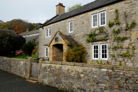
Click image to visit gallery of 9 images.
This Peak District walk starts by climbing onto the high ground to the west of Monsal Dale before descending to the Wye Valley to pass Litton Mill, Cressbrook and Monsal Head. The route uses well signed paths and apart from the initial ascent provides easy walking throughout. After rain some of the paths can be quite muddy but the views across the Derbyshire dales more than compensate for this inconvenience. The start is the pay and display car park at Lees Bottom (grid ref. SK170706) where there are also public toilets. Refreshments can be obtained at Monsal Head by following a short diversion from the route. .
Exit the car park onto the A6 main road. Cross over to the signed path, descend the awkward stile and follow the path into the woodland. Where the path splits turn left following the sign to Brushfield. The path climbs steadily through the woodland to reach the farm at Brushfield Hough. Here arrows help with route finding across a field and then between the farm buildings and onto the farm access track. After exiting the farm, follow the track across the first field to a gateway in a wall. Here the right of way bears half right (not along the track) to reach a finger post. Turn left here along a clear track descending towards Brushfield.
Go past the cottages at Brushfield, bear right onto a well maintained track and continue along the eastern edge of High Dale. Continue along this undulating track until it turns sharp left (grid ref. SK151724). Go right here along a wide area between walls with evidence of earlier mining activity. Continue between the walls to join a footpath descending into the Wye Valley. The path drops down quite steeply to reach a bridge over the former railway and now the Monsal Trail. Descend to Monsal Trail on the right before crossing the bridge and then bear left down a narrow path that leads across the River Wye onto a road. Turn right along the road to Litton Mill, with its rather infamous past. Go to the left of the mill and follow the clearly marked concessionary path past the main building. This leads onto a path beside the River Wye.
Follow the path downstream. Initially the river is quite narrow but after a while it becomes much wider passing a limestone crag on your left popular with climbers. The wider river is due to the weir at Cressbrook which was used to ensure a constant water supply for the mill. Bear right across the weir, climbs some steps and follow the path which bears left and rises gently up onto the Monsal Trail. Joining the former railway the walking is easy and you can make good progress along the dale to the viaduct below Monsal Head.
If you require refreshments then cross the viaduct and take the path on the left which leads up to Monsal head. However to continue this walk take the path on the right just before the viaduct and drop down to the meadow beside the River Wye. Bear right and follow the riverside path back to the A6 and the start.
Other walks nearby
| Walk 1827 | Ashford-in-the Water,Magpie Mine & Over Haddon | easy/mod | 7.1 miles |
| Walk 1206 | Chelmorton & Flagg from Taddington | easy/mod | 6.0 miles |
| Walk 1650 | Miller's Dale & Cressbrook Dale from Tideswell Dale | easy/mod | 5.5 miles |
| Walk 1859 | Chee Dale & Monk's Dale from Miller's Dale | moderate | 7.3 miles |
| Walk 1146 | Bradford & Lathkill Dales | moderate | 11.3 miles |
| Walk 3046 | Lathkill Dale & Monyash | easy | 4.0 miles |
| Walk 2573 | Tideswell, Miller's & Cressbrook Dales from Litton | easy | 7.0 miles |
| Walk 2798 | Bakewell to Edale | mod/hard | 18.0 miles |
| Walk 1945 | Lathkill Dale & Over Haddon circular | easy/mod | 5.7 miles |
| Walk 1043 | Chelmorton & the Monsal Trail | easy/mod | 8.1 miles |
Recommended Books & eBooks
Walking in Derbyshire
 Walking guidebook to 60 circular day walks in Derbyshire and the Peak District. Includes the Derwent, Wye and Trent river valleys, near Derby, Matlock, Glossop, Bakewell and Ripley. Routes range from easy to moderate and are between 4 and 14km (2 to 10 miles). Walks focus on places of interest, from Stone Age forts to castles to grand estates.
More information
Walking in the Peak District - White Peak East
 Guidebook describing 42 half-day and day walks in the limestone landscapes of Derbyshire's White Peak, part of the Peak District National Park. One of two volumes, this book covers the east of the region, with potential bases including Bakewell, Eyam, Castleton, Birchover, Matlock and Wirksworth.
More information
Messaging & Social Media
Message Walking Britain and follow the latest news.

Mountain Weather
Stay safe on the mountains with detailed weather forecasts - for iOS devices or for Android devices.