Lathkill Dale & Monyash
Peak District Walk
Nat Park - Peak District - Lathkill Dale High Peak
County/Area - Derbyshire
Author - Lou Johnson
Length - 4.0 miles / 6.5 km Ascent - 300 feet / 91 metres
Time - 2 hours 20 minutes Grade - easy
Walk Route Description
Click image to visit gallery of 9 images.
This is a short and popular Peak District walk that includes some of the highlights of Lathkill Dale. It starts from the small Derbyshire village of Monyash (grid ref. SK149666) where limited roadside parking and a small car park are available. A longer version of this route can be found in walk 1146 which includes a longer section of Lathkill Dale together with Bradford Dale.
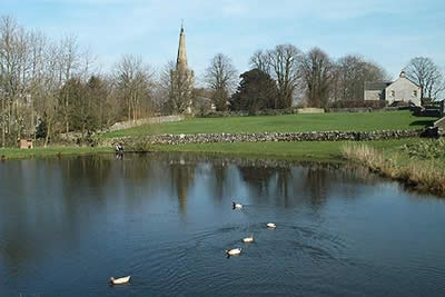
After parking walk to the cross-roads in the centre of the village and follow the road south passing the duck pond on your left. Where the road turns sharp right continue straight ahead along the Limestone Way. This is a walled lane at first before becoming a footpath across fields. The route is obvious and well signed and leads without further problem to One Ash Grange Farm. The route through the farm is marked although there is some confusion over the exact right of way. Pass to the left of the farm with some rather attractive and derelict pigsties on your left before heading between buildings to descend stone steps to regain the path.
This soon descends quite steeply into Cales Dale. On reaching the valley floor turn left ignoring the path climbing out of the dale that continues to Calling Low. After a short distance you reach a footbridge over the River Lathkill, which must be crossed to gain the north bank. Turn left back towards Monyash and follow the clear path up the dale. You are now in a superb section of limestone scenery and after a short distance you will notice that the stream disappears. Continue along the dry valley which becomes much shallower to reach the B5055 Monyash to Bakewell road.
Turn left along the road and cross to the other side. Just opposite the toilets you will locate a footpath sign. Follow this path across fields through Bagshaw Dale to reach a further lane. Turn left and you are soon back in the village centre.
Maps 

| Ordnance Survey Explorer OL24 | Sheet Map | 1:25k | BUY |
| Anquet OS Explorer OL24 | Digital Map | 1:25k | BUY |
| Ordnance Survey Digital Map Subscription | |||
| Latest Ordnance Survey Discounts | |||
Other walks nearby
| Walk 3709 | Sparklow, Crowdicote & Pilsbury Circular | easy/mod | 9.0 miles |
| Walk 1206 | Chelmorton & Flagg from Taddington | easy/mod | 6.0 miles |
| Walk 1651 | Monsal Trail & Ashford-in-the-Water from Lees Bottom | easy/mod | 8.8 miles |
| Walk 3341 | Brushfield, Miller's Dale & Monsal Head from Lees Bottom | easy/mod | 6.5 miles |
| Walk 1569 | Lathkill Dale & Bradford Dale | easy/mod | 8.2 miles |
| Walk 1589 | Lathkill & Bradford Dales (short version) | easy/mod | 6.0 miles |
| Walk 1590 | Monyash & Lathkill Dale | easy/mod | 8.2 miles |
| Walk 1043 | Chelmorton & the Monsal Trail | easy/mod | 8.1 miles |
| Walk 1945 | Lathkill Dale & Over Haddon circular | easy/mod | 5.7 miles |
| Walk 1369 | Tissington Trail - Hartington to Parsley Hey | easy | 4.0 miles |
Recommended Books & eBooks
Dark Peak Walks
 Guidebook to 40 walks in the Dark Peak area of the Peak District National Park. 35 circular routes for most abilities, from 8km to 19km, around Edale, Marsden, Fairholmes, Baslow and Castleton, including Kinder Scout and Mam Tor, and 5 longer (25km to 45km) routes highlighting the best of the Gritstone Edges, High Moorland and Deep Valleys.
More information
Great Mountain Days in the Pennines
 An inspirational guidebook to 50 classic walks on the rolling Pennine landscape. The graded routes, between 6 and 13 miles in length, cover classic Pennine fells and moorland such as Whernside, Ilkley Moor and Pendle Hill; exploring the North and South Pennines, Yorkshire Dales, Howgills and Dark Peak. Many routes are also suited to fell running.
More information
