Ledwell & Nether Worton from Great Tew Walk
Walk 3728 - Route Maps
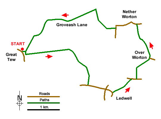
Route Map
Digital Maps - Copyright © 2011-2024. All rights reserved.
Sketch Map
Suggested Maps 

| Ordnance Survey Explorer 191 | Sheet Map | 1:25k | BUY |
| Anquet OS Explorer 191 | Digital Map | 1:25k | BUY |
It is recommended you take a map. The preferred scale is 1:25k.
Start Point Details
Ordnance Survey Grid Ref SP395293
Latitude 51.960786 Longitude -1.426548
Postcode OX7 4DB
what3words start twisting.yield.rational
Walk description may contain detailed information on the start point for this walk.
Further Information
Cotswolds
The Cotswold National Landscape (formerly AONB) covers about 800 square miles in six counties of England. It is mostly farmland, both cultivated and pasture, with some areas of woodland and open upland. Bearing this in mind staying on signed rights of way is important so as to maintain the important balance between landowner and visitor. Cotswolds Walking Guide
Oxfordshire
The County of Oxfordshire is located between the River Thames in the south, the Cotswolds to the west and the Chilterns in the east. Much of the county's wealth was from wool production in what is predominantly agricultural area. Local Government reorganisation in 1974 saw changes to the county boundaries with the Vale of White Horse and an area south of the Thames added to the county. Oxfordshire includes sections of three Areas of Outstanding Natural Beauty - the Cotswolds, the North Wessex Downs, and the Chilterns. Long-distance footpaths include the Ridgeway, Macmillan Way, Oxfordshire Way, and the D'Arcy Dalton Way. The Thames path follows the river and the valleys of the Thame, Windrush and Cherwell tributaries also provide excellent walking. The Oxford Canal follows the Cherwell from Banbury to Kidlington and again provides some excellent walking on the well-maintained tow path.
Walk grading - Learn how each walk is assessed and select a walk to suit your ability and experience by going to Walk Grading Details.
Messaging & Social Media
Message Walking Britain and follow the latest news.

Mountain Weather
Stay safe on the mountains with detailed weather forecasts - for iOS devices or for Android devices.